Illegal fishing practices through spoofing tracking devices in ships have become a common practice in the industrial use of our oceans. A new study published in the journal Nature corroborates the trend and offers a view of the changing oceanic activities and landscape.
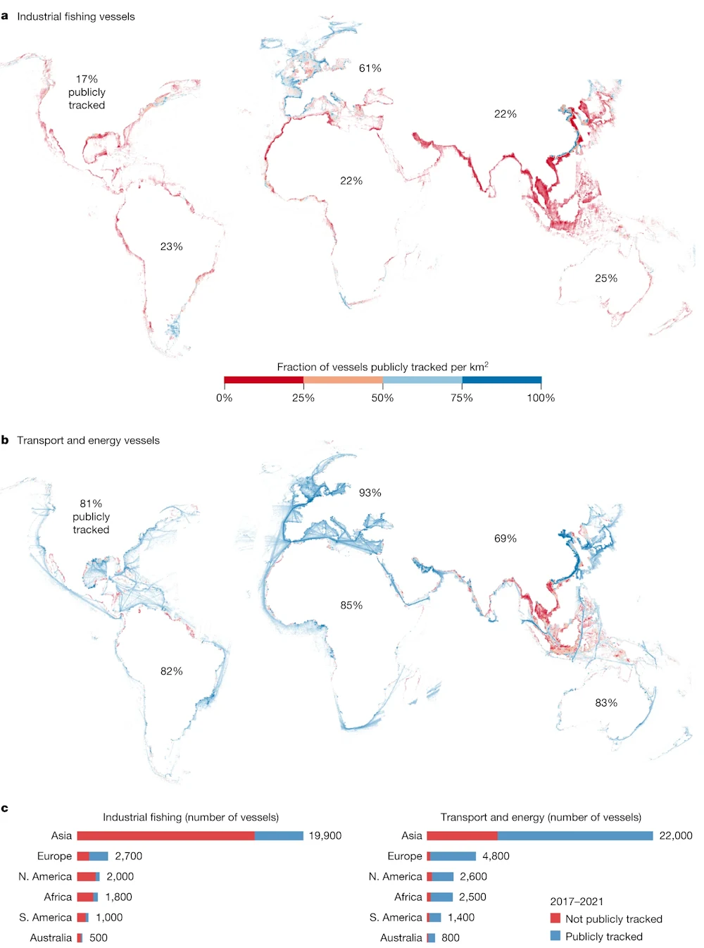
Led by Global Fishing Watch, a company founded by Google, the study uses Artificial Intelligence, Machine Learning, and satellite imagery to create the first global map of large vessel traffic and offshore infrastructure, while finding that over 75% of the world’s industrial fishing vessels are not publicly tracked.
Researchers from Global Fishing Watch, the University of Wisconsin-Madison, Duke University, UC Santa Barbara, and SkyTruth analyzed 2 million gigabytes of satellite imagery spanning 2017-2021 to detect vessels and offshore infrastructure in coastal waters across six continents where more than three-quarters of industrial activity is concentrated.