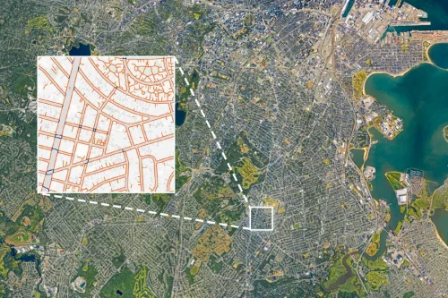
It’s easier than ever to view maps of any place you’d like to go — by car, that is. By foot is another matter. Most cities and towns in the U.S. do not have sidewalk maps, and pedestrians are usually left to fend for themselves: Can you walk from your hotel to the restaurants on the other side of the highway? Is there a shortcut from downtown to the sports arena? And how do you get to that bus stop, anyway? Now MIT researchers, along with colleagues from multiple other universities, have developed an open-source tool that uses aerial imagery and image-recognition to create complete maps of sidewalks and crosswalks. The tool can help planners, policymakers, and urbanists who want to expand pedestrian infrastructure. The tool, called TILE2NET, has been developed using a few U.S. areas as initial sources of data, but it can be refined and adapted for use anywhere. “We thought we needed a method that can be scalable and used in different cities,” says Maryam Hosseini, a postdoc in MIT’s City Form Lab in the Department of Urban Studies and Planning (DUSP), whose research has focused extensively on the development of the tool.