Cities really are hotter than surrounding areas due to the urban heat island effect, first observed in London during the 1800s, explained Binghamton University Associate Professor of Geography Thomas Pingel. The buildings, parking lots and sidewalks absorb heat during the day, releasing it during the night. This excess heat is more than just an annoyance; it can kill. “With climate change, not only is the earth warming, but cities are warming at a faster rate than the earth is, so it becomes a particularly salient problem,” Pingel said. “Heat is the number one weather-related cause of death in the United States.”
Cities really are hotter than surrounding areas due to the urban heat island effect, first observed in London during the 1800s, explained Binghamton University Associate Professor of Geography Thomas Pingel. The buildings, parking lots and sidewalks absorb heat during the day, releasing it during the night. This excess heat is more than just an annoyance; it can kill. “With climate change, not only is the earth warming, but cities are warming at a faster rate than the earth is, so it becomes a particularly salient problem,” Pingel said. “Heat is the number one weather-related cause of death in the United States.”
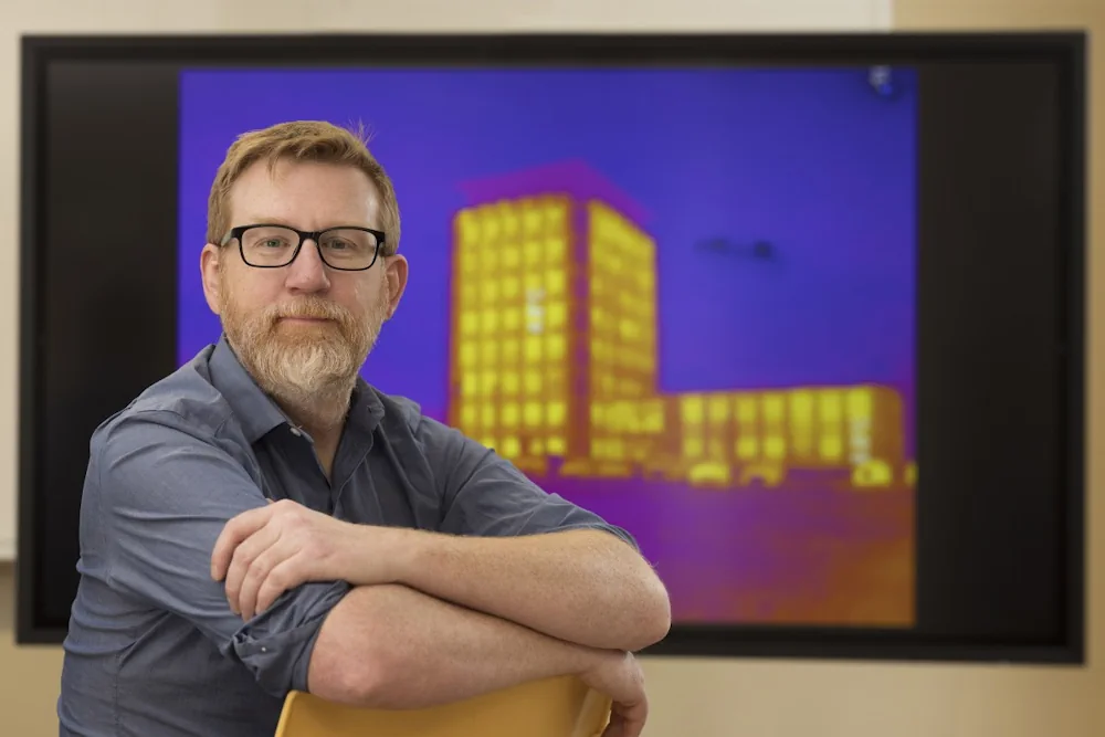
In his current project, Pingel and his Near Earth Imaging Lab will create high-quality, 3-D thermal models of Broome County areas expected to undergo revitalization in the next decade. That will involve using drones, cameras and lidar platforms to map the area and features such as building facades, overlaid with temperature data. The combination of mapping and thermal data will allow researchers to determine exactly how much a building’s façade heats up in the summer sun and how the placement of trees can cool the surrounding environment. “You can build good information about how changes to the local environment improve the thermal properties of a place,” he said. In addition to software, the grant provided the scanning equipment that Pingel and his lab use to build models from the ground up. Known as real-time kinematic GPS, it allows for accuracy within a few centimeters.
The early stages of the project will identify the best places for thermal mapping, which will need to be conducted during the summer. The mapping process is expected to continue over the next two to three years, culminating in the sharing of findings with the local community. That process essentially creates a digital twin of the neighborhood, with every feature — including sidewalks, parking lots, individual trees and landscaping— included in rich detail. In thermal models, asphalt-filled parking lots glow brightly, demonstrating how quickly they heat up, while grass provides a cooling effect.