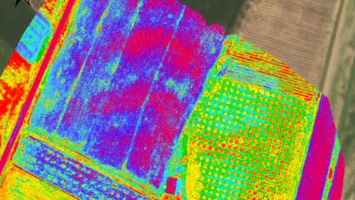
Mapping an archaeological site is key to being able to dig with greater precision. Now with the latest digital methods, areas of interest can easily be identified rapidly and non-invasively – helping to protect the site and future excavations. Here, Chris Thompson, Global Sales Manager at AgEagle, looks at how a team of Duke University researchers used the eBee X fixed-wing drone and RedEdge-MX multi-spectral camera to map a large archaeological site in Italy, to unveil a hidden history just below the surface.