Researchers have developed a compact and lightweight single-photon airborne lidar system that can acquire high-resolution 3D images with a low-power laser. This advance could make single-photon lidar practical for air and space applications such as environmental monitoring, 3D terrain mapping and object identification.
Single-photon lidar uses single-photon detection techniques to measure the time it takes laser pulses to travel to objects and back. It is particularly useful for airborne applications because it enables highly accurate 3D mapping of terrain and objects even in challenging environments such as dense vegetation or urban areas.
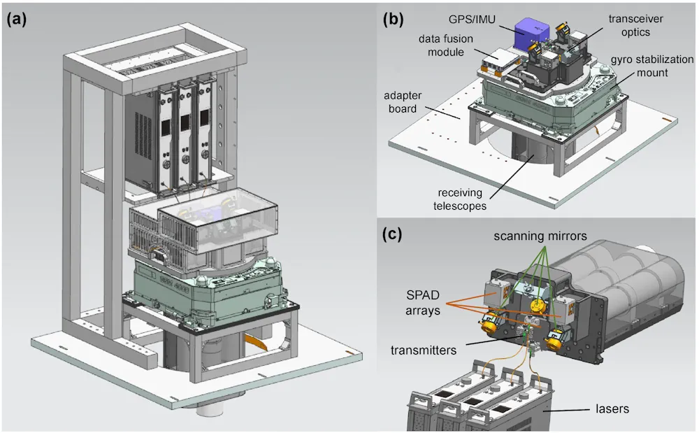
“Using single-photon lidar technology on resource-limited drones or satellites requires shrinking the entire system and reducing its energy consumption,” said research team member Feihu Xu from University of Science and Technology of China.
“We were able to incorporate recent technology developments into a system that, in comparison to other state-of-the-art airborne lidar systems, employs the lowest laser power and the smallest optical aperture while still maintaining good performance in terms of detection range and imaging resolution.“
In Optica the researchers show that the system has the capability to achieve an imaging resolution that surpasses the diffraction limit of light when used with sub-pixel scanning and a new 3D deconvolution algorithm. They also demonstrate the system’s ability to capture high-resolution 3D images during daytime over large areas aboard a small plane.