A team of researchers has unveiled a novel approach to accurately characterizing tree height composition in forests using the Global Ecosystem Dynamics Investigation (GEDI) Light Detection and Ranging (LiDAR) technology. This study marks a significant advancement in our understanding of forest ecosystems, shedding light on the intricacies of tree height variability and its implications for ecological studies and climate change mitigation efforts.
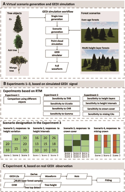
Leveraging GEDI LiDAR, a pinnacle of spaceborne technology, the research delved into the complexities of forest canopies with an accuracy never before achieved. Through the use of advanced radiative transfer models paired with an innovative technique for generating virtual forest objects, the researchers endeavored to simulate the interaction between GEDI’s laser pulses and various forest landscapes. This method allowed for the accurate mapping of tree heights and canopy structures across a spectrum of forest conditions, showcasing the tool’s ability to capture the nuanced details of forest structures, from the towering trees to the dense underbrush.
A key innovation of the study was the development of Tree generation based on Asymmetric Generalized Gaussian (TAG) method, which markedly improved the modeling of forest scenes by precisely replicating the physical characteristics of trees within diverse ecosystems. The simulation results confirmed that GEDI waveforms are capable of reflecting complex variations within forest stands, including the differences in tree heights and canopy layer density. This revelation holds profound implications for our understanding of forest structure providing a fresh perspective on forest biodiversity, carbon sequestration, and ecosystem processes with a level of detail previously beyond reach.