The TRISHNA (Thermal Infra-Red Imaging Satellite for High-resolution Natural Resource Assessment) mission, a collaborative endeavor between ISRO and CNES, is engineered to deliver high spatial and high temporal resolution monitoring of Earth’s surface temperature, emissivity, biophysical and radiation variables for surface energy budgeting at regional to global scale. This mission addresses critical water and food security challenges, focusing on the impacts of human-induced climate change and efficient water resource management through evapotranspiration monitoring.
TRISHNA’s primary objectives include detailed monitoring of the energy and water budgets of the continental biosphere for quantifying terrestrial water stress and water use and high-resolution observation of water quality and dynamics in coastal and inland waters. In addition, as secondary objectives, the TRISHNA mission will also help in a comprehensive assessment of urban heat islands, detection of thermal anomalies linked to volcanic activity and geothermal resources, and precise monitoring of snow-melt runoff and glacier dynamics. The mission will also provide valuable data on aerosol optical depth, atmospheric water vapor, and cloud cover.
The scientific and societal benefits of TRISHNA are extensive. In agricultural water management, TRISHNA science data products will help to assess irrigation water use, issue advisories for water savings and enhance crop water productivity through efficient and sustainable water management practices, and better micro-watershed management. For climate monitoring, the mission will track key indicators such as droughts, permafrost changes, and evapotranspiration rates. Urban planners will benefit from detailed urban heat island maps and heat alerts; while water quality monitoring will aid in detecting pollution in coastal and inland water bodies. It will also help in identifying sub-marine groundwater discharge at the coastal fringes. Additionally, TRISHNA will support the detection of sub-surface fires and assessment of geothermal resources; while cryosphere monitoring will evaluate snow cover and snow-melt patterns, contributing to improved hydrological models.
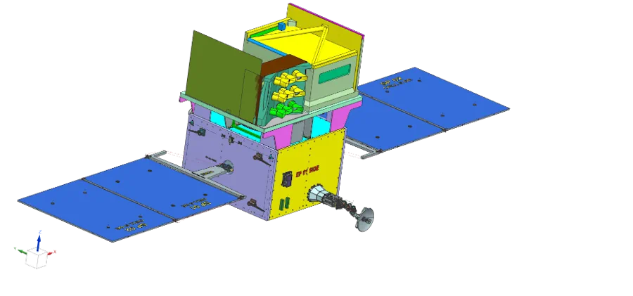
TRISHNA satellite is equipped with two primary payloads. The Thermal Infra-Red (TIR) payload, provided by CNES, features a four-channel long-wave infrared imaging sensor capable of high-resolution surface temperature and emissivity mapping. The Visible – Near Infra-Red – Short Wave Infra-Red (VNIR-SWIR) payload, developed by ISRO, includes seven spectral bands designed for detailed mapping of surface reflectance of VSWIR bands for generating important biophysical and radiation budget variables. The variables retrieved from the combination of payload data would help in solving surface energy balance to estimate surface heat fluxes.
The satellite will operate in a sun-synchronous orbit at an altitude of 761 km, with a local time of 12:30 PM at the equator. This orbit will provide a spatial resolution of 57 meters for land and coastal areas and 1 km for oceanic and polar regions. The mission is designed for a 5-year operational life.
TRISHNA’s data will contribute to several global initiatives, such as GEOGLAM for agricultural monitoring, the UN’s Sustainable Development Goals and targets, and the Global Water Watch. Some of the mission’s outputs will serve as Essential Agricultural Variables (EAVs), and Essential Climate Variables (ECVs) for the global community.
TRISHNA mission is expected to signify a substantial advancement in remote sensing technology, addressing critical water and food security issues and providing essential data to help bring out sustainable solutions for policy/decision makers, watershed managers, agro-industries and farming community over inland and coastland. With its high-resolution high-repeat imaging capabilities, it would enhance our understanding of Earth’s natural processes and support global efforts in climate change mitigation through optimized resource management.