The search for the perfect driving road never ends. Besides being a subjective matter, how does one even begin such a monumental task as seeking out roads around the world? Actually, it may not be as daunting as you think, thanks to this very cool website that not only highlights twisty roads, but delivers gobs of info about the route.
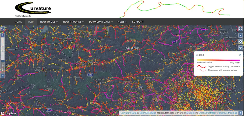
It’s called roadcurvature.com, but it’s way more than just a nifty map with colored lines. It’s an interactive tool that uses terrain data and satellite imagery to take you from a space-eye view to road level as you zoom in. Predominately straight roads with sparse, gentle curves don’t get special attention, but as things start getting fun, colors are added. There’s even a color code to denote the twistiest of the twisties, starting with yellow for “moderately twisty” and progressing to hot pink for “very twisty.”
Sticking with the visuals, the thickness of the colored lines denotes major or minor roads. You can also add less twisty roads to the mix, showing up as green lines. As you zoom in, the map changes to satellite imagery showing the actual road and the surroundings. At this point, you can then click on the road to open up a window with all kinds of information. You’ll find speed limits, total route distance, the distance between corners, road surface, road smoothness, and each road is ranked with a “curvature value.”