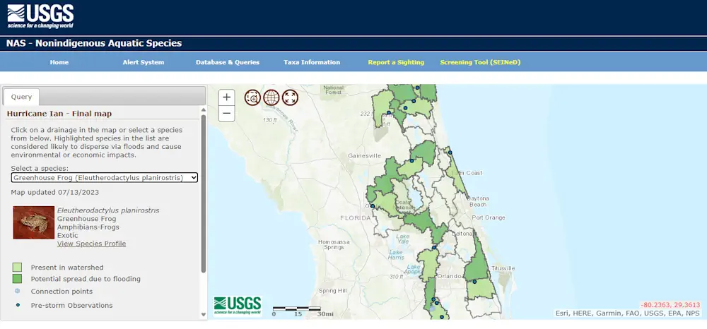
Hurricane-related flooding can result in a slow transformation of ecosystems found on land and in water, as floodwaters can carry invasive wildlife and plant species into new regions, accelerating their spread. When invasive species spread into new areas, there can be environmental, economic and human health effects that can cost the U.S. billions of dollars. Due to the importance of the issue, farmers, ranchers, businesses, and Tribal and government officials are working to mitigate the threats these invaders pose. The U.S. Geological Survey aids these efforts by creating Flood and Storm Tracker maps that identify where non-native species may have been carried during a major flood event.
The first Flood and Storm Tracker map was produced in 2017 after Hurricane Harvey made landfall in Texas and USGS experts have created more than a dozen since. The most recent map created was a preliminary map for Hurricane Ian with the final version being available soon. When a map is created for a major storm, it focuses on local species from the almost 1,400 various plants and animals included in the database. Past maps created by the USGS have forecast the spread of many notorious invasive species, such as giant apple snails, African Jewelfish, zebra mussels and water hyacinth.