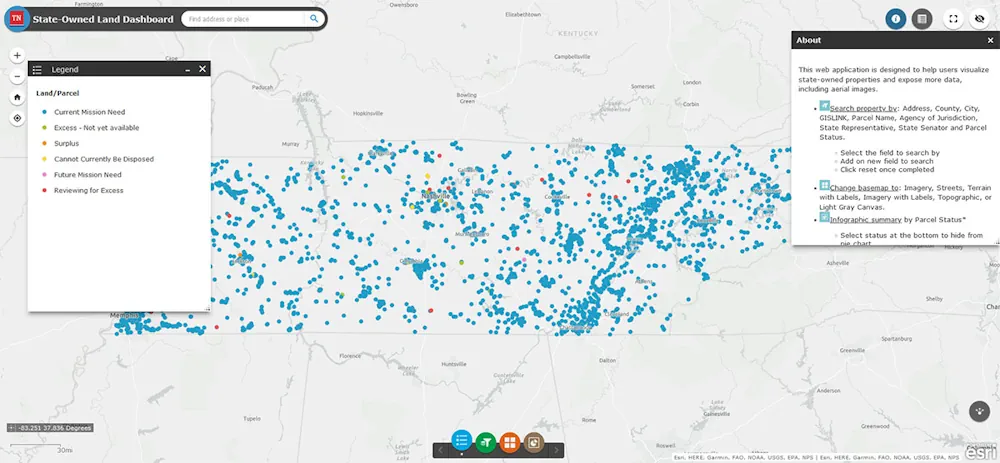
The Tennessee Department of General Services is pleased to announce the launch of the new State-Owned Land Dashboard, a Geographic Information System (GIS) public-facing map displaying all the land the state owns. The map gives users access to a comprehensive list of state-owned properties with numerous data points for each property, including address, District, State Agency, State Senator, State Representative, and more. The State of Tennessee Real Estate Asset Management division in the Department of General Services developed this map in partnership with the Tennessee State GIS Office in the Department of Finance and Administration and the Office of the Tennessee Comptroller of the Treasury.