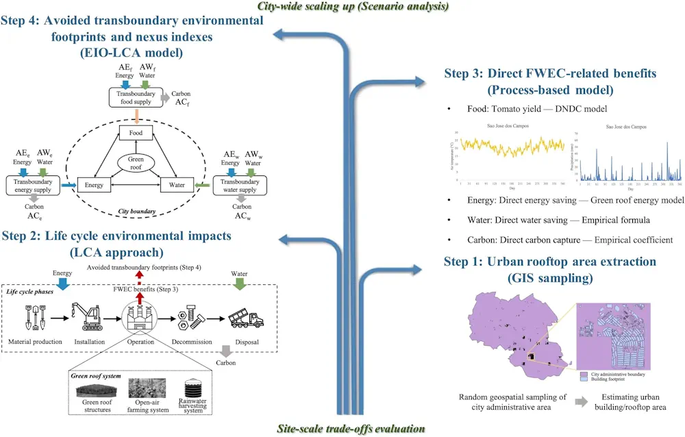
Geoscientists Aim To Improve Human Security Through Planet-scale POI Modeling
Through an intelligent combination of geotagged social media, global location and natural language data, ORNL’s Junchuan Fan and Gautam Thakur developed MapSpace, a publicly available, scalable land-use modeling framework. By providing data characteristics broader and deeper than satellite imagery alone, MapSpace can generate population analytics invaluable for urban planning and disaster response. The researchers’ findings ...
phys.org