Geomaticians

Transportation

Nowa Aplikacja Bukle App Do Planowania Podróży Komunikacją Miejską

Najważniejszą funkcją systemu to możliwość dodania do niego rozkładów jazdy dowolnej firmy transportowej. Celem projektu jest dotarcie do lokalnych przewoźników i przekonanie ich do umieszczenia i (regularnego) aktualizowania swoich rozkładów jazdy, ponieważ serwis pozwala na samodzielne zarządzanie rozkładem przez firmy transportowe. Aplikacja wyznacza połączenia między dwoma miejscami z możliwymi przesiadkami, pozwala zobaczyć czasy odjazdów czy ...
gisplay.pl
Un Sistema Basado En Sensores Ópticos Y Algoritmos Detectará Fisuras En Las Vías Férreas

Un Sistema Basado En Sensores Ópticos Y Algoritmos Detectará Fisuras En Las Vías Férreas

La Escola de Enxeñaría Aeronáutica e do Espazo del campus de Ourense reunió este martes a expertos en infraestructuras y mantenimiento en el sector ferroviario para conocer los avances del proyecto RIIM, en el que trabajan investigadores del grupo de Ingeniería Física de este centro y la empresa Copasa. El objetivo de esta investigación, explicaron, ...
Nexar Revolutionizes Map-Making With 40x Reduction In Real-time Mapping Costs

Nexar Revolutionizes Map-Making With 40x Reduction In Real-time Mapping Costs

Nexar, the leading real-time mapping company, announced today it has achieved a dramatic 40x reduction in the cost of real-time mapping by leveraging cutting-edge technologies, edge AI, change detection and crowdsourcing. As a result, Nexar’s CityStream Live platform is making real-time mapping data more accessible to the mobility industry than ever before. Nexar dramatically reduces ...
prnewswire.com
자율주행용 정밀도로지도, 일반 국도까지 지원한다

자율주행용 정밀도로지도, 일반 국도까지 지원한다

국토교통부 국토지리정보원은 고속국도와 일반국도를 대상으로 자율주행의 핵심 인프라인 정밀도로지도 구축을 완료하고 지난달 27일부터 무상으로 제공하고 있다. 정밀도로지도는 차선, 표지, 도로시설 등을 도로 디지털트윈으로 구현한 고정밀 전자지도로 차선 단위의 차량위치 결정이 가능해 자율주행을 지원하도록 제작된 지도를 말한다. 자율주행 뿐만 아니라 고정밀 내비게이션과 운전 중 발생할 수 있는 상황을 차량이 스스로 인지해 판단하는 전자 제어 시스템인 ADAS(Advanced ...
hellot.net
광주시, AI·빅데이터 활용 미래형 스마트 교통도시로 거듭난다

광주시, AI·빅데이터 활용 미래형 스마트 교통도시로 거듭난다

광주시는 지능형교통체계(ITS) 스마트 횡단보도를 구축하고 교통안전시설물 관리시스템을 추진하는 등 미래형 스마트 교통도시로 거듭난다고 2일 밝혔다. 시는 광주경찰청 교통안전시설 담당자들과 워크숍을 열어 교통시설 추진정책 및 확충분야를 심도 있게 논의, 시민 불편은 줄이고 교통안전은 높이는 ‘2023년 미래형 교통시설 중점 추진 정책’을 마련해 이날 발표했다. 먼저 AI 센서와 빅데이터를 활용한 ITS 스마트횡단보도 구축사업을 추진한다. 스마트횡단보도는 첨단센서 기술로 보행자와 ...
chum-dan.net
NOAA Making Vessel Traffic Data More Accessible To Public

NOAA Making Vessel Traffic Data More Accessible To Public

The Automatic Identification System that tracks vessel movements with transponders on ships has helped create an “AIS database of 30 billion-plus vessel locations has become the go-to resource for maritime planners and ocean geospatial tech experts,” according to a recent summary from NOAA. That data is a base for a NOAA website, MarineCadastre.gov . For ...
workboat.com
SwRi Tests Automated Vehicles In Virtual Off-road Environments

SwRi Tests Automated Vehicles In Virtual Off-road Environments

Southwest Research Institute (SwRI) has created a 3D simulation tool to test automated vehicles in virtual off-road environments modeled after real-world conditions. The research expands SwRI’s investment into software-in-the-loop solutions to test connected and automated vehicles (CAVs) in scenarios ranging from congested roadways to off-road terrain. SwRI’s simulator consists of a graphics engine, dynamics engine, ...
eurekalert.org
St. Cloud Launches Interactive Road Closure Map

St. Cloud Launches Interactive Road Closure Map

St. Cloud has a live interactive map to help people navigate the city’s road closures. The online information includes long-term road projects, short-term closures for repairs or emergencies, and event-related road closures. The map is updated with every closure that occurs. Just click on the highlighted road segment, and a pop-up window will appear with ...
knsiradio.com

Seoul Robotics Partners With Temple For Street-level 3D Solutions

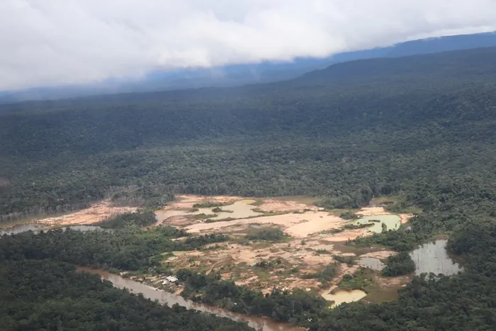
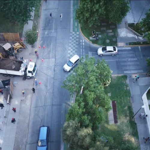
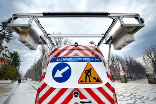
Seoul Robotics, the company powering smart 3D infrastructure solutions, announced a distribution partnership with Temple, a provider of intelligent transportation systems, to bring its proprietary software, SENSR™, to customers in the Southeast. This is Seoul Robotics’ first partnership with a transportation technology distributor in the U.S. and will expand the company’s deployment of smart infrastructure ...
geospatialworld.net
Mapping Pedestrian Street Behavior Using Unmanned Aerial Vehicles

Mapping Pedestrian Street Behavior Using Unmanned Aerial Vehicles

A new study published in PLOS ONE tests the performance of UAV-based observation techniques in measuring pedestrian activity in two comparative settings in Santiago de Chile. Scientists developed an alternative approach of systematic behavioral observation of daily activities in the street based on the use of a UAV. They adapted the data acquisition techniques of ...
techexplorist.com

Des Chercheurs Suisses Se Lancent Dans Un Projet De Numérisation Pour Des Villes Durables En Afrique De L’ouest

À partir de septembre 2024, un groupe de recherche de l’École polytechnique fédérale de Lausanne se lancera dans le projet « Solutions numériques pour la ville durable en Afrique de l’Ouest » à Abidjan, en Côte d’Ivoire. L’initiative vise à numériser quatre villes de la sous-région, dont Abidjan, Bamako, Cotonou et Ouagadougou, et est cofinancée ...
afriqueitnews.com
Politechnika Gdańska Kupiła Pojazd Do Pomiaru Stopnia Zużycia Dróg

Politechnika Gdańska Kupiła Pojazd Do Pomiaru Stopnia Zużycia Dróg

Politechnika Gdańska pozyskała samochód badawczy wyposażony w system laserowy umożliwiający zaawansowane pomiary stopnia zużycia nawierzchni drogowych, autostradowych oraz lotniskowych. Nowe narzędzie badawcze ma pomóc w opracowywaniu wytycznych dla zarządców dróg, które pozwolą ograniczyć remonty i związane z nimi utrudnienia w ruchu. System ten z dużą czułością i dokładnością potrafi wyłapać uszkodzenia na większości typów nawierzchni ...
gisplay.pl

Govt To Introduce GPS-based Toll System In Six Months

The Indian government has announced plans to implement a GPS-based toll system within the next six months, which will replace traditional toll plazas, said Union minister Nitin Gadkari. This new system will rely on GPS technology to track and charge vehicles as they use highways and other roads, eliminating the need for physical toll booths ...
Where the sidewalk ends

Where the sidewalk ends

It’s easier than ever to view maps of any place you’d like to go — by car, that is. By foot is another matter. Most cities and towns in the U.S. do not have sidewalk maps, and pedestrians are usually left to fend for themselves: Can you walk from your hotel to the restaurants on ...
news.mit.edu
MTC Presenta Rutas De Tránsito Alternas Durante Emergencia Climática

MTC Presenta Rutas De Tránsito Alternas Durante Emergencia Climática

Con el objetivo de mantener informados a los conductores, transportistas y pasajeros que requieren trasladarse por las vías nacionales del país, el Ministerio de Transportes y Comunicaciones (MTC), a través de Provías Nacional, presentó el Mapa de Alertas, que ofrecerá detalles sobre las 106 rutas alternas que pueden utilizar en esta emergencia climática. La ministra ...
gob.pe

SLTB To Add Routes Into Geographic Information Systems To Improve Public Transportation Services

The Sri Lanka Transport Board (SLTB) has announced a new pilot program that aims to incorporate bus route maps into a geographic information system (GIS). This program will allow SLTB to effectively manage and monitor bus routes and schedules, thereby improving the quality of public transportation services in Sri Lanka. Through this pilot program, bus ...
english.newsfirst.lk
From Tires To Brakes, U Of T Researchers Tackle ‘Non-tailpipe’ Air Pollution From Vehicles

From Tires To Brakes, U Of T Researchers Tackle ‘Non-tailpipe’ Air Pollution From Vehicles

While the push to mandate EVs aims to reduce tailpipe emissions such as carbon dioxide — the federal government has set a target of complete EV adoption by 2035 — swapping every vehicle on the road still won’t eliminate all the sources of air pollution that can impact human health. That’s because brake pads, rotors ...
news.engineering.utoronto.ca

Wrocław Testuje Aplikację, Która Pomaga Znaleźć Miejsce Do Parkowania

Wrocław to kolejne miasto, które testuje bezpłatną aplikację ParkSpace Eco, ułatwiającą znalezienie wolnego miejsca w strefach płatnego parkowania. Aplikacja pokazuje dokładną lokalizację parkometrów oraz prawdopodobieństwo zaparkowania. Ma także moduł nawigacji. Aplikacja jest bezpłatna i gotowa do pobrania z platformy Android i iOS. Nie wymaga rejestracji ani logowania. Obecnie pozwala znaleźć miejsce do parkowania w kilkudziesięciu ...
gisplay.pl
Researchers Illuminate Gaps In Public Transportation Access, Equity

Researchers Illuminate Gaps In Public Transportation Access, Equity

Public transit systems offering broad coverage of stops and routes may still underserve the communities that rely on them the most, according to a new University of Illinois Urbana-Champaign study. The study applies contextual engineering to help determine lapses in equity in public bus transportation access using data from the Champaign-Urbana Mass Transit District as ...
news.illinois.edu
China To Employ Beidou Satellite-based Augmentation System In Railway Survey

China To Employ Beidou Satellite-based Augmentation System In Railway Survey

China will employ BeiDou satellite-based augmentation system (BDSBAS) to provide high-precision positioning service in railway survey and construction, according to the China Railway Siyuan Survey and Design Group Co., Ltd. Four satellite-based and 12 ground-based observation stations will be set up along the Wufeng-Enshi railway section in central China’s Hubei Province. This is the first ...
english.news.cn
Map Shows Where Every Prague Transit Vehicle Is In Real Time

Map Shows Where Every Prague Transit Vehicle Is In Real Time

Prague has an excellent public transit system, but there still are delays. An online map shows the exact location of all public transit vehicles in real time, so you can decide if it is worth waiting or making alternative plans. The function will likely soon be added to the PID Lítačka application. People in Prague ...
expats.cz
Godoy Cruz Creó Un Sistema Que Ayuda A Elegir Los Mejores Recorridos Para Trasladarse Caminando

Godoy Cruz Creó Un Sistema Que Ayuda A Elegir Los Mejores Recorridos Para Trasladarse Caminando

Durante un año y medio de trabajo, desarrollado junto a la Facultad de Ingeniería de la Uncuyo, se analizó y diagnosticó la situación de caminabilidad. Esto es, cuánto se demora una persona en llegar a sus actividades de forma peatonal. Y qué tan amigable es una zona. Para el desarrollo de dicho indicador, se tuvieron ...
losandes.com.ar
Geotrack Desarrollará El Concepto “Geoblockchain” Para Mejorar La Logística Y El Transport

Geotrack Desarrollará El Concepto “Geoblockchain” Para Mejorar La Logística Y El Transporte

“Gracias al desarrollo del concepto ‘geoblockchain’ se podrá mejorar significativamente la trazabilidad integral de mercancías, agilizar procesos asociados, mejorar rendimientos productivos y aumentar la competitividad de las empresas, contribuyendo con ello a la sostenibilidad y eficiencia de la distribución de mercancías”, Ramón García, director general del Centro de Innovación para la Logística y Transporte de ...
diariodelpuerto.com
New Research Reveals Shifting Identities Of Global Fishing Fleet To Help Bolster Fisheries Management

New Research Reveals Shifting Identities Of Global Fishing Fleet To Help Bolster Fisheries Management

A new study published today in Science Advances combines a decade’s worth of satellite vessel tracking data with identification information from more than 40 public registries to determine where and when vessels responsible for most of the world’s industrial fishing change their country of registration, a practice known as “reflagging”, and identify hotspots of potential ...
eurekalert.org
Wrocław Udostępnił Mapę Dostępności Komunikacyjnej

Wrocław Udostępnił Mapę Dostępności Komunikacyjnej

Dobra komunikacja i sprawne przemieszczanie po mieście często decydują o jakości życia. Wrocław twierdzi, że jako pierwsze miasto w Polsce ocenił dostępność komunikacyjną w zależności od lokalizacji. Mapa dostępności komunikacyjnej nazwana też „zielonym pająkiem Wrocławia” od wtorku 17 stycznia dostępna jest dla każdego. Wyniki analizy poznać mogą zarówno mieszkańcy jak i inwestorzy. Mapa wykonana została ...
portalsamorzadowy.pl
Hexagon And Ness Provide Digital Maps For Czech Railways

Hexagon And Ness Provide Digital Maps For Czech Railways

Ness Czech will supply the Czech Railway Administration with a Digital Technical Railway Map (DTRM) with help from Hexagon’s Safety, Infrastructure and Geospatial division. The DTRM project has been underway since September 2022 and will be implemented by 2025. DTRM is a railway-specific geographic information system (GIS), that provides access to transport and technical infrastructure ...
b2bchief.com
اولین کامیونت هوشمند ایران با شتاب سیستم معرفی شد

اولین کامیونت هوشمند ایران با شتاب سیستم معرفی شد

سیستم ioTrailer اولین سیستم هوشمند سازی خودروهای کار و تجاری است که توسط شرکت ” شتاب سیستم ” معرفی شده و امکانات منحصر بفردی را ارائه می دهد. این سیستم میزان وزن بار، کنترل محور عقب، سرویس های دوره ای، مسیریابی و تطبیق هواشناسی، موقعیت یابی جغرافیایی و حصار جغرافیایی، مانیتورینگ دما و رطوبت یخچالی، ...
asbe-bokhar.com
Owl Autonomous Imaging Launches Monocular 3D Thermal Ranger Computer Vision

Owl Autonomous Imaging Launches Monocular 3D Thermal Ranger Computer Vision

At CES 2023, Owl Autonomous Imaging announced the availability of an Evaluation Kit for their new Thermal Ranger™ ADAS & Autonomous Navigation Development Platform. This hardware and software kit enables Tier 1 and OEM automotive companies to easily evaluate Owl AI’s Thermal Ranger imaging solution for use in their Pedestrian Automatic Emergency Braking (PAEB) and ...
memuk.org
All Roads In Telangana To Be Mapped By Remote Sensing

All Roads In Telangana To Be Mapped By Remote Sensing

All roads in Telangana would be mapped with the help of satellite remote sensing systems to help in better planning and maintenance, Vice-Chairman of the State Planning Board B. Vinod Kumar said on Monday. The mapping would include length of the roads, width of roads at different locations, their conditions, existing culverts and bridges. The ...
thehindu.com

Vianova Builds Location Data Platform For Shared Mobility Companies And Cities

Vianova, a French startup is building a data platform for shared mobility companies as well as local governments. The company acts as both a data repository and a data visualization dashboard. The mobility fleets all have some form of connectivity with a GPS chip and a cellular modem. Companies and local governments can use data ...
geospatialworld.net