Geomaticians

SWOT

Water-Tracking Satellite Reveals First Views

Water-Tracking Satellite Reveals First Views

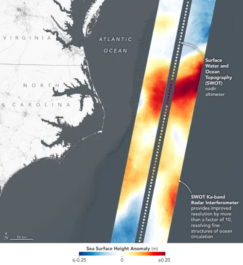
The international Surface Water and Ocean Topography (SWOT) mission—led by NASA and the Centre National d’Études Spatiales (CNES)—has sent back some of its first glimpses of water on the planet’s surface, showing ocean currents like the Gulf Stream in unprecedented detail. The spatial resolution of SWOT ocean measurements is 10 times greater than the composite ...
earthobservatory.nasa.gov
US-European Satellite Will Make World’s First Global Freshwater Survey

US-European Satellite Will Make World’s First Global Freshwater Survey

Water is life, but for all its importance, humanity has a surprisingly limited view of Earth’s freshwater bodies. Researchers have reliable water level measurements for only a few thousand lakes around the world, and little to no data on some of the planet’s important river systems. The upcoming Surface Water and Ocean Topography (SWOT) satellite ...
jpl.nasa.gov