Geomaticians

Surveying

Fashola Inaugurates Governing Council Of Federal School Of Surveying

The Minister of Works and Housing, Babatunde Fashola, has inaugurated the 7th governing council of the 114-year-old Federal School of Surveying (FSS), Oyo, with the Surveyor General of the Federation (SGoF), Abudulganiyu Adebomehin as Chairman. Head of Press and Public Relations of the SGoF office, Micheal Abu, in a statement noted that the developments was ...
thisdaylive.com
Zapowiedź Kolejnej Edycji Geodezyjnej Olimpiady

Zapowiedź Kolejnej Edycji Geodezyjnej Olimpiady

Komitet Główny Olimpiady Wiedzy Geodezyjnej i Kartograficznej oraz Stowarzyszenie Geodetów Polskich zapraszają uczniów i szkoły do udziału w 45. edycji tego wydarzenia w roku szkolnym 2022/2023. Organizatorem zawodów drugiego i trzeciego stopnia obecnej edycji będzie Zespół Szkół Budowlanych w Bydgoszczy oraz Zarząd Oddziału Stowarzyszenia Geodetów Polskich w Bydgoszczy. Organizatorzy przewidują, że zawody te zostaną przeprowadzone ...
geoforum.pl
Trimble Introduces GNSS Data Integrity Monitoring For PPP Corretion Service

Trimble Introduces GNSS Data Integrity Monitoring For PPP Corretion Service

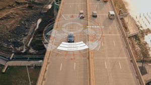
Trimble has introduced data integrity monitoring for its precise point positioning (PPP) correction service, CenterPoint RTX Fast. The Trimble RTX Integrity monitoring system is an innovative, patented solution, built in direct response to client requirements for production-ready applications. The solution continuously validates the reliability of correction data processed by the network, which is broadcast to ...
gim-international.com
Scanning Complex Areas Just Got Easier With Trimble X12

Scanning Complex Areas Just Got Easier With Trimble X12

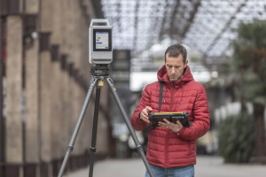
Surveying involves on-point details of scanning and developing complex yet high quality images with ease but the task is not easy to perform, which is why Trimble has introduced Trimble X12 3D laser scanning system. The Trimble X12 is a high-end 3D laser scanner with superior speed, accuracy, and range and image quality for demanding ...
geospatialworld.net

China Supports Pakistan In Geomatics Technology Upgrading

The Advanced Seminar on Geomatics Technology for Pakistan sponsored by the Ministry of Commerce of China is ongoing online to help improve Pakistani scientists and officers’ expertise in geomatics. It’s learned that a total of 19 Pakistani experts and officers from the Society of Engineering, National Institute of Computer Sciences, University of AJ & K ...
en.ce.cn

Guyana To Establish Land Surveying Institution To Serve Caribbean, Latin America

President Irfaan Ali has announced plans to develop a Land Surveying Institution in Guyana which will serve the entire Caribbean as well as countries in Latin America. “Our vision is to create a land surveying institute in this country that will provide services for the entire Caribbean and Latin America. We must be in a ...
demerarawaves.com

تهیه نقشه ۳۵۰ شهر بدون نقشه، با استفاده از پهپاد و دانش بنیان برای اولین بار

رئیس سازمان نقشه برداری كشور با بیان اینكه با یك كار انقلابی تهیه اطلس تحت وب تا مهرماه آماده بهره برداری خواهد بود افزود: در راستای استفاده عملی از ظرفیت های دانش بنیان تهیه نقشه ۳۵۰ شهر بدون نقشه با استفاده از پهپاد برای اولین بار در دستور كار سازمان نقشه برداری قرار گرفت.
dolat.ir
BMC Developing 3D Digital Map Of Mumbai City

BMC Developing 3D Digital Map Of Mumbai City

After attempting the project as a pilot in South Mumbai’s Worli neighbourhood in September of last year, the Brihanmumbai Municipal Corporation (BMC) has begun the process of developing a three-dimensional digital model of Mumbai city. In addition to its open spaces, municipal facilities, and slums, Mumbai’s buildings, roads, bridges, underpasses, water bodies, means of transportation, ...
scoopearth.com
Haritalar Insansiz Hava Araci Ile Üretilecek

Antalya Büyüksehir Belediyesi, mühendislik hizmetlerinde ihtiyaç duydugu haritalari ve cografi veri teminini insansiz hava araci destegiyle saglamaya basladi. Bu çerçevede belediye personeline Insansiz Hava Araci ile Cografi Veri Üretimi Bilgilendirme toplantisi gerçeklestirildi. Toplantida Bilgi Islem Dairesi Baskanligi Cografi Bilgi Sistemleri Sube Müdürlügü’nce kullanilmaya baslanilan, haritalama çalismalarina yönelik gelistirilmis RTK/GPS sistemine sahip IHA ile havadan ekonomik, ...
beyazgazete.com
New Scanning And Imaging Solution From Trimble Simplifies 3D Deliverables

New Scanning And Imaging Solution From Trimble Simplifies 3D Deliverables

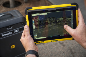
Trimble introduced today the new Trimble® X12 scanning system to the geospatial scanning portfolio. The X12 integrates intuitive Trimble software for precise data capture and in-field registration with state-of-the-art 3D laser scanning and imaging hardware technology from Zoller+Fröhlich (Z+F), combining the expertise of two industry leaders into a single solution.
prnewswire.com

Trimble Introduces Next Generation High-Accuracy Mapping Solution For GIS Field Applications

Trimble announced today a new high-performance data collector for its Mapping and Geographic Information Systems (GIS) portfolio—the Trimble TDC650 handheld. Built for GIS data collection, inspection and asset management activities, the TDC650 provides users a rugged solution with scalable high-accuracy Global Navigation SatelliteSystem (GNSS) positioning for professional field workflows. The TDC650 is fully integrated with ...
fieldtechnologiesonline.com