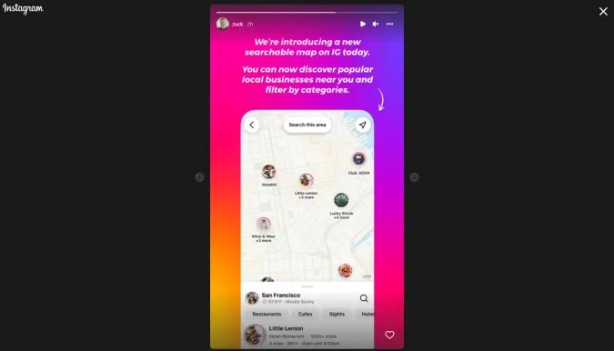
The New Instagram Map Is Like Google Maps But With More Selfies
The map function on Instagram got a lot more useful today, in a Google-inspired kind of way. The new Instagram map supports searches and filters, allowing users to look up restaurants, attractions and other hot spots directly in the app, rather than simply viewing where a photo was posted. The updated map also features posts, ...
engadget.com