Geomaticians

SAR

Capella’s Earth-Imaging Satellites Are Deorbiting Faster Than Expected

Capella Space’s synthetic aperture radar satellites are falling back to Earth much sooner than the three years they were anticipated to operate, according to publicly available satellite data. The startup has launched a total of ten small satellites to low Earth orbit since 2018, including eight in its family of “Whitney”-class spacecraft. Five of these ...
techcrunch.com
Project Aims To Help Address The Loss Of Cultures Worldwide Caused By Climate Change

Project Aims To Help Address The Loss Of Cultures Worldwide Caused By Climate Change

A team of international researchers, led by Nanyang Technological University, Singapore (NTU Singapore), has announced the initial findings of a project to address the loss of cultures by measuring the impact that climate change has on communities. One finding from the joint project, titled Climate Crisis and Cultural Loss, or 3CL, is the practice of ...
phys.org

INIA Desarrolla Mapas Con Imágenes Satelitales Que Reflejan La Magnitud De Las Zonas Agrícolas Inundadas

Sentinel-1 es un satélite de observación de la Tierra desarrollado por la Agencia Espacial Europea (ESA), que utiliza tecnología de radar de apertura sintética (SAR, por sus siglas en inglés) para adquirir imágenes de la superficie terrestre. Y gracias a sus registros, el Instituto de Investigaciones Agropecuarias (INIA) elaboró mapas satelitales que visualizan las zonas ...
entreprenerd.cl
U.S. And India To Expand Spaceflight Cooperation

U.S. And India To Expand Spaceflight Cooperation

The governments of the United States and India have agreed to work more closely together in spaceflight, with India signing the Artemis Accords and the two countries planning for a joint mission of some kind to the International Space Station. In a fact sheet distributed by the White House, the governments said they agreed that ...
spacenews.com

Ex-ISRO Official Promoted Sisir Radar Test Flew Drone Fitted With ‘Rabbit SAR’

Space sector startup, Sisir Radar Private Ltd has successfully tested its Synthetic Aperture Radar (SAR) fitted on a drone, said a senior company official. “The drone fitted with SAR was flown (on Friday) at a place called Sonarpur, about 50 km from Kolkata,” Tapan Misra, Founding Director and Chief Scientist, Sisir Radar Private Ltd, told. ...
dtnext.in

Arianespace Will Launch Kompsat-6 With The Vega C For KARI

Kompsat-6 is the second SAR (Synthetic Aperture Radar) imaging satellite developed by KARI and will replace its predecessor, Kompsat-5, while deploying improved imaging radar performance. This EO satellite will carry two payloads, the SAR instrument (X-Band Synthetic Aperture Radar) and the S-AIS (Satellite-Automatic Identification System). SAR payload is a high-resolution all-weather imager, which has applications ...
news.satnews.com
Nuri Successfully Sends 5 Out Of 8 Satellites Into Orbit

Nuri Successfully Sends 5 Out Of 8 Satellites Into Orbit

Five out of the total of eight satellites separated from Korea’s domestically developed space rocket Nuri, successfully entered their target orbits and are sending signals. Meanwhile, attempted communication with the remaining three satellites are “still ongoing.” The main payload, Next Generation Small Satellite, or NEXTSat-2, successfully entered its target orbit and two-way communication was made, ...
koreajoongangdaily.joins.com
httpsspacewatch.global202305iceye-introduces-satellite-radar-dwell-capability

ICEYE Introduces Satellite Radar Dwell Capability

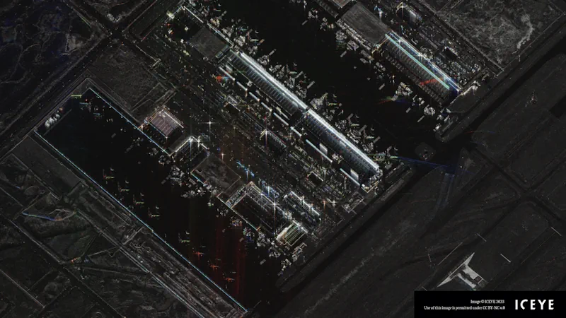
ICEYE has announced a new imaging mode known as Dwell to enable its synthetic aperture radar (SAR) satellites to remain focused on a specific point on the ground for an extended collection time. This long-duration imaging mode allows ICEYE satellites to capture significantly more information about the imaging target, creating a new capability for imagery ...
spacewatch.global

Bayanat And Yahsat Announce Space Programme To Build Satellite Capabilities

Bayanat, a geospatial data products and services provider, and Abu Dhabi’s Al Yah Satellite Communications, better known as Yahsat, have launched a space programme aimed at building national satellite remote sensing and earth observation (EO) capabilities within the UAE. The space programme will look for business opportunities in the local and global EO market, Bayanat ...
thenationalnews.com
Airbus-backed Satellite Planned For Launch

Airbus-backed Satellite Planned For Launch

Called Carbsar, the mission is being developed by Surrey Satellite Technology and Oxford Space Systems. The project responds to the effective use of radar tech in the ongoing Ukraine conflict, currently used to monitor Russian movements, and is intended to fill a gap in U.K. surveillance. The work has been jointly funded by Airbus Defense ...
iotworldtoday.com

Synspective And Thaicom Partner On Disaster Response In Southeast Asia

Imagery startup Synspective and regional operator Thaicom are partnering to jointly offer synthetic aperture radar (SAR) for disaster response in Thailand. The two companies announced Tuesday they plan to offer a solution to government, defense, agriculture, and finance sectors in Thailand, with Synspective’s SAR technology and Thaicom’s knowledge of the satellite and space sector in ...
satellitetoday.com
ISRO To Launch Singapore’s EO Satellite

ISRO To Launch Singapore’s EO Satellite

The Indian Space Research Organisation (ISRO) will launch the Singaporean Earth Observation satellite TeLEOS-02 on Saturday, April 22. The launch will take place at 2.19 pm from the first launch pad at Sriharikota. The satellite on board will be TeLEOS 2—a 750kg earth observation satellite that has synthetic aperture radar capable of providing data in ...
geospatialworld.net
Brasil E China Vão Fabricar E Lançar Satélite Para Monitorar A Amazônia

Brasil E China Vão Fabricar E Lançar Satélite Para Monitorar A Amazônia

Os governos do Brasil e a China assinaram nesta sexta-feira (14) 15 acordos de cooperação entre os quais o que vai possibilitar o desenvolvimento, fabricação, lançamento e operação de um satélite para aperfeiçoar o monitoramento da Amazônia. Trata-se do Satélite Sino Brasileiro de Recursos Terrestres – CBERS-6, que possui uma nova tecnologia: o Radar de ...
vermelho.org.br

Synspective And Insight Terra Announce Space-enabled Data And Monitoring Solution For Mine Tailings Facilities

Synspective, a Tokyo based SAR (synthetic aperture radar) satellite data and solutions provider, and Insight Terra, a London based start-up providing a cloud based environmental and infrastructure risk management platform and solutions, have entered into a strategic partnership to deliver a new space enabled data and monitoring solution for the mining industry. The solution uses ...
realwire.com

ساخت سنجنده راداری زمینی برای شناسایی آثار باستانی و نشست‌های ایستگاه‌های مترو

محققان دانشکده مهندسی نقشه‌برداری و اطلاعات مکانی دانشگاه تهران، موفق به طراحی و ساخت سنجنده‌های زمین مبنای راداری با روزنه مصنوعی (GBSAR) با قدرت نفوذپذیری و قابلیت استفاده در هر ساعت از شبانه‌روز شدند. دکتر جلال امینی، استاد دانشکده مهندسی نقشه‌برداری و اطلاعات مکانی دانشگاه تهران که با تجربه حاصل از گذراندن سیر مطالعاتی در ...
isna.ir

Surveillance Satellitaire : Unseenlabs S’associe À Un Spécialiste De L’analyse Géospatiale

La société française Unseenlabs, spécialisée dans les nano-satellites de géolicalisation, vient de conclure un partenariat avec Ursa Space Systems, un spécialiste de l’analyse géospatiale, pour fournir des solutions visant à la surveillance des espaces maritimes, dans un but de sûreté et de sécurité maritime. Ce nouveau partenariat vise à permettre permet d’améliorer la surveillance du ...
meretmarine.com

Synspective’s Third SAR Satellite “Strix-1” Successfully Reaches Target Orbit

Synspective Inc., a SAR satellite data and solutions provider, announced today that StriX-1, its third SAR satellite, has successfully been put into its target orbit. On September 16 (JST), StriX-1 was deployed by Rocket Lab’s Electron at Rocket Lab Launch Complex 1 on New Zealand’s Mahia Peninsula. The satellite was put into its target orbit: ...
geospatialworld.net

Leading Space Innovators Join Forces To Create World’s First Satellite With Both SAR And Optical Payloads To Revolutionize Geospatial Imaging

Antaris, the software platform provider for space, and GalaxEye, an imaging satellite operator, today announced the signing of a Memorandum of Understanding to create the world’s first satellite featuring both SAR and optical sensors on a single satellite. The MOU highlights a unique commitment between three Indian space leaders—GalaxEye, Ananth Technologies and XDLINX Labs—and US-based ...
spaceref.com

ICEYE To Provide Radar Imaging Satellite For BAE Systems

ICEYE, the global leader in persistent monitoring with radar satellite imaging, is partnering with BAE Systems to provide advanced Synthetic Aperture Radar (SAR) technology as part of BAE Systems’ new multi-sensor satellite cluster launching in 2024. Known as Azalea™, this group of Earth sensing satellites will use a range of instruments to collect visual, radar, ...
geospatialworld.net
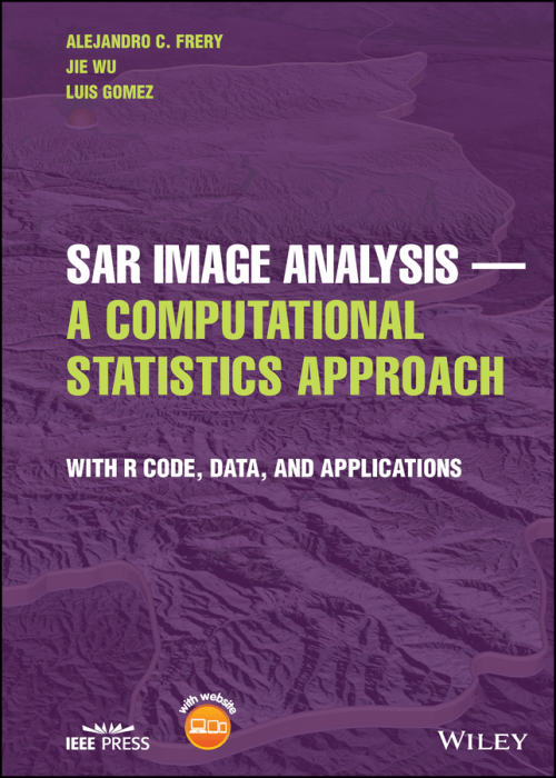
SAR Image Analysis - A Computational Statistics Approach With R Code, Data, and Applications

SAR Image Analysis – A Computational Statistics Approach: With R Code, Data, and Applications

In SAR Image Analysis — A Computational Statistics Approach, an accomplished team of researchers delivers a practical exploration of how to use statistics to extract information from SAR imagery. The authors discuss various models, supply sample data and code, and explain theoretical aspects of SAR image analysis that are highly relevant to practitioners and students. ...
wiley.com

ESA Ends Efforts To Recover Sentinel-1b

The European Space Agency is ending efforts to restore operations of the Sentinel-1B radar imaging satellite that malfunctioned more than half a year ago and will instead move up the launch of a replacement. ESA said in an Aug. 3 statement that the agency and the European Commission, partners on the Copernicus series of Earth ...
spacenews.com
An Interactive Map To Monitor The Activity Of Dark Fleets In Coastal Waters_2

An Interactive Map To Monitor The Activity Of Dark Fleets In Coastal Waters

Powered by satellite radar imagery and machine learning, the new interactive map layer from Global Fishing Watch reveals a global view of hidden vessels around the world. Global Fishing Watch has developed and publicly released the first ever global map of previously undetected dark fleets, or vessels that do not broadcast their location or appear ...
nationalfisherman.com

UAE Sets Up $816m Fund To Support Space Sector

The UAE Space Agency has announced a new three billion dirhams ($816 million) investment and development fund for the space sector, which will support new programmes in leading edge space sector engineering, sciences and research. The fund’s first investment will be in the development and launch of a constellation of advanced imaging satellites for the ...
gdnonline.com

Synspective Releases First Image From Its Small SAR Satellite That Captures Three Cities

Synspective Inc., a SAR satellite data and analytic-solution provider, announced that it has successfully acquired its first image from its second SAR satellite, “StriX-β”. “StriX-β” was launched by Rocket Lab’s Electron from New Zealand’s Mahia Peninsula launch site on March 1, 2022 (JST) and put into target orbit at an altitude of 561km in a ...
geospatialworld.net