Geomaticians

Rail

Network Rail Seeks InSAR Provider For Geotechnical Asset Monitoring

The UK rail infrastructure operator wants to create an integrated system that combines interferometric synthetic aperture radar (InSAR) – which can monitor ground deformation at very high temporal and spatial resolution – with its existing asset data. InSAR could be used to alert Network Rail to areas that show instability based on their movement history. ...
geplus.co.uk

Trimble Monitoring Software Expands Sensor Support To Deliver Broader Rail And Structural Deformation Analytics

Trimble announced today at the INTERGEO conference the latest release of Trimble® 4D (T4D) Control™ software, version 6.5, expanding rail track monitoring capabilities to address a wider range of standards and specifications. This update also adds support for Syscom Instruments acceleration sensors for event-based monitoring of ground motion, as well as updating authentication methods for ...
amerisurv.com

Queensland’s Spatial Cadastre Updated For Inland Rail

A two-year project to survey and model nearly 233,000 hectares of land — equivalent to the size of the Australian Capital Territory — to upgrade Queensland’s spatial cadastre, has been completed as a vital part of delivering the Inland Rail project. The spatial cadastre is used to accurately identify the location of the new rail ...
spatialsource.com.au
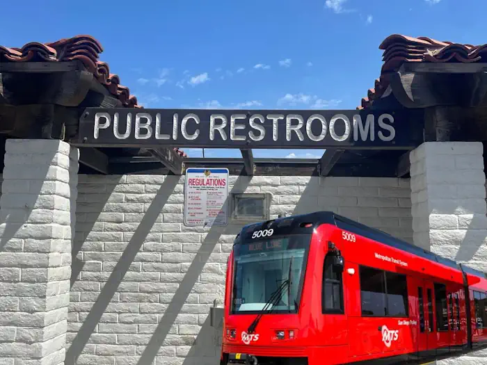
Where To Go SDSU Student Identifies Transit Line Needs

Where To Go? SDSU Student Identifies Transit Line Needs

An interdisciplinary team from San Diego State University analyzed the accessibility of public restrooms along transit lines countywide and found a shortage of facilities, particularly in the busiest stations, and a lack of important features in existing restrooms. Their project, “Where Can You Go On the Go?” was an initiative of SDSU’s Project for Sanitation ...
newscenter.sdsu.edu
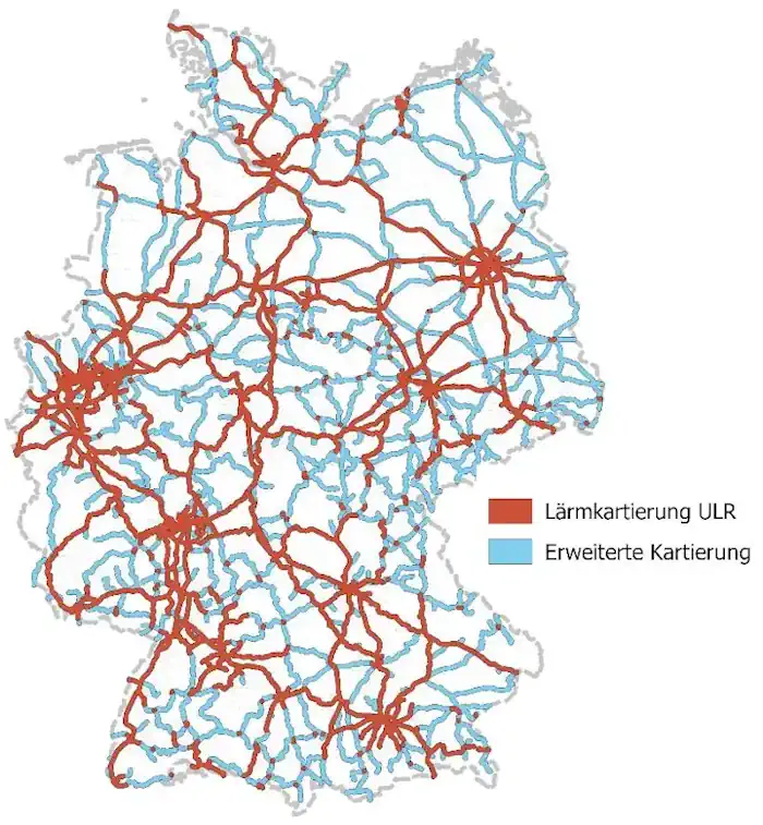
Lärmkartierung Für Das Eisenbahn-Bundesamt Abgeschlossen

Lärmkartierung Für Das Eisenbahn-Bundesamt Abgeschlossen

„Trotz aller Herausforderungen ist es uns gemeinsam gelungen, für das Eisenbahn-Bundesamt eines der größten deutschlandweiten Geodatenmanagementprojekte termingerecht abzuschließen. Ein derart komplexes Projekt erfordert auch ein professionelles Projektmanagement. Durch die Bündelung erfahrener Lärmexperten, Qualitätsmanager und Datenspezialisten konnte das eingespielte Kompetenzteam Risiken bewerten und passgenaue Lösungen entwickeln“, blickt Claus Hofmann, Geschäftsführer von Disy Informationssysteme, auf die gut ...
rheinischer-spiegel.de
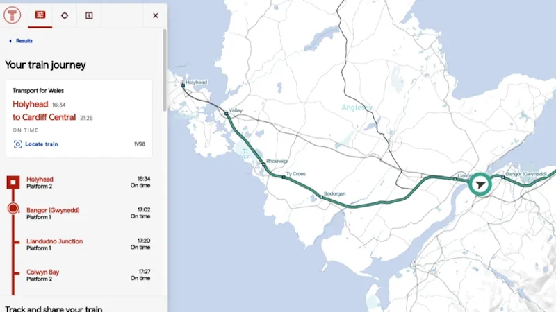
Transport For Wales Launches New Live Map That Shows Passengers Where Their Train Is

Transport For Wales Launches New Live Map That Shows Passengers Where Their Train Is

A brand new live digital map has been launched showing customers exactly where their train is. Launched by Transport for Wales, the map has been described as “fantastic” by rail bosses. It shows the location of every TfW train and allows customers to view a train’s journey in real time and see the expected arrival ...
itv.com
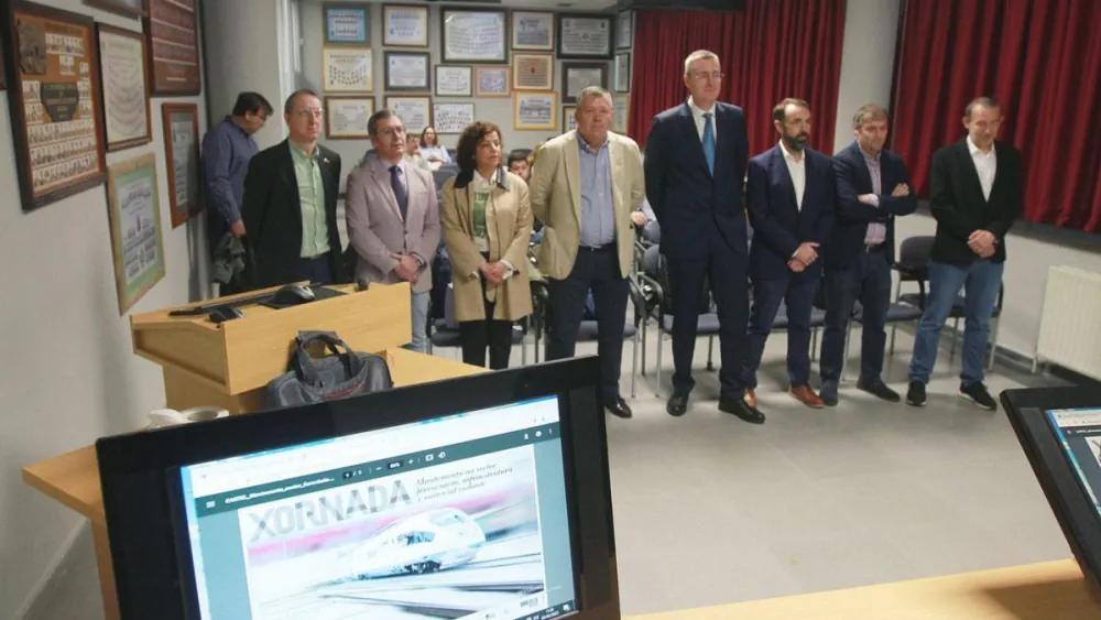
Un Sistema Basado En Sensores Ópticos Y Algoritmos Detectará Fisuras En Las Vías Férreas

Un Sistema Basado En Sensores Ópticos Y Algoritmos Detectará Fisuras En Las Vías Férreas

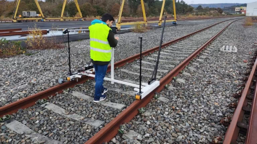
La Escola de Enxeñaría Aeronáutica e do Espazo del campus de Ourense reunió este martes a expertos en infraestructuras y mantenimiento en el sector ferroviario para conocer los avances del proyecto RIIM, en el que trabajan investigadores del grupo de Ingeniería Física de este centro y la empresa Copasa. El objetivo de esta investigación, explicaron, ...
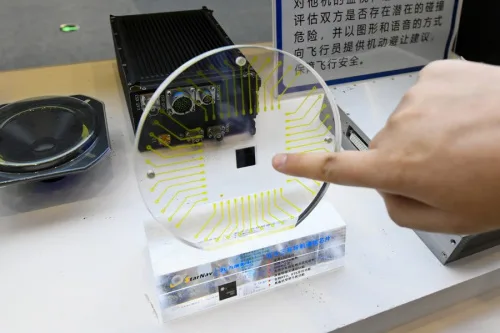
China To Employ Beidou Satellite-based Augmentation System In Railway Survey

China To Employ Beidou Satellite-based Augmentation System In Railway Survey

China will employ BeiDou satellite-based augmentation system (BDSBAS) to provide high-precision positioning service in railway survey and construction, according to the China Railway Siyuan Survey and Design Group Co., Ltd. Four satellite-based and 12 ground-based observation stations will be set up along the Wufeng-Enshi railway section in central China’s Hubei Province. This is the first ...
english.news.cn
Hexagon And Ness Provide Digital Maps For Czech Railways

Hexagon And Ness Provide Digital Maps For Czech Railways

Ness Czech will supply the Czech Railway Administration with a Digital Technical Railway Map (DTRM) with help from Hexagon’s Safety, Infrastructure and Geospatial division. The DTRM project has been underway since September 2022 and will be implemented by 2025. DTRM is a railway-specific geographic information system (GIS), that provides access to transport and technical infrastructure ...
b2bchief.com

Sacyr Digitaliza El Control De La Vegetación De La Plataforma Ferroviaria

Valoriza (grupo Sacyr) realiza para ADIF el control de la vegetación en la plataforma ferroviaria en las líneas convencionales y de la red de ancho métrico en la zona Sur, con el objetivo de minimizar el riesgo de incendios y prevenir daños en la infraestructura. Este proyecto engloba 11 provincias: Almería, Badajoz, Cáceres, Cádiz, Ciudad ...
vivabarbate.es
Testing Lidar Technology On A Real-world Rail System In Canada

Testing Lidar Technology On A Real-world Rail System In Canada

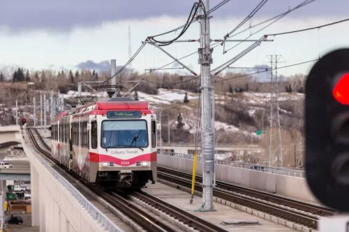
Canadian start-up Lux Modus has tested its Lidar technology as an affordable and easy-to-use 3D data collection platform on a real-world light rail system by participating in the city of Calgary’s Living Labs. A number of years ago, the city’s Living Labs helped Calgary-based Lux Modus successfully test its Lidar technology built for pipeline construction ...
gim-international.com
Copasa Y La Universidad De Vigo Prueban Un Sistema De Mantenimiento Predictivo Para Las Vías Ferroviarias

Copasa Y La Universidad De Vigo Prueban Un Sistema De Mantenimiento Predictivo Para Las Vías Ferroviarias

La alianza entre la Universidad de Vigo y la constructora ourensana Copasa para desarrollar un sistema de mantenimiento predictivo de las vías férreas ya se encuentra en fase de pruebas sobre el terreno. El proyecto RIIM -siglas en inglés de Modelo de Inspección e Información Ferroviaria- trabaja en la mejora de las operaciones de inspección ...
lavozdegalicia.es
Trimble Introduces Innovative Rail Module For Real-time Monitoring Software

Trimble Introduces Innovative Rail Module For Real-time Monitoring Software

Trimble announced today Trimble® 4D Control™ (T4D) software version 6.4, featuring an add-on rail-specific monitoring solution. T4D is a software suite for real-time displacement monitoring and detection. The rail module simplifies the data collection process and reduces up to 95 percent of the office work required to automate movement detection.
amerisurv.com
Researchers Use Lidar Point Cloud Reconstruction To Improve Railway Systems

Researchers Use Lidar Point Cloud Reconstruction To Improve Railway Systems

In an article published in Remote Sensing, researchers presented a point cloud reconstruction approach for a mobile laser scanning technique based on trajectory filtering. The authors employed deep learning to identify railway feature recognition points, and Rauch-Tung-Striebel (RTS) filtering to enhance the trajectory outcomes and correct the odometer data. The maximum discrepancy between the east ...
azooptics.com