Geomaticians

Natural Hazard

New Flood Evacuation Tool Helps With Preparedness, Evacuation And Response

Four Clemson University researchers are part of a national team that has developed a Flood Evacuation Tool to help forecast floods, identify at-risk roads and verify safe evacuation routes. The tool partners artificial intelligence (AI) with human knowledge. Researchers are using this human-AI teaming (HAT) partnership to create an intelligent model for addressing flood evacuation ...
news.clemson.edu

SISPER, Herramienta Para Conocer Los Peligros Naturales En Nuestro Entorno

Los riesgos y peligros a los que estamos expuestos vuelven vulnerables a las poblaciones. Por ello, conocer qué territorios representan mayor peligro a fin de ayudar en la planificación y reducción de daños es el objetivo del Sistema de Información Sobre Peligros y Riesgos (SISPER), una plataforma web desarrollada por científicos de distintas especialidades de ...
cronica.com.mx
Investigadores De La UNAM Diseñan Algoritmo Capaz De Detectar Las Cenizas Del Volcán Popocatépetl

Investigadores De La UNAM Diseñan Algoritmo Capaz De Detectar Las Cenizas Del Volcán Popocatépetl

Investigadores de la UNAM, bajo la dirección del maestro en Geografía Víctor Manuel Jiménez Escudero, han desarrollado un algoritmo innovador que puede detectar con precisión las emisiones de ceniza provenientes del volcán Popocatépetl, conocido por su constante actividad, uno de los más dinámicos y vigilados del mundo. El Laboratorio Nacional de Observación de la Tierra ...
es.wired.com
Genera UAEMÉX Productos Cartográficos Para Ayuda En Afectaciones Provocadas Por 'Otis'

Genera UAEMÉX Productos Cartográficos Para Ayuda En Afectaciones Provocadas Por ‘Otis’

En el Laboratorio Nacional de Observación de la Tierra de la Facultad de Geografía de la Universidad Autónoma del Estado de México, han recibido más de 300 imágenes satelitales con las cuales han podido realizar al menos 12 productos cartográficos de valor agregado. Con los cuales, busca dar atención con mayor rapidez a las zonas ...
milenio.com
An Open-Source Tool To Assist In Multi-Hazard Risk Assessment

An Open-Source Tool To Assist In Multi-Hazard Risk Assessment

RiskChanges is an open-source cloud-based spatial decision support tool using a dynamic and comprehensive approach to multi-hazard risk assessment. It is designed to support orgaizations in assessing and managing risks associated with multiple hazards at the local level to select optimal risk reduction alternatives. RiskChanges was developed by the University of Twente in collaboration with ...
reliefweb.int
Scientists Map Loss Of Groundwater Storage Around The World

Scientists Map Loss Of Groundwater Storage Around The World

Global water resources are stretched by climate change and human population growth, and farms and cities are increasingly turning to groundwater to fill their needs. Unfortunately, the pumping of groundwater can cause the ground surface above to sink, as the aquifers below are drained and the architecture of the ground collapses. For the first time, ...
phys.org
Geospatial Technology Can Help Corn Producers Assess Potential Wind Damage In Fields

Geospatial Technology Can Help Corn Producers Assess Potential Wind Damage In Fields

As cornfields suffer crop damage caused by weather, corn producers can use geospatial and remote sensing technologies to get a more accurate measurement of the damage and estimate potential economic loss, according to a recent study published in Frontiers in Agronomy. In the study, the United States Department of Agriculture’s (USDA), Agricultural Research Service (ARS) ...
phys.org
Geospatial Data Used To Identify Geohazards For Site Investigations

Geospatial Data Used To Identify Geohazards For Site Investigations

Consultant Card Geotechnics (CGL) has applied aerial laser surveying to pinpoint natural hazards on development sites across the UK. CGL is using geospatial data from aerial survey and geographic data company Bluesky. The data has formed part of the investigation stage on projects ranging from proposed residential developments to long, linear overhead powerlines. High-resolution aerial ...
geplus.co.uk
RD Y Cuba Unirán Capacidades Para Desarrollar Atlas De Riesgo Climático

RD Y Cuba Unirán Capacidades Para Desarrollar Atlas De Riesgo Climático

República Dominicana y Cuba exploran vías de intercambio y colaboración para impulsar los Atlas de Riesgo Climático de ambos países, basándose en las capacidades y fortalezas que cada uno de ellos ha desarrollado en materia de observación geoespacial; recolección y sistematización de datos; y desarrollo de las plataformas tecnológicas. “Cuba ha desarrollado y actualiza cada ...
visitantes.do

La UCLM Y El MNCN Desarrollan Un Método Que Obtiene Mapas Más Fiables Del Riesgo De Las Inundaciones Fluviales

Cuando un río se desborda, inunda los terrenos que lo rodean provocando numerosos daños y situaciones de peligro. La Directiva Europea de Inundaciones regula, entre otras materias, qué se puede cultivar, edificar o programar en las vegas de los ríos con la intención de minimizar los efectos indeseados de un desbordamiento. Un equipo de investigadores ...
lacerca.com
HHS Launches Climate And Health Outlook Portal To Identify Counties At Risk Of Climate-related Hazards

HHS Launches Climate And Health Outlook Portal To Identify Counties At Risk Of Climate-related Hazards

Today, in coordination with the White House Summit on Building Climate Resilient Communities, the U.S. Department of Health and Human Services’ (HHS) Office of Climate Change and Health Equity (OCCHE) and Administration for Strategic Preparedness and Response’s (ASPR) Geospatial Team launched the Climate and Health Outlook Portal , an interactive tool that provides actionable, county-level ...
hhs.gov

As Wildfires Worsen, Canada’s Space Agency Wants To Become Firefighters’ Eye In The Sky

Canada’s fire forecasters will be getting a new tool in their battle against out-of-control blazes. In this year’s record-scorching fire season, provincial and federal wildfire agencies had to rely on a mix of European and NASA satellite instruments to help monitor and predict fire behaviour. Now, however, the Canadian Space Agency is preparing to launch ...
cbc.ca

NWS Unveils New Experimental Flood Inundation Maps For Much Of East Texas, Central Pennsylvania And Parts Of The Northeast

Flooding is the most frequent severe-weather related threat and the costliest natural disaster in the United States. To improve flood warning communication and help emergency managers prepare for and respond to flooding, the National Weather Service (NWS) has begun to add new experimental flood inundation mapping services to its suite of forecast products. These new ...
weather.gov

Ecuador Crea Su Primer Atlas Geográfico Y Estadístico Ambiental Y De Los Recursos Hídricos

Ecuador presentó su primer Atlas Geográfico y Estadístico Ambiental y de los Recursos Hídricos para facilitar el acceso a información oficial actualizada, validada y confiable sobre el patrimonio natural y los recursos hídricos, informó este viernes el Ministerio del Ambiente, Agua y Transición Ecológica. Esta herramienta de información está dividida en cinco secciones que contienen ...
lavanguardia.com
Governo Lança Painel Que Detalha Ocorrências De Desastres Naturais No Rio Grande Do Sul

Governo Lança Painel Que Detalha Ocorrências De Desastres Naturais No Rio Grande Do Sul

As informações sobre ocorrências de desastres naturais no Rio Grande do Sul entre os anos de 2003 e 2022 foram disponibilizadas pelo governo do Estado em um novo painel, apresentado nesta terça-feira (29/8) durante a 46ª Expointer, em Esteio. No portal, elaborado pela Secretaria de Planejamento, Governança e Gestão (SPGG) em parceria com a Defesa ...
estado.rs.gov.br
Minagri Utilizará Imágenes Satelitales Para Identificar Zonas Agrícolas Inundadas

Minagri Utilizará Imágenes Satelitales Para Identificar Zonas Agrícolas Inundadas

Con el objetivo de conocer a la brevedad cuáles son las zonas agrícolas del centro-sur del país que están inundadas a causa del sistema frontal, la subsecretaria de Agricultura, Ignacia Fernández, instruyó al Centro de Información de Recursos Naturales (CIREN), coordinar el procesamiento de imágenes satelitales y la entrega de información geoespacial, a través del ...
minagri.gob.cl
Measuring The Extent Of Global Droughts In Unprecedented Detail

Measuring The Extent Of Global Droughts In Unprecedented Detail

While some parts of the world suffer extreme heat and persistent drought, others are being flooded. Overall, continental water volumes vary so much over time that global sea levels fluctuate significantly too. By combining the hydrological model WaterGAP with GRACE satellite data, a team of geodesists at the University of Bonn have come up with ...
phys.org
Un Approccio Innovativo Per La Mappatura Delle Inondazioni Fluviali

Un Approccio Innovativo Per La Mappatura Delle Inondazioni Fluviali

Le inondazioni rappresentano uno dei disastri naturali più comuni e più impattanti a livello mondiale. Tali eventi aumenteranno ulteriormente in futuro a causa dei cambiamenti climatici, della crescita economica e dell’urbanizzazione. I ricercatori del laboratorio LSD&D (Land Surface Dynamics and Degradation) del CNR-IMAA, unitamente a ricercatori dell’Università Federico II di Napoli, propongono un approccio innovativo ...
smartgreenpost.it
Global GPS Measurements Indicate Observable Phase Of Fault Slip Two Hours Before Large Earthquakes

Global GPS Measurements Indicate Observable Phase Of Fault Slip Two Hours Before Large Earthquakes

Analysis of Global Positioning System (GPS) time-series data from nearly 100 large earthquakes worldwide has provided evidence for the existence of a precursory phase of fault slip occurring two hours before seismic rupture. “If it can be confirmed that earthquake nucleation often involves an hours-long precursory phase, and the means can be developed to reliably ...
eurekalert.org
On The Trail Of Landslides And Rockfalls Graz University Of Technology Measurement Method Uses Existing Fibre Optic Lines

On The Trail Of Landslides And Rockfalls: Graz University Of Technology Measurement Method Uses Existing Fibre Optic Lines

Landslides and rockfalls are increasingly becoming a real threat to people and infrastructure in light of the changing climate and the associated changes in soil and rock structure. The more precise the measurement, the earlier hazards can be detected, and consequently damage can be limited or even avoided altogether. A team at the Institute of ...
tugraz.at
Oregon Beginning Work On Revised 'Wildfire Hazard' Map

Oregon Beginning Work On Revised ‘Wildfire Hazard’ Map

What was called the ‘wildfire risk map’ is now the ‘wildfire hazard map.’ The map is intended to educate homeowners about their exposure to wildfire risk, determine where fire mitigation resources should be prioritized and identify where future state rules on home hardening and defensible space will apply. The name change reflects a shift by ...
ijpr.org

UNBC Research Project To Examine How Mountain Communities Can Better Prepare For Geohazards

If you live in a community in the mountains like Valemount, McBride or Dunster, you are more than aware that rockfalls, landslides, mudslides and floods are facts of life, and as climate change is making those events more common, a new UNBC research project is looking at how mountain communities can better prepare for these ...
ckpgtoday.ca
Tool Automatically Detects Natural Disasters Using Social Media Images

Tool Automatically Detects Natural Disasters Using Social Media Images

A new deep learning system can detect natural disasters using images posted on social media. The international group of researchers applied computer vision tools that, once trained using 1.7 million photographs, proved capable of analyzing, filtering, and detecting real disasters, writes the Universitat Oberta de Catalunya (UOC) in a press release. Previous research focused on ...
innovationorigins.com
معرفی یک شاخص جدید برای پایش خشکسالی با کمک سنجش از دور

معرفی یک شاخص جدید برای پایش خشکسالی با کمک سنجش از دور

در پژوهشی که به تازگی در دانشکده جغرافیا دانشگاه تهران به راهنمایی دکتر عطاالله عبدالهی کاکرودی، دانشیار گروه سنجش از دور و GIS انجام شده است، شاخصی بهینه و کارآمد برای پایش ماهواره‌ای خشکسالی معرفی شده است. «در سال‌های اخیر بهره‌گیری از داده‌های سنجش از دور برای پایش خشکسالی گسترش یافته و شاخص‌های سنجش از ...
news.ut.ac.ir
Depremlerde Hasar Alan Evler Türk Ve Japon Mühendislerce Denetleniyor

Depremlerde Hasar Alan Evler Türk Ve Japon Mühendislerce Denetleniyor

Gaziantep’te 6 Şubat’taki depremlerde az ve orta hasar alan binalar, Türk ve Japon mühendislerin ortak çalışmasıyla coğrafi bilgi sistemi temelli uygulamayla denetleniyor. Büyükşehir Belediyesinden yapılan açıklamaya göre, Uluslararası Miyamoto-Protek Firması ile kentteki az ve orta hasar alan yaklaşık 50 bin hanenin denetlenmesi için işbirliği yapıldı. Projeyle depremzedelerin güvenli şekilde evlerine dönüş işlemlerinin hızlandırılması amaçlanıyor. İş ...
elbistaninsesi.com

Una Nueva Herramienta Explora El Riesgo De Inundaciones Costeras En Garachico

El proyecto Life Garachico, que acaba de finalizar su primera fase, ha presentado una nueva herramienta en línea que sirve para mejorar la vigilancia y el conocimiento sobre el riesgo de inundaciones por temporales marítimos en el casco urbano de Garachico, en la Isla Baja. Se trata del llamado Visor GIS, un mapa interactivo que ...
elperiodicodeycodendaute.es
3d-Laserscanning Zeigt Ausmaß Des Fluchthorn-Bergsturzes

3D-Lasers­can­ning Zeigt Aus­maß Des Flucht­horn-Berg­stur­zes

Bereits 48 Stunden nach dem massiven Bergsturz am Fluchthorn in der Silvrettagruppe am 11. Juni 2023 war ein Forscher:innen-Team des Instituts für Geographie in Kooperation mit dem Spinoff-Unternehmen Laserdata und Heli Tirol für das Land Tirol an der Absturzstelle mit dem Hubschrauber im Einsatz. Mit hochpräziser 3D-Laserscanning-Technologie erfassten die Expert:innen 3D-Geodaten, mit denen das Volumen ...
uibk.ac.at
Denizli Disaster Master Plan Will Set An Example For Turkey

Denizli Disaster Master Plan Will Set An Example For Turkey

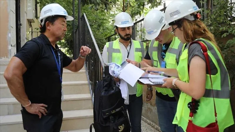
Within the scope of the “Denizli Disaster Master Plan” announced by Denizli Metropolitan Municipality Mayor Osman Zolan, the first meeting with Turkey’s leading academics was held. In the first meeting with wide participation, where all stakeholders in the city, especially scientists, local governments, public institutions and NGOs, met, it was emphasized that Denizli Disaster Master ...
New Study Reveals The Resilience Patterns Of Human Mobility In Response To Extreme Urban Floods

New Study Reveals The Resilience Patterns Of Human Mobility In Response To Extreme Urban Floods

Resilience can be interpreted as the comprehensive ability of a system to prepare for, absorb, and recover from external or internal disturbances and shocks. In the context of human mobility, resilience therefore refers to the ability of people’s movements within and between cities to cope with and adapt to disruptive events, such as natural disasters. ...
phys.org
Le Mappe Dei Satelliti Per Pianificare Soccorsi E Ricostruzione Post-alluvione

Le Mappe Dei Satelliti Per Pianificare Soccorsi E Ricostruzione Post-alluvione

Studiomapp, azienda con base a Ravenna specializzata in geo-intelligence e già premiata dal Dipartimento di Difesa degli Stati Uniti per aver vinto una sfida internazionale per velocizzare le operazioni di soccorso dopo disastri naturali analizzando immagini satellitari con l’intelligenza artificiale, ha reso disponibile mercoledì l’ultima mappa aggiornata delle aree colpite dall’alluvione in Romagna. per far ...
ravennatoday.it