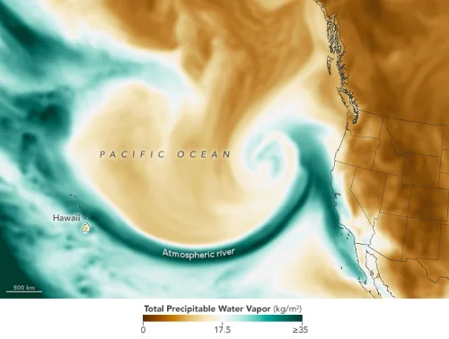
Atmospheric River Lashes California
Just four days after heavy rain hit California, the state was drenched with another atmospheric river on January 4 and 5, 2023. A plume of moisture from the tropical Pacific interacted with a low-pressure system that rapidly strengthened over the northeast Pacific, producing a storm that caused flooding, toppled trees, and downed power lines. This ...
earthobservatory.nasa.gov