Geomaticians

Leica Geosystems

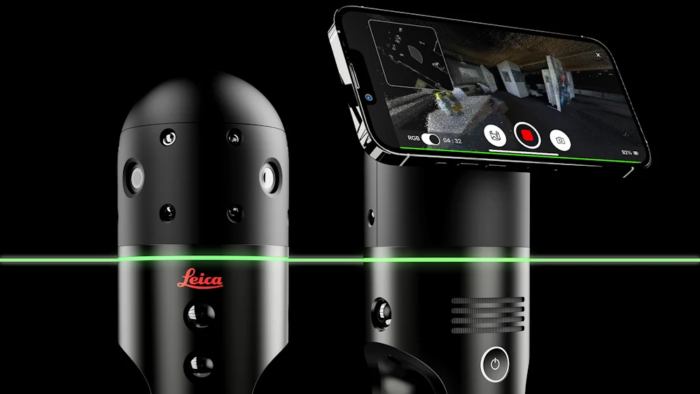
Leica Geosystems Develops First-Person Laser Scanner

Leica Geosystems Develops First-Person Laser Scanner

Leica Geosystems, part of Hexagon has developed the Leica BLK2GO PULSE, its first-person laser scanner that combines lidar sensor technology with the original Leica BLK2GO form factor. The technology is set to be released in early 2024. The scanner offers users a rapid, simple and intuitive first-person scanning method that can be controlled with a ...
gpsworld.com

Leica Geosystems Upgrades Lidar UAV

Leica Geosystems, part of Hexagon, has added new capabilities to the Leica BLK2FLY. It now has the ability to scan indoors, providing expanded coverage for complex scanning projects, and the ability to create digital twins for entire structures, both indoors and outdoors. Hexagon upgraded the autonomous UAV scanning system to allow for safe, effective indoor ...
gpsworld.com
Leica Geosystems Presents Hybrid Imaging And Lidar Sensor For Extensive Airborne Surveys

Leica Geosystems Presents Hybrid Imaging And Lidar Sensor For Extensive Airborne Surveys

Leica Geosystems, a part of Hexagon, has launched the brand-new Leica CountryMapper, its most efficient solution yet for large-area imaging and Lidar mapping. The company unveiled this latest expansion to its hybrid sensor portfolio during the annual HxGN Live event. By integrating a large-format photogrammetric camera and a high-performance Lidar unit into a single system, ...
gim-international.com
Leica Geosystems Introduces The Next Evolution In Smart, Autonomous Mobile Mapping

Leica Geosystems Introduces The Next Evolution In Smart, Autonomous Mobile Mapping

Leica Geosystems, part of Hexagon, today announced the latest addition to its Leica Pegasus TRK portfolio of mobile mapping solutions, the Leica Pegasus TRK100. Specifically designed for GIS professionals, the new mobile mapping system is a powerful, easy-to-use geospatial solution built for large-scale infrastructure measurement and digital twin creation. The Pegasus TRK100 is designed to ...
directionsmag.com

Leica Geosystems Launches New Locator Technology

Leica Geosystems, part of Hexagon, announced its latest solution for utility and excavation professionals. The new Leica DD175 utility locator and Leica DA175 signal transmitter complement the existing Leica DD100 series and help operators easily detect underground utilities to ensure site workers’ safety. Locating the position of underground cables and pipes before excavation is paramount ...
geospatialworld.net

Leica Geosystems Announces New Leica DMC-4 Airborne Imaging Sensor Delivering Superior Image Fidelity

Leica Geosystems, part of Hexagon, today announced the introduction of the Leica DMC-4, a highly efficient airborne imaging sensor providing unsurpassed image quality for various applications and complex mapping environments. The new system continues Leica Geosystems’ tradition of combining industry-leading optics with precision mechanics to deliver the highest mapping performance. The sensor provides superior image ...
directionsmag.com