Geomaticians

IPS | INS

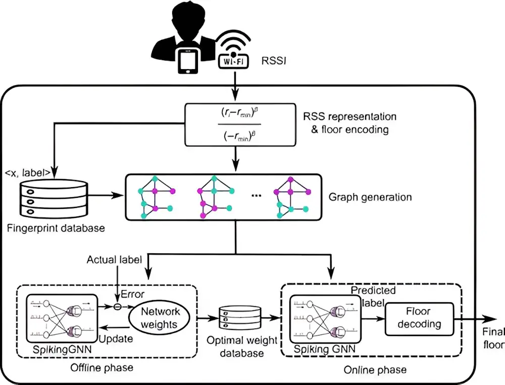
Introducing Floorlocator, A System That Enhances Indoor Navigation

Introducing Floorlocator, A System That Enhances Indoor Navigation

Indoor positioning is transforming with applications demanding precise location tracking. Traditional methods, including fingerprinting and sensor-based techniques, though widely used, face significant drawbacks, such as the need for extensive training data, poor scalability, and reliance on additional sensor information. Recent advancements have sought to leverage deep learning, yet issues such as low scalability and high ...
techxplore.com

GeoComm And Rapidsos Empower Emergency Communications Centers With Enhanced Indoor Maps

GeoComm, provider of Public Safety Location Intelligence, and RapidSOS, creator of the world’s first intelligent safety platform, are excited to announce the integration of GeoComm Indoor Maps into RapidSOS premium. Currently, telecommunicators in the U.S. are typically provided limited building structure information during a 9-1-1 call. An address point on a map with no additional ...
police1.com
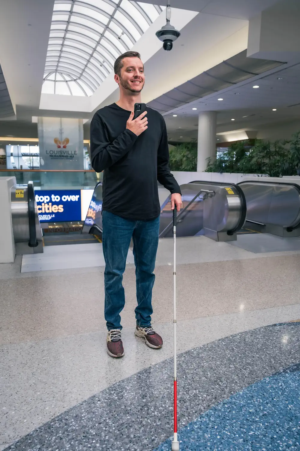
How This App Is Helping The Visually Impaired Navigate Around Airports

How This App Is Helping The Visually Impaired Navigate Around Airports

Ever wonder where you were at an airport or transit station and needed to find your gate or a restroom? GoodMaps, based out of Louisville, Kentucky, is working on an app to use your smartphone’s features to help you find your place. GoodMaps will come to a venue like an airport or a transit agency ...
simpleflying.com

NextNav Completes Initial Tests For 3D Poisition, Navigation And Timing Service

The solution combines NextNav’s reliable TerraPoiNT system with existing LTE and 5G network signals. The tests, conducted in and around San Jose, California, US, showcased the integration of TerraPoiNT signals with cellular infrastructure to deliver highly accurate 3D positioning and timing information without depending solely on traditional satellite-based GPS and GNSS signals. NextNav’s system utilises ...
construction-europe.com
Newly Released IEEE 802.11az Standard Improving Wi-Fi Location Accuracy Is Set To Unleash A New Wave Of Innovation

Newly Released IEEE 802.11az Standard Improving Wi-Fi Location Accuracy Is Set To Unleash A New Wave Of Innovation

When you use an IEEE 802.11™ (Wi-Fi®) enabled device, such as your mobile phone, it can use GPS when outdoors because it has a clear line of sight to satellites. But indoors, with a roof overhead and surrounding walls and other obstacles, GPS signals are blocked, and the device needs to connect to Wi-Fi. Outdoors, ...
standards.ieee.org

Mappedin Expands Strategic Indoor Mapping Initiatives And Scale With Microsoft

Mappedin, the leading platform for creating and maintaining indoor maps, is excited to announce its partnership with Microsoft. As a Microsoft Managed Solution Partner, Mappedin is bringing the best of digital indoor mapping to Azure Marketplace, Microsoft 365, and Power Platform. This partnership will enable Microsoft customers to seamlessly use Mappedin’s indoor mapping software regardless ...
newswire.ca

GeoComm Announces Availability Of School Mapping Solution Designed To Accelerate School Incident Response

GeoComm, provider of Public Safety Location Intelligence®, is excited to announce the availability of GeoComm School Safety, a digital mapping solution which leverages the latest Esri ArcGIS technology to support faster response to school emergencies. The solution provides detailed indoor maps of schools and surrounding grounds, along with critical information needed by school safety authorities, ...
directionsmag.com

AIIMS To Launch India-made Real-time Navigation System

All India Institute of Medical Sciences (AIIMS), New Delhi, to launch an internal navigation system to help patients and their caregivers with accurate location. To help it materialise as soon as possible, a five-member team has been formed by Dr M Srinivas, Director, AIIMS. The team, headed by Dr Vivek Tandon from the neurosurgery department, ...
newindian.in

Radisys Introduces Reachpoint Indoor Navigation And Geo-location Services For Enterprises

Radisys Corporation, a global leader of open telecom solutions, today announced the availability of Radisys ReachPoint, a smart network-based geolocation platform that allows Mobile Network Operators (MNOs) to deliver real-time geolocation service capable of reaching places where GPS may not be available, such as inside tall buildings. The solution enables Enterprises to get the location ...
businesswire.com

GPS 신호 안 닿는 실내서도 5m 오차 수준 위치 확인

국토부가 GPS가 단절된 실내에서도 활용할 수 있는 위치정보 기술을 개발했다. 오차는 5m 내외로 별도 장치나 애플리케이션 없이 스마트폰만으로 실내 경로와 피난 안내, 응급상황 신고 등 위치정보 서비스를 받아 볼 수 있다. 국토교통부 국토지리정보원은 15일 서울 상암동 스마트시티센터에서 GPS(위성항법시스템) 신호가 단절된 실내에서도 5m 오차로 위치를 결정하는 실내 위치결정 기술(측위기술)을 시연했다고 밝혔다.
shinailbo.co.kr
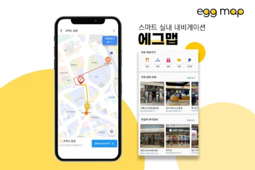
로보프렌, 스마트 실내 내비게이션 ‘에그맵’ 모바일 앱 론칭

로보프렌, 스마트 실내 내비게이션 ‘에그맵’ 모바일 앱 론칭

스마트 위치정보 서비스 기업 로보프렌(대표 김영식)은 복잡한 대형 복합 시설 안의 실시간 길 안내가 가능한 실내 내비게이션 ‘에그맵(egg map)’을 애플 앱스토어와 구글 플레이스토어에 정식 출시한다고 15일 밝혔다. 로보프렌은 에그맵 론칭으로 실내 경로 안내 서비스를 대형 복합 시설 시장으로 확장하는 첫발을 내딛게 된다. 에그맵 앱은 대형 복합 시설에서 실내 길 찾기부터 매장 정보까지 쉽고 편리하게 이용할 ...
newswire.co.kr
The World's Largest Indoor Mapping Deployment Goes Live At A Leading Home Improvement Store Chain In The US

The World’s Largest Indoor Mapping Deployment Goes Live At A Leading Home Improvement Store Chain In The US

One of the largest home improvement stores in the US has partnered with Pointr, a mapping and geolocation leader, to provide a digital mapping experience inside their mobile app. This is the largest ever deployment of its kind to enable Store Mode experiences that allow shoppers to interact with the store: (1) Lookup the availability ...
prnewswire.com
This Kickstarter project turns an iPhone into your smart home’s magic wand

This Kickstarter project turns an iPhone into your smart home’s magic wand

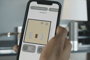
The smart home has an interface problem, and six undergrads from Duke think they’ve solved it with a Raspberry Pi and Apple’s U1 chip. They believe most of today’s methods for controlling smart devices — voice control, fiddly apps with multiple menus, motion sensors — are cumbersome and sometimes frustrating. What the smart home needs, ...
theverge.com

Esri Launches Indoor Positioning System For Facility Wayfinding

Smartphone navigation apps have given people a greater sense of personal freedom, allowing them to efficiently venture from one unfamiliar place to another, still knowing where they are. That sense of knowing can quickly fade once someone has arrived at an airport, corporate campus, or medical center complex. While a global positioning system (GPS) can’t ...
geospatialworld.net