Geomaticians

Hyperspectral

Australian Space Startup Esper Wants To Build Hyperspectral Sats For Cheap

Australian Space Startup Esper Wants To Build Hyperspectral Sats For Cheap

Australian remote sensing startup Esper wants to capture hyperspectral imagery from space at a fraction of the price of its competitors. The company, which launched its first demonstration satellite this Monday on SpaceX’s Transporter-10 mission, is entering a field rife with competition. There’s a reason for that: Hyperspectral is an incredibly powerful type of remote ...
techcrunch.com

Bayanat Partners With HySpecIQ And AzurX To Enable Hyperspectral Imaging And Analysis For The UAE

HySpecIQ, a hyperspectral imaging and data analytics company, today announced a partnership with Bayanat, an ADX-listed public company and provider of AI-powered geospatial solutions. The relationship between HySpecIQ and Bayanat will support the creation of hyperspectral data applications as well as the development of systems that can combine hyperspectral with other geospatial data to produce ...
geospatialworld.net
Spacex Wyniesie Polskiego Satelitę. Start Już W Tym Roku

Spacex Wyniesie Polskiego Satelitę. Start Już W Tym Roku

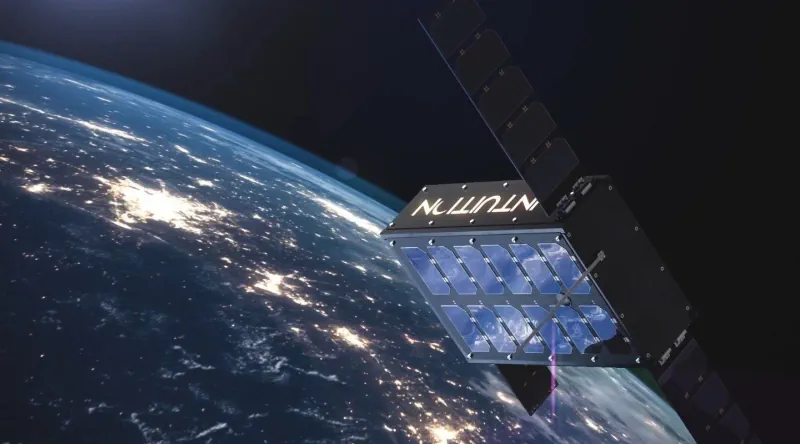
W październiku br. będziemy świadkami wyniesienia w przestrzeń kosmiczną kolejnego satelity pochodzącego z Polski. Celem misji kosmicznej Intuition-1 jest wykonywanie zobrazowań Ziemi z wykorzystaniem satelity z instrumentem hiperspektralnym oraz zaawansowaną jednostką do przetwarzania danych na pokładzie opartej o głębokie sieci neuronowe w postaci komputera pokładowego – Leopard. Będzie to pierwszy na świecie satelita o mocy ...
space24.pl

China’s Hyperspectral Earth Observation Satellite Put Into Use

China’s hyperspectral satellite for Earth observation has gone into use after completing in-orbit tests, the Ministry of Ecology and Environment, the primary developer of the spacecraft, announced on Tuesday. The satellite, Gaofen-5 02, was launched into space on Sept. 7, 2021. Designers mounted seven payloads on it, including short-wave infrared hyperspectral cameras. The onboard devices ...
english.news.cn
NASA, USGS Map Minerals To Understand Earth Makeup, Climate Change

NASA, USGS Map Minerals To Understand Earth Makeup, Climate Change

NASA and the U.S. Geological Survey (USGS) will map portions of the southwest United States for critical minerals using advanced airborne imaging. Hyperspectral data from hundreds of wavelengths of reflected light can provide new information about Earth’s surface and atmosphere to help scientists understand Earth’s geology and biology, as well as the effects of climate ...
nasa.gov