Geomaticians

Heritage

Mapping Ireland UL Researchers Create New Ordnance Survey Digital Heritage Resource

Mapping Ireland: UL Researchers Create New Ordnance Survey Digital Heritage Resource

Researchers at University of Limerick have created a new digital heritage resource centred on the early years of the Ordnance Survey in Ireland. Marking two-hundred years since the beginnings of the first Ordnance Survey of Ireland, the ‘OS200—Digitally Re-Mapping Ireland’s Ordnance Survey Heritage’ project gathered historic Ordnance Survey (OS) maps and texts, held in disparate ...
ul.ie
London Heritage Properties Marked For Demolition Digitally Preserved By City

London Heritage Properties Marked For Demolition Digitally Preserved By City

A growing number of heritage buildings primed for demolition in London will live on virtually with the help of high-end 3D technology. The city has amassed a small but growing number of virtual building replicas as part of its regular process to document and photograph heritage properties, or properties with heritage components, before their date ...
cbc.ca
Un Equipo Multidisciplinar De La UBU Hace Posible Visitar Las Alturas De La Catedral

Un Equipo Multidisciplinar De La UBU Hace Posible Visitar Las Alturas De La Catedral

Si aún lo ha probado, no tarde en hacerlo: la experiencia es fascinante. No es de extrañar, pues, que se esté poco a poco convirtiendo en uno de los grandes atractivos de la Catedral, que ya es decir tratándose de la gran joya del gótico español. Acertó de pleno el Cabildo metropolitano cuando, ante los ...
diariodeburgos.es
El Casco Histórico De Cáceres, Modelo Digital En 3D Con Una Altísima Resolución

El Casco Histórico De Cáceres, Modelo Digital En 3D Con Una Altísima Resolución

El Ministerio de Transportes, Movilidad y Agenda Urbana (Mitma) realiza, a través del Centro Nacional de Información Geográfica (CNIG), una recreación en tres dimensiones (3D) del casco histórico de Cáceres mediante una serie de trabajos fotogramétricos. El objetivo es que sirva de experiencia piloto para otras ciudades Patrimonio de la Humanidad, convirtiendo en este municipio ...
digitalextremadura.com
Museum In Bayreuth Macht Kunst Für Blinde Sichtbar

Museum In Bayreuth Macht Kunst Für Blinde Sichtbar

In der kleinen Brautgasse, die direkt in den Bayreuther Marktplatz mündet, fliegt eine Drohne um eine mehr als zwei Meter hohe, schwarz-glänzende Bronze-Skulptur auf einem Sockel. Das Werk “Marsyas I” von Alfred Hrdlicka steht direkt am Eingang des Bayreuther Kunstmuseums und ist so etwas wie dessen Wahrzeichen. Marsyas entstammt der griechischen Mythologie, er forderte Apoll ...
br.de
UNESCO Launches Map Of UK Sites Including The Living Coast

UNESCO Launches Map Of UK Sites Including The Living Coast

A new map has been unveiled featuring all 58 United Nations Education, Scientific and Cultural Organization (UNESCO) sites in the UK. It includes biospheres, creative cties, global geoparks and World Heritage sites. The map, illustrated by artist Tom Woolley, was launched by UNESCO to raise awareness of the breadth of natural, cultural and built heritage ...
brighton-hove.gov.uk
Project Aims To Help Address The Loss Of Cultures Worldwide Caused By Climate Change

Project Aims To Help Address The Loss Of Cultures Worldwide Caused By Climate Change

A team of international researchers, led by Nanyang Technological University, Singapore (NTU Singapore), has announced the initial findings of a project to address the loss of cultures by measuring the impact that climate change has on communities. One finding from the joint project, titled Climate Crisis and Cultural Loss, or 3CL, is the practice of ...
phys.org

Archeologia Italiana A Portata Di Click: Il Nuovo Geoportale Nazionale Svela I Segreti Del Nostro Patrimonio Storico

Il Geoportale Nazionale per l’Archeologia (GNA) è un punto di raccolta e di condivisione dei dati esito delle indagini archeologiche condotte sul territorio italiano, realizzato grazie alla collaborazione delle soprintendenze e degli archeologi, di altri enti e liberi professionisti. Si tratta di una mappa archeologica dinamica del territorio nazionale, di accesso libero e di facile ...
scintilena.com
Restoration Of Hatay's Damaged Landmarks Made Via 3D Modeling

Restoration Of Hatay’s Damaged Landmarks Made Via 3D Modeling

Teams from Istanbul University started their investigations of historical buildings that were severely damaged. Working in separate groups in the field, the teams make measurements using the photogrammetry technique with the help of drones and performing lidar mapping. “… The first step is the three-dimensional (3D) visualization of the surrounding buildings and the most important ...
dailysabah.com

Cartographie Et Expositions Interactives Pour L’histoire De Metz

Considéré comme « la mémoire cartographiée » de Metz, METÆ est un parcours interactif et de découverte permettant à tous d’accéder, à distance et facilement, à de nombreuses ressources numérisées et géolocalisées. Ces documents éclectiques et précieux, conservés aux Archives municipales, racontent la formidable histoire de la cité messine, celle de ses quartiers, de ses ...
rfgenealogie.com

Historical Heritage Sites In Kochi Geotagged

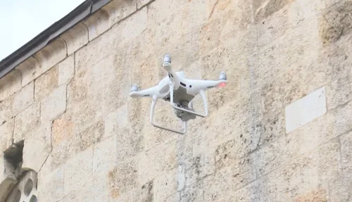
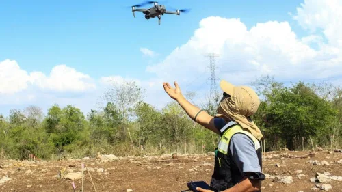
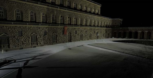
The Greater Cochin Development Authority (GCDA) has completed the first phase of geotagging its heritage and historic sites, especially in Fort Kochi and Mattancherry. GCDA chairman Chandran Pillai said that the first phase of the project, which identifies places, buildings, roads, and objects of historical heritage importance in Kochi, is complete. It was implemented with ...
newindianexpress.com
How Climate Change Is Impacting Galleries, Libraries, Archives And Museums

How Climate Change Is Impacting Galleries, Libraries, Archives And Museums

To further understand the impact of climate change on these cultural and information repositories, the Institute of Museum and Library Services based in Washington, D.C. has awarded a grant to LSU School of Library & Information Science Associate Professor Edward Benoit III and LSU Department of Geography & Anthropology Associate Professor Jill Trepanier with collaborator ...
lsu.edu
Tecnología De Última Generación Para Salvaguardar Vestigios Arqueológicos En La Ruta Del Tren Maya

Tecnología De Última Generación Para Salvaguardar Vestigios Arqueológicos En La Ruta Del Tren Maya

El proyecto de Salvamento Arqueológico U Lu’ umil Maaya Wínikoób del Tren Maya, a cargo de la Secretaría de Cultura, a través del Instituto Nacional de Antropología e Historia (INAH), se inscribe dentro de las medidas de protección y rescate de asentamientos prehispánicos, con el objetivo de explorar, preservar y salvaguardar todos los restos que ...
heraldodemexico.com.mx

Bursa’nın Tarihi Haritaları Emin Ellerde

Tarihi ve kültürel miras alanındaki çalışmalarıyla Türkiye’ye örnek olan Bursa Büyükşehir Belediyesi, kentin tarihi haritalarını konservasyon çalışmalarıyla koruma altına alıyor. Bursa Kent Müzesi koleksiyonunda yer alan ancak zamanla yıpranan tarihi haritalar da ‘konservasyon sürecinin ardından’ müzede sergileniyor. İçlerinde Bursa şehir merkezini gösteren 1862 Suphi Bey Bursa Nazım planının ve 1960 tarihli Piccinato Şehir Planı’nın da ...
bursa.bel.tr

ساخت سنجنده راداری زمینی برای شناسایی آثار باستانی و نشست‌های ایستگاه‌های مترو

محققان دانشکده مهندسی نقشه‌برداری و اطلاعات مکانی دانشگاه تهران، موفق به طراحی و ساخت سنجنده‌های زمین مبنای راداری با روزنه مصنوعی (GBSAR) با قدرت نفوذپذیری و قابلیت استفاده در هر ساعت از شبانه‌روز شدند. دکتر جلال امینی، استاد دانشکده مهندسی نقشه‌برداری و اطلاعات مکانی دانشگاه تهران که با تجربه حاصل از گذراندن سیر مطالعاتی در ...
isna.ir
El Gobierno De Castilla-la Mancha Terminará De Cargar Toda La Información Sobre Patrimonio Cultural En El Sistema De Información Geográfica A Finales De 2023

El Gobierno De Castilla-la Mancha Terminará De Cargar Toda La Información Sobre Patrimonio Cultural En El Sistema De Información Geográfica A Finales De 2023

La consejera de Educación, Cultura y Deportes, Rosa Ana Rodríguez; el director de Sostenibilidad de Red Eléctrica, Antonio Calvo; y el delegado en la región de Red Eléctrica, Roberto Arranz, han rubricado hoy el tercer y último convenio de colaboración para la elaboración de un Sistema de Información Geográfica (SIG) en el que se incluyan ...
infoclm.es
Unveiling Italy’s Hidden History With Fixed-wing Mapping UAVs

Unveiling Italy’s Hidden History With Fixed-wing Mapping UAVs

Mapping an archaeological site is key to being able to dig with greater precision. Now with the latest digital methods, areas of interest can easily be identified rapidly and non-invasively – helping to protect the site and future excavations. Here, Chris Thompson, Global Sales Manager at AgEagle, looks at how a team of Duke University ...
gim-international.com
Venise Révélée Par La Magie Du Numérique Avec Iconem Au Grand Palais Immersif

Venise Révélée Par La Magie Du Numérique Avec Iconem Au Grand Palais Immersif

Seule une ingénierie numérique de pointe peut dévoiler l’exceptionnelle ingéniosité d’une cité ciselée sur la lagune. Venise est une ville construite sur un territoire instable et inhospitalier, qui n’a eu de cesse d’inventer des procédés pour stabiliser ses sols et faire en sorte qu’ils puissent soutenir des palais à plusieurs étages, récolter les eaux de ...
grandpalais.fr
Map Of Italy's Fascist Monuments Goes Online

Map Of Italy’s Fascist Monuments Goes Online

More than 1,400 monuments, street signs and plaques honoring fascism have been put online in the first nationwide attempt to document the symbols of Benito Mussolini’s regime that still dot the urban landscape of Italy. The “places of fascism” website was unveiled on Tuesday by the Istituto Nazionale Parri, a Milan-based historical research institute, following ...
cnn.com
Fotogrametría, El Patrimonio Madrileño En 3D

Fotogrametría, El Patrimonio Madrileño En 3D

La Biblioteca Digital memoriademadrid está de estreno. ‘Fotogrametría’ es una sección de ‘EsConD: Gabinete de humanidades digitales’, que, desde la web de la biblioteca, te quiere acercar piezas del patrimonio cultural de la ciudad para que las conozcas y aprecies todos sus detalles desde diversos ángulos y desde cualquier lugar, de forma interactiva. ¿Imaginas tener ...
diario.madrid.es

U.N. Uses Before-And-After Photos To Track Ukraine’s Cultural Destruction

The United Nations is reinforcing efforts to track the devastation inflicted on Ukraine’s architecture, art and historical sites by using satellite imagery to verify reports of destruction, two of its agencies announced. Using before-and-after satellite images taken by private companies, UNESCO and the U.N.’s Satellite Center plan to systematically document confirmed reports of damage to ...
washingtonpost.com
An Urban Oasis Online Map Identifies Native Trees On Marquette’s Campu

An Urban Oasis: Online Map Identifies Native Trees On Marquette’s Campus

Located in downtown Milwaukee, Wisconsin, Marquette University is an oasis of biodiversity. Most notably, Marquette’s high concentration of Wisconsin-native trees makes the campus a unique space for research, appreciating nature, discovering sacred spaces and more. In 2012, Facilities Planning and Management realized the opportunity Marquette’s campus offers the community and began taking inventory of Wisconsin-native ...
today.marquette.edu
Il Modello Digitale Di Palazzo Pitti È Pronto

Il Modello Digitale Di Palazzo Pitti È Pronto

Se n’era cominciato a parlare un anno e mezzo fa, del progetto dedicato ai grandi edifici storici nell’era della transizione tecnologica. Oggi gli Uffizi presentano il gemello digitale del più grande edificio storico civile fiorentino, ed è la prima volta che un complesso antico così vasto e articolato viene integralmente riprodotto ad altissima definizione, “fedele ...
insideart.eu
Scientists Map Hidden Waterways Under Naples

Scientists Map Hidden Waterways Under Naples

Avast network of waterways lies hidden under Naples, Italy, including aqueducts that were built when the ancient Greeks colonized the area. “They are waterways or aqueducts that were constructed during that period and also during Roman times,” says Nick De Pace. “There are also streams and other waterways that were developed over time to guide ...
yaleclimateconnections.org
Quando I Rifiuti Raccolti Sulla Spiaggia Diventano Pezzi Da Museo

Quando I Rifiuti Raccolti Sulla Spiaggia Diventano Pezzi Da Museo

In mezzo a luoghi incantevoli come l’arenile di Pantanagianni, è nato in Puglia, nel 2018, Archeoplastica, un progetto di sensibilizzazione sull’inquinamento del mare i cui protagonisti sono volontari che raccolgono i rifiuti presenti sulle spiagge di questi territori. Tutto è cominciato grazie a Enzo Suma – guida naturalistica e «cercatore di ulivi secolari e antichi ...
linkiesta.it
Lanzan Plataforma Interactiva Sobre El Patrimonio Cultural De La Comuna De Cochamó

Lanzan Plataforma Interactiva Sobre El Patrimonio Cultural De La Comuna De Cochamó

La comuna de Cochamó históricamente ha estado en un contexto de aislamiento geográfico, lo que ha forjado una comunidad con un interesante patrimonio histórico-cultural y natural. En este contexto, surge el proyecto “Patrimonio de Cochamó a un Click: cultura al alcance de todos”, que a través de un proceso de participación comunitaria y de la ...
eha.cl
Ukrainians Using New Smartphone App To Make Precious 3D Records Of War-threatened Historic Buildings And Monuments

Ukrainians Using New Smartphone App To Make Precious 3D Records Of War-threatened Historic Buildings And Monuments

A new smartphone app is offering hope to people trying to preserve Ukraine’s war-threatened historic buildings. The “Backup Ukraine” project now lets ordinary people become archivists by using an app to digitally capture buildings and monuments as 3D models. Already, the app has recorded more than 6,000 downloads, and has between 30 and 50 active ...
abc.net.au

Ψηφιακή Χαρτογράφηση Του Σπηλαίου Κιλκίς

Το Σπήλαιο του Λόφου Αγίου Γεωργίου, το υπόγειο κόσμημα της πόλης του Κιλκίς, με εντυπωσιακό όσο και σπάνιο κοραλλιογενές διάκοσμο, με άφθονους σταλακτίτες και σταλαγμίτες, ‘’αναδύεται’’ από τα έγκατα της γης, χάρη στις νέες ψηφιακές τεχνολογίες που ανοίγουν το δρόμο για την εικονική περιήγησή του. Το Σπήλαιο Κιλκίς θα χαρτογραφηθεί ψηφιακά από ερευνήτρια του ΔΙΠΑΕ, ...
kede.gr
Pompei Apre I Suoi Archivi Digitali Alla Libera Consultazione – Attraverso Il Sistema Open Pompeii Una Rivoluzione Nell’accesso Ai Dati

Pompei Apre I Suoi Archivi Digitali Alla Libera Consultazione – Attraverso Il Sistema Open Pompeii Una Rivoluzione Nell’accesso Ai Dati

Un immenso patrimonio di dati del Parco archeologico di Pompei, raccolti in decenni e aumentato significativamente in tempi recenti grazie al Grande Progetto Pompei sotto la direzione di Massimo Osanna, da oggi sarà alla portata di tutti con un click, per consultazione, studio e approfondimento. Un archivio di vetro trasparente, disponibile e accessibile a tutti, ...
pompeiisites.org
Aboriginal Teen Uses Drone Technology To Preserve Heritage

Aboriginal Teen Uses Drone Technology To Preserve Heritage

An Aboriginal teenager from Far North Queensland is using the power of drone technology to preserve the history of the Wallara clan of the Koko-Muluridji people. 19-year-old James Cook University Bachelor of Science student, Gullara McInnes has combined her love of drones and mapping with her passion for her traditional country to give local Elders ...
theeducatoronline.com