Geomaticians

Google

Google’s New Astra AI Model Unveiled By DeepMind Team

Google’s New Astra AI Model Unveiled By DeepMind Team

Google DeepMind introduced a new AI assistant model named Astra at their Google I/O developer conference. Astra is designed to be a highly functional AI assistant capable of understanding and responding to complex and dynamic environments. It aims to be proactive, teachable, and personal, allowing for natural and lag-free interactions. This groundbreaking technology is expected ...
geeky-gadgets.com

Google Maps Is Getting Geospatial AR Content Later This Year

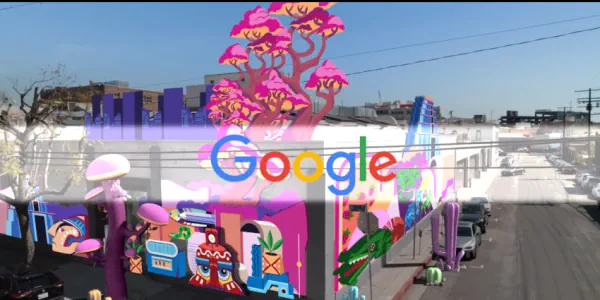
At its annual Google I/O 2024 conference, Google announced that users will soon be able to access geospatial augmented reality (AR) content directly on Google Maps on their phones. The feature will first appear in Singapore and Paris as part of a pilot program launching later this year. Users will be able to access the ...
techcrunch.com

In A First, Japan Doctors Sue Google Over Negative Reviews On Firm’s Map App

A group of 63 doctors filed a lawsuit with the Tokyo District Court on Thursday against Google seeking ¥1.45 million (about $9,400) in compensation for causing harm to their businesses through what they described as one-sided, hateful reviews for their clinics on Google Maps. The suit is the first in Japan — and possibly the ...
japantimes.co.jp
Researchers From ETH Zurich And Google Introduce InseRF A Novel AI Method For Generative Object Insertion In The NeRF Reconstructions Of 3D Scenes

Researchers From ETH Zurich And Google Introduce InseRF: A Novel AI Method For Generative Object Insertion In The NeRF Reconstructions Of 3D Scenes

In 3D scene generation, a captivating challenge is the seamless integration of new objects into pre-existing 3D scenes. The ability to modify these complex digital environments is crucial, especially when aiming to enhance them with human-like creativity and intention. While adept at altering scene styles and appearances, earlier methods falter in inserting new objects consistently ...
marktechpost.com
Google Launches Flood Hub In The U.S., Which Predicts When Rivers Will Flood And Warns People To Evacuate

Google Launches Flood Hub In The U.S., Which Predicts When Rivers Will Flood And Warns People To Evacuate

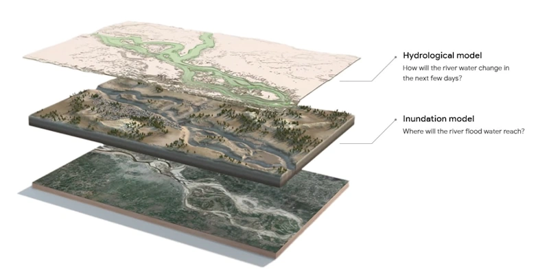
In August, when heavy rain hit parts of Chile, tens of thousands of people had to evacuate their homes as their communities flooded. Many got a warning a couple of days in advance, thanks to a tool from Google called Flood Hub that rolled out in the country earlier this year. Before Flood Hub existed, ...
fastcompany.com
Google Sued For Negligence After Man Drove Off Collapsed Bridge While Following Map Directions

Google Sued For Negligence After Man Drove Off Collapsed Bridge While Following Map Directions

The family of a North Carolina man who died after driving his car off a collapsed bridge while following Google Maps directions is suing the technology giant for negligence, claiming it had been informed of the collapse but failed to update its navigation system. Philip Paxson, a medical device salesman and father of two, drowned ...
ctvnews.ca
Google Expands Environmental Mapping Tools

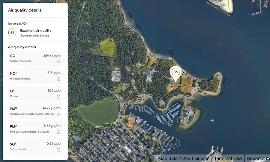
Google Expands Environmental Mapping Tools

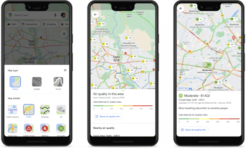
Google is expanding its sustainability offerings with new products from its Google Maps platform, including mapping technologies for solar energy, air quality, and pollen distribution. The mapping tools use AI and machine learning paired with aerial imagery and environmental data to provide valuable information for developers, businesses, and organizations to track and mitigate their environmental ...
environmentalleader.com

Google Lays Off Staff At Its Mapping App Waze

Alphabet-owned Google on Tuesday said it is cutting jobs at mapping app Waze as it merges the app’s advertising system with Google Ads technology, without giving details on the number of layoffs. Google had in December said that it will merge Waze and Google Maps teams to consolidate processes, making it a part of the ...
reuters.com
DragGAN Transforming Image Manipulation With Interactive Point-based Control

DragGAN: Transforming Image Manipulation With Interactive Point-based Control

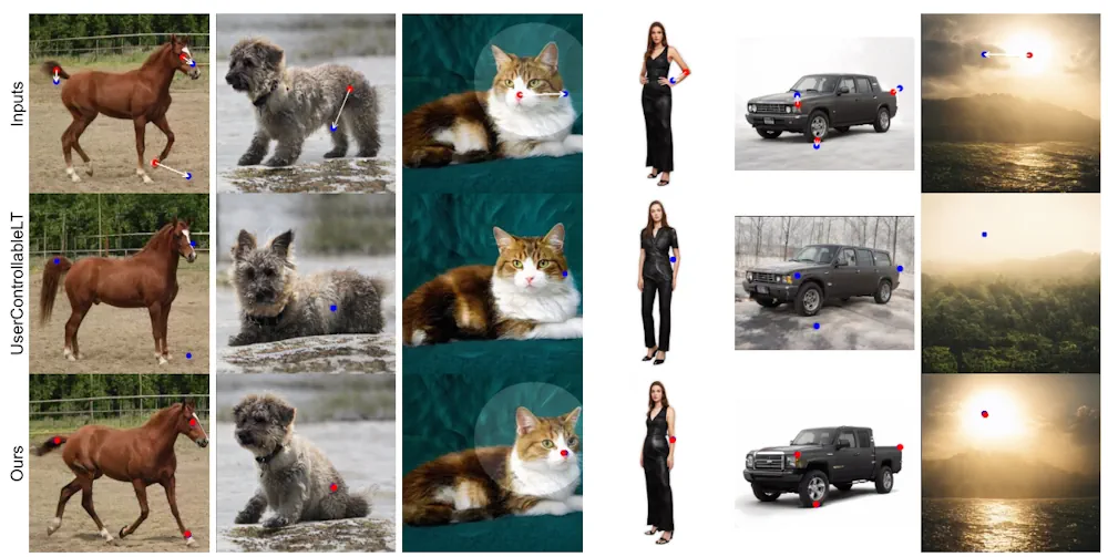
The ability of AI tools to manipulate images continues to grow. The latest example is shown in a research paper from the Max Planck Institute. For now, it’s “only” a research paper, but a very impressive one, letting users drag elements of a picture to change their appearance. Not only can you change the dimensions ...
innovationorigins.com
Google Partners With Singapore Tourism Board For AI-powered Guided Tours

Google Partners With Singapore Tourism Board For AI-powered Guided Tours

At Google I/O 2023 on Wednesday, Google’s ARCore and the Singapore Tourism Board (STB) launched a preview of two new immersive AR experiences around Merlion Park and Victoria Theatre & Concert Hall in the Visit Singapore app. Powered by Google’s ARCore Geospatial API, visitors will be able to embark on an immersive guided tour. “Google’s ...
Google Releases AR Geospatial Creator For Unity

Google Releases AR Geospatial Creator For Unity

Google has unveiled its Geospatial Creator for Unity platform, allowing developers to preview 3D assets via the Unity Editor. Viewing spatially-linked assets on a hyperrealistic 3D planet map, the toolkit powers ARCore and Photorealistic 3D Tiles via the Google Maps Platform, it said on its website. Users can select locations, retrieve 3D geometry of the ...
xrtoday.com
Quintar Uses Google ARCore To Help People Navigate Live Events And Big Venues

Quintar Uses Google ARCore To Help People Navigate Live Events And Big Venues

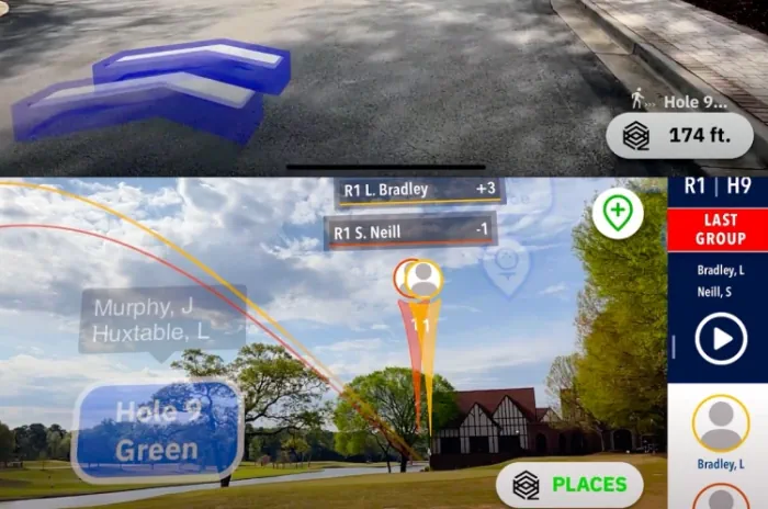
Quintar wants to enhance navigation with augmented reality so you can have an easier time navigating live events at big venues for sports or concerts. And so it announced today at Google I/O that is has partnered with Google on its ARCore tech platform. Quintar tried out the tech recently as the official mobile augmented ...
venturebeat.com
Google And Taito Reveal Augmented Reality 'Space Invaders' Game

Google And Taito Reveal Augmented Reality ‘Space Invaders’ Game

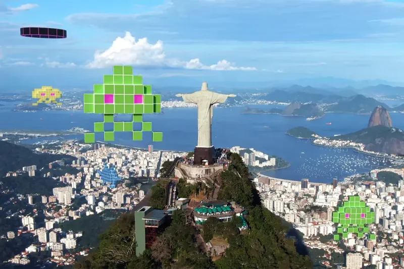
Google and Japanese games company Taito are teaming up for a new augmented reality version of the 1978 shoot ‘em-up arcade game Space Invaders. Inspired by the original gameplay, players are tasked with defending the Earth from Space Invaders in their neighborhood. Powered by Google’s ARCore Geospatial API and Streetscape Geometry API, the upcoming SPACE ...
hypebeast.com
New Google Search Advisory Extreme Heat Alerts

New Google Search Advisory: Extreme Heat Alerts

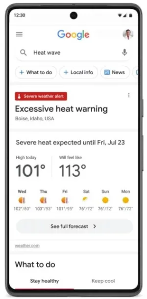
Google has announced a series of measures to provide up-to-date and actionable information to help people and cities cope with rising temperatures due to climate change. These initiatives include new extreme heat alerts on Google Search, the expansion of the Tree Canopy tool for urban planning, and a $5 million investment in the World Resources ...
searchenginejournal.com

Mercedes-Benz And Google Join Forces To Create Next-generation Navigation Experience

Mercedes-Benz and Google announced today a long-term strategic partnership to further accelerate auto innovation and create the industry’s next-generation digital luxury car experience. With this partnership, Mercedes-Benz will be the first automaker to build its own branded navigation experience based on new in-car data and navigation capabilities from Google Maps Platform. This will give the ...
prnewswire.com

Air Quality Map For Dublin City Released As Part Of Google’s Project Air View

Dublin City Council has launched the results of Google’s Project Air View initiative, which measured the air quality of Dublin City’s streets over a period of 16 months and gathered over 50 million pieces of data. The project was delivered in partnership with the City Council’s Smart Dublin programme, with data captured by Google’s first ...
techcentral.ie

Google To Combine Maps And Waze Teams

Google, owned by Alphabet Inc., plans to merge its teams working on Maps products and the mapping service Waze with effect from December 9, reports said. The decision to consolidate processes comes as the search giant is facing pressure to streamline operations and cut costs. The restructuring is expected to reduce overlapping work across the ...
geospatialworld.net
Google Expands AI-powered Flood Detection And Wildfire Systems

Google Expands AI-powered Flood Detection And Wildfire Systems

For the last several years, Google has been using artificial intelligence to develop a system that can predict floods. It has also been working on wildfire tracking tools. Ahead of the COP27 climate conference taking place next week, the company announced that it is expanding those tools. First, Google says it will offer flood forecasts ...
engadget.com

Meet ‘Dreamfusion,’ An Effective AI Technique That Uses Machine Learning To Synthesize 3D Models From Text Prompts

By prompting a text-to-image model we can generate images of a wide variety of objects. With clever prompting, it’s also possible to synthesize different perspectives of a specific object. To use text to generate 3d objects, we start by feeding a caption to a text-to-image model, such as Imagen, adding minor tweaks to the prompt ...
marktechpost.com
Indian Cities Partner With Google To Improve Road Safety, Cut Emissions

Indian Cities Partner With Google To Improve Road Safety, Cut Emissions

Navigating peak rush hour traffic has become a familiar fixture of city life, leading to interminable gridlocks, frustrating congestions and severe pollution, along with crucial hours lost daily. The problem is quite acute in Bengaluru, where, as per a 2019 TomTom report, residents lose over 243 hours every year due to traffic. In order to ...
geospatialworld.net
Google Maps Ha Ripreso Lo Stesso Cane Nello Stesso Posto A Distanza Di 7 Anni

Google Maps Ha Ripreso Lo Stesso Cane Nello Stesso Posto A Distanza Di 7 Anni

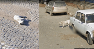
Quando si usa Google Maps, di solito si controllano le indicazioni per un nuovo posto. Non ci si aspetta però di imbattersi in qualcosa che solleva più domande che risposte. Gli utenti di Reddit sono infatti rimasti a bocca aperta per un post bizzarro. Una telecamera di Google Maps avrebbe infatti ripreso un cane randagio ...
commentimemorabili.it

Google Cloud Expands Earth Engine To Help Businesses And Governments Boost Sustainability

Announced at the Google Cloud Sustainability Summit today, the tool is said to provide access to more than 70 petabytes of “analysis-ready geospatial data.” Google Earth Engine is not a new product. In fact, it has been available for more than a decade, but until now access has been restricted to academia and the nonprofit ...
siliconangle.com