Geomaticians

GIS

University Of Waterloo Students Study Noise Near Region's Airport, Review Flight Paths To Lessen Impact

University Of Waterloo Students Study Noise Near Region’s Airport, Review Flight Paths To Lessen Impact

People who live near the Region of Waterloo International Airport know it can get noisy there and that intrigued a group of third-year geography and aviation students at the University of Waterloo. As pilots, Matthew Toy, Chase Cardoza, Nikith Challa and Isabelle Mazzoco know planes can get loud and wanted to look into just how ...
cbc.ca
We Are Not Tracking The Impact Of Half The World’s Mines

We Are Not Tracking The Impact Of Half The World’s Mines

A modern, sustainable society depends on the mining industry to supply crucial materials. Batteries and electric vehicles require metals like lithium and cadmium, wind turbines require rare earth metals and our cities need aggregate materials like gravel and sand for construction. On the other hand, the mining industry also produces materials like coal which are ...
pursuit.unimelb.edu.au

Coinvolge Anche Il Friuli L’audio-Mappa Digitale Dei Dialetti

Una mappa interattiva open con migliaia di file audio, registrati dai cittadini, in 18 dialetti e lingue minoritarie darà vita alla più grande banca dati digitale mai realizzata dedicata allo studio, alla documentazione e alla ricerca sui dialetti e le varietà linguistiche con status di lingua minoritaria parlate nelle regioni del Nord Italia. Questo uno ...
udineoggi.news
Hochwasserschutz In Bayern Interaktive Gefahrenkarten Online

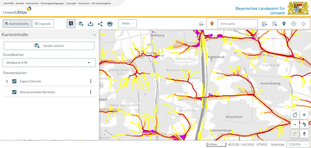
Hochwasserschutz In Bayern: Interaktive Gefahrenkarten Online

Zum besseren Schutz der bayerischen Bevölkerung vor Sturzfluten steht im Internet ab sofort eine landesweite Gefahrenlandkarte zur Verfügung. “Die Hinweiskarte ist ein wichtiger Schritt hin zu einem besseren Umgang mit Sturzflutgefahren. Die Karte gibt allen Verantwortlichen vor Ort die Möglichkeit zu einer ersten Beurteilung des jeweiligen Sturzflutrisikos”, sagte Umweltminister Thorsten Glauber (Freie Wähler) der Nachrichtenagentur ...
br.de

Le Deep Learning Et La Cartographie Pour Établir Des Liens Entre Exposition Aux Pesticides Et Cancer

Présomption forte de lien entre exposition aux pesticides et six pathologies, dont plusieurs cancers et la maladie de Parkinson. C’est ce que confirme le rapport de l’Inserm (Institut national de la santé et de la recherche médicale) de 2021, en s’appuyant sur plusieurs études épidémiologiques récentes. Et cette conclusion concerne autant les professionnels du monde ...
cio-online.com
Mapeamento De Cabo Verde Para Proteger As Tartarugas Do Plástico

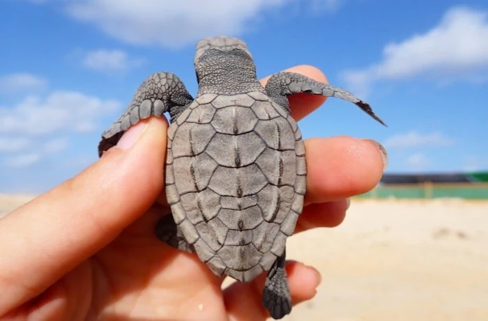
Mapeamento De Cabo Verde Para Proteger As Tartarugas Do Plástico

A estudante do Programa Doutoral em Biologia da FCUP, Diana Sousa Guedes, tem estado a mapear, com recurso a um drone, o lixo marinho das praias de Cabo Verde, num trabalho que procura perceber o impacto do plástico nas tartarugas-marinhas. O objectivo é proteger estas espécies ameaçadas de extinção, num cenário cujos resultados não são, ...
campeaoprovincias.pt
Auckland Tsunami Map Refreshed

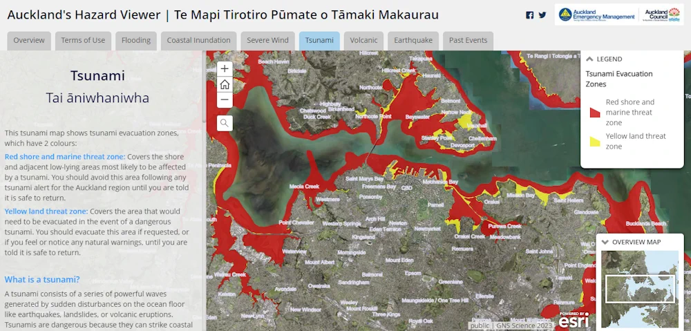
Auckland Tsunami Map Refreshed

Fewer Auckland residents would be at risk in the event of a tsunami than the council previously thought. Auckland Emergency Management (AEM) has updated the region’s tsunami map in the wake of new data which it says showed less of the city’s coastline would be at threat. AEM head of operations John Cranfield said the ...
rnz.co.nz
Esri Launches Maps.Com, A Content Platform For Creators Demonstrating The Power Of Maps

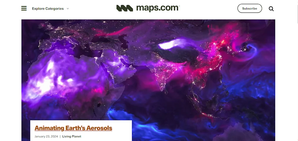
Esri Launches Maps.Com, A Content Platform For Creators Demonstrating The Power Of Maps

Created by Esri, the global leader in mapping and location intelligence software, the new website is a platform for sharing and discussing visually engaging maps that inspire, challenge, educate, reward, and provoke across a range of topics and formats. The site will serve as a celebration of science and art, presenting maps that captivate not ...
businesswire.com

Cyfrowy Bliźniak Pomoże Ograniczyć Emisję Dwutlenku Węgla

Naukowcy z Instytutu Geodezji i Geoinformatyki UPWr pracują nad projektem DigiTwins4PEDs, który do modelowania aspektów energetycznych miast wykorzysta cyfrowego bliźniaka miasta. To krok w kierunku miast neutralnych pod względem emisji dwutlenku węgla i zrównoważonej przyszłości energetycznej. Badania finansuje Narodowe Centrum Nauki. Project „Utilisation of urban digital twins to co-create flexible positive energy systems for districts” ...
tuolawa.pl
How Maintained Are Paso Robles' Streets

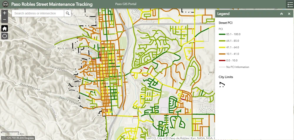
How Maintained Are Paso Robles’ Streets? This Interactive Map Will Tell You

The City of Paso Robles is trying to make it easier for residents to get information about road conditions and future repairs in their neighborhoods. The new interactive street maintenance map application was developed after damage from last year’s storms. Residents now have the opportunity to check a street’s pavement condition index rating, the last ...
ksby.com

Council To Map Dog Attacks On Sheep In Bid To Identify Culprits

Dog attacks on sheep in Kerry in 2024 are to be mapped by Kerry County Council in an effort to identify the dogs and their owners. The Department of Agriculture is also being asked to employ its satellite tracking system in conjunction with the council maps, to help identify the out-of-control dogs. The move is ...
irishexaminer.com
Baidu And Huawei Forge Strategic Partnership For Advanced Navigation And Smart Cockpit Technologies

Baidu And Huawei Forge Strategic Partnership For Advanced Navigation And Smart Cockpit Technologies

On January 18, 2024, Baidu (Google of China) and Huawei signed an ecological cooperation agreement focusing on navigation, Advanced Driver Assistance Systems (ADAS), and Huawei’s smart cockpit technology. The signing ceremony was attended by Huawei division General Manager Jin Yongfu and Baidu Vice President Shang Guobin. The collaboration aims to improve the navigation and travel ...
carnewschina.com
This ‘Digital Twin’ Of The Planet Could Rival Google Earth

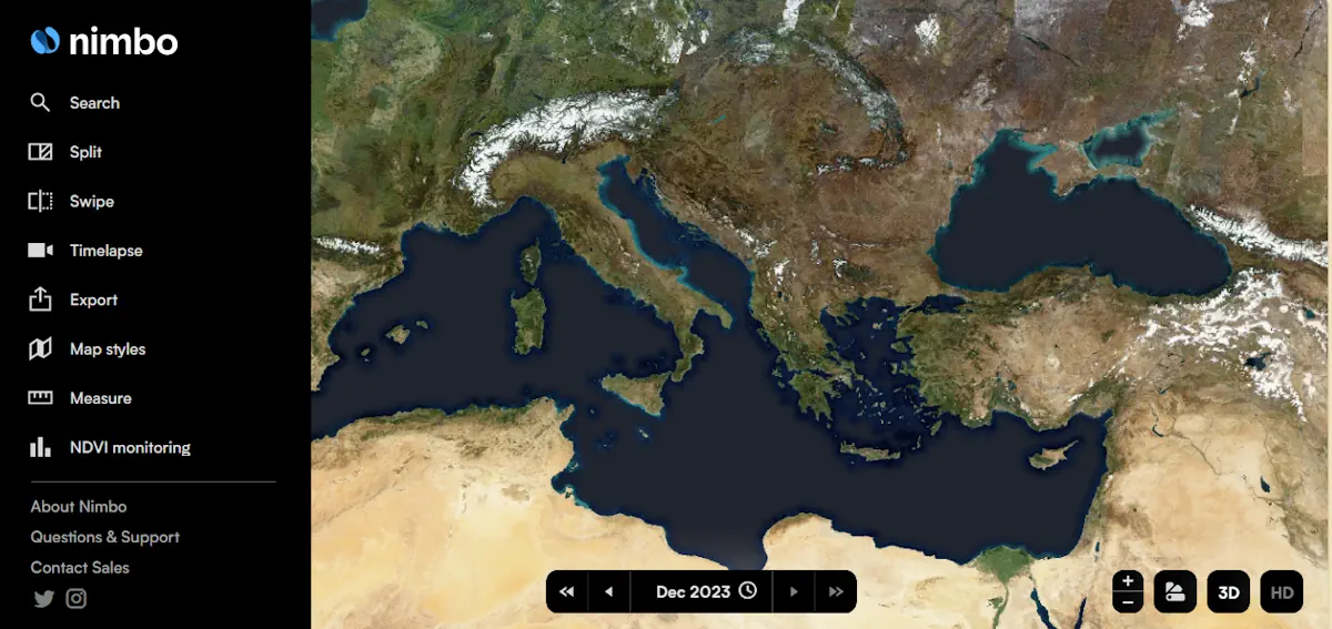
This ‘Digital Twin’ Of The Planet Could Rival Google Earth

French startup Kermap has developed a ‘digital twin’ of the Earth that claims to offer the most up-to-date views of our home planet. The programme is called Nimbo Earth Online and it is the only platform providing new satellite views of the world every month, without clouds. Google Earth refreshes its imagery every several months ...
thenextweb.com
Students Analyze How U.S. Could Support Allies During Health Emergencies

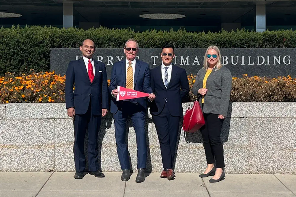
Students Analyze How U.S. Could Support Allies During Health Emergencies

What if there were a public health crisis facing a U.S. ally? And what if the U.S. and other governments and international organizations were called on to offer humanitarian support? At Harvard T.H. Chan School of Public Health, three students with decades of experience in fields including data science, population health, and national security tackled ...
hsph.harvard.edu

Belarus To Create National Spatial Data Infrastructure

National spatial data infrastructure will be created in Belarus. The step is stipulated by the Council of Ministers’ resolution No.32 of 16 January 2024, BelTA has learned. The document has been published by the national legislation registry. It approves a regulation on the national spatial data infrastructure. The State Property Committee has been entrusted with ...
eng.belta.by

İzmir’in Tsunami Haritası Çıkarılacak

İzmir Dokuz Eylül Üniversitesi (DEÜ) Mühendislik Fakültesi Jeoloji Mühendisliği Bölümü Öğretim Üyesi ve Deprem Araştırma ve Uygulama Merkez (DAUM) Müdürü Doç. Dr. Ökmen Sümer, İzmir iç ve dış körfezindeki tüm kıyıların ve koyun geometrisini çıkartıp, depremlerin tsunami etkilerini araştırdıklarını belirtip, sonunda oluşturulacak tsunami baskın haritalarıyla, risklerin azaltılmasına imkan sağlanacağını söyledi. Doç. Dr. Sümer, “Bu proje ...
cumhuriyet.com.tr
Neue Luftbilder Der Stadt Bern Sind Verfügbar

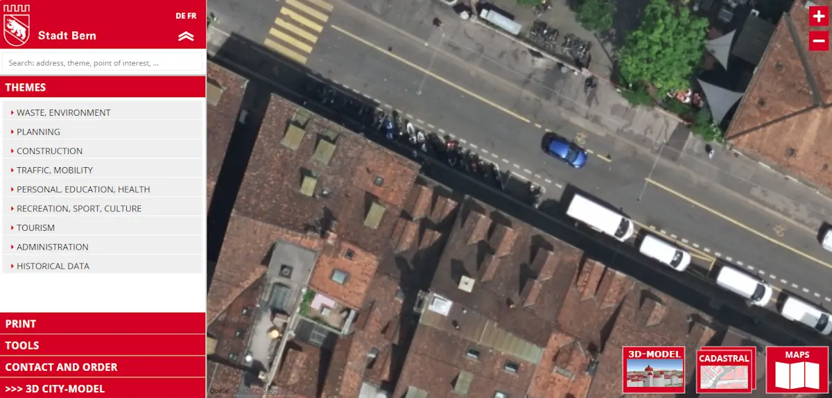
Neue Luftbilder Der Stadt Bern Sind Verfügbar

Drei Jahre nach den letzten Aufnahmen hat die Stadt Bern neue Luftbilder der gesamten Gemeinde erstellt. Sie setzt damit eine Zeitreihe mit Aufnahmen von 1999, 2004, 2008, 2012, 2016 sowie 2020 fort. Die Luftaufnahmen wurden am 30. Mai 2023 gemacht und anschliessend zu einem Orthofotomosaik verarbeitet. Künftig dienen sie als Hintergrund- und Referenzdaten für Arbeiten ...
bern.ch
Cartographie Des Traditions Orales Terrastories Arrive Sur Le Maroni

Cartographie Des Traditions Orales : Terrastories Arrive Sur Le Maroni

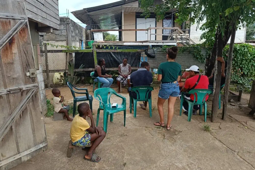
Déjà testée et approuvée au Suriname, l’application Terrastories est désormais en train d’être introduite sur le Haut-Maroni et Papaïchton, afin que les communautés Wayana et Aluku puissent cartographier leurs traditions orales sur des lieux qui ont une signification ou une valeur importante pour elles. Terrastories est une application mobile permettant aux communautés de cartographier, protéger ...
franceguyane.fr
Projeto Biogeomar Convida O Público A Fotografar Animais E Plantas Marinhos

Projeto Biogeomar Convida O Público A Fotografar Animais E Plantas Marinhos

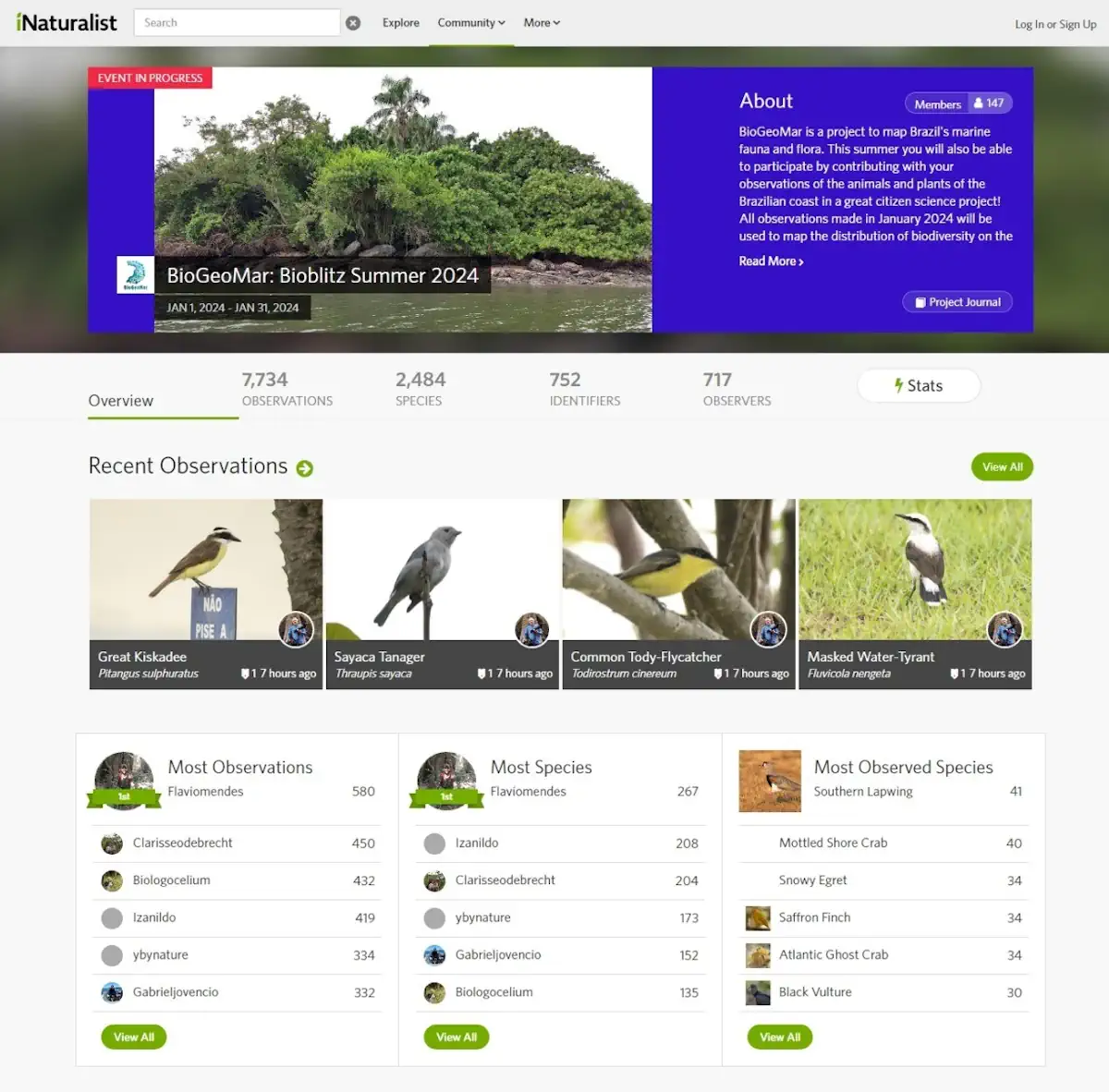
Onde estão as espécies do litoral brasileiro? Buscando conhecer melhor a biodiversidade marinha brasileira, o Programa BioGeoMar acaba de lançar a campanha de ciência cidadã BioBlitz Verão 2024. Nela, o público é convidado a explorar, identificar e registrar a vida dentro e fora da água, sejam animais ou plantas, encontrados em praias, mergulhos ou em ...
ufpr.br

It’s Challenging To Determine Bead-Eligible Locations, Says Wireless 20/20

It’s become obvious that it’s going to be super complicated for states to define the bidding areas for Broadband Equity, Access & Deployment (BEAD) grants. Some states may define bid areas by census blocks, school districts or some other defined geography or cluster. But other states may go with a “free-for-all” approach, allowing bidders to ...
fiercetelecom.com
From Forest-Listening To Advanced Remote Sensing, Can AI Turn The Tide On Deforestation

From Forest-Listening To Advanced Remote Sensing, Can AI Turn The Tide On Deforestation?

Monitoring deforestation across millions of hectares of Amazonian jungle has always been an onerous ask. When illegal logging first became an issue, the authorities relied on word-of-mouth and reports from indigenous communities, before buzzing the jungle in small planes to find the deforested areas. In the 1980s the first satellite images became available, with resolution ...
reuters.com
New Map Shows Where Damaging Earthquakes Are Most Likely To Occur In US 

New Map Shows Where Damaging Earthquakes Are Most Likely To Occur In US 

Nearly 75% of the U.S. could experience damaging earthquake shaking, according to a recent U.S. Geological Survey-led team of more than 50 scientists and engineers. This was one of several key findings from the latest USGS National Seismic Hazard Model (NSHM). The model was used to create a color-coded map that pinpoints where damaging earthquakes ...
phys.org

Google Maps For Android Now Supports Bluetooth Beacons For Tunnel Navigation

GPS makes it possible to navigate the globe with relative ease, but tunnels have long been a sore spot for apps like Google Maps. But, widely available now, Google Maps now supports Bluetooth beacons to fill in the gap left by tunnels. Bluetooth beacons are not really a new idea. Google-owned Waze has supported the ...
9to5google.com
Investigadores De La UPCT Proponen Integrar Módulos Solares En Parcelas Agrícolas Del Mar Menor Para Reducir Uso De Agua Y Fertilizantes

Investigadores De La UPCT Proponen Integrar Módulos Solares En Parcelas Agrícolas Del Mar Menor Para Reducir Uso De Agua Y Fertilizantes

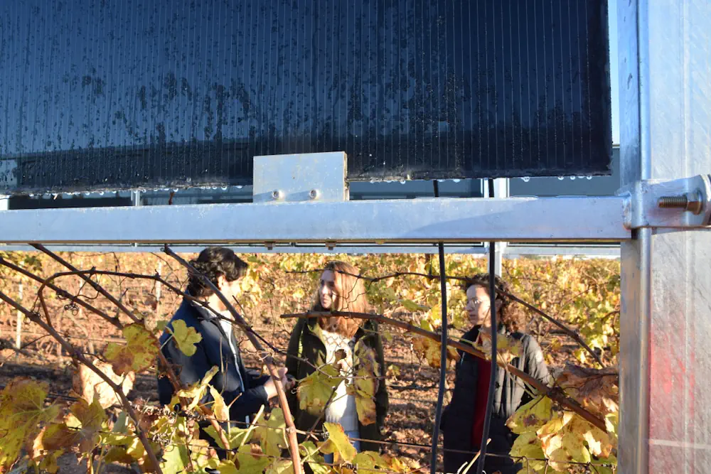
Un estudio realizado por investigadores del grupo Materiales Avanzados para la Producción y Almacenamiento de Energía de la Universidad Politécnica de Cartagena (UPCT) muestran que se pueden evitar hasta 1377 toneladas/año de fertilizantes nitratos y se puede reducir el uso de agua hasta 27 Hm3/año, dependiendo del escenario seleccionado integrando módulos solares con tecnología fotovoltaica ...
upct.es
Mapbox And Hyundai Autoever Collaborate On 3D Navigation With MapGPT

Mapbox And Hyundai Autoever Collaborate On 3D Navigation With MapGPT

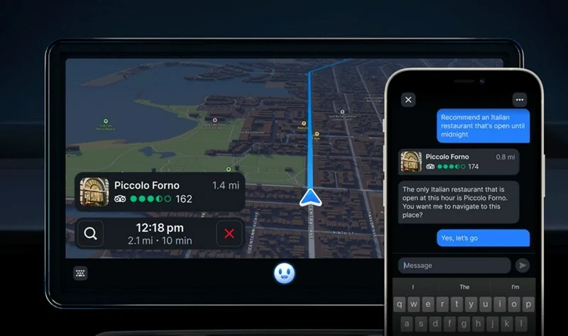
Mapbox, a global company in location technology, announces its collaboration with Hyundai Autoever, an automotive software innovation leader of the Hyundai Motor Group. Together, Mapbox and Hyundai Autoever are set to redefine the driving experience by developing an AI-powered digital ecosystem centred around Mapbox MapGPT, a location-intelligent AI voice assistant capable of natural and actionable ...
geospatialworld.net

Alberta Seeks Public Input On Updated Flood Maps, Even During A Drought

Even as Alberta prepares for a serious drought this spring, government officials continue to update flood mapping studies covering 1,600 kilometres of riverways. The province is asking for public feedback on 27 flood studies across the province, encompassing 600 kilometres of updated mapping and 1,000 kilometres of new mapping. “That’s more flood mapping we are ...
calgaryherald.com

IMD Launches Weather Forecast Portal For Farmers & MAUSAM App

New Delhi, Jan 15 (UNI) India Meteorological Department (IMD) on the 150th year of its establishment, on Monday launched the weather forecast portal ‘Panchayat Mausam Seva for farmers’ to support farmers with timely weather alerts and warnings for planning agricultural activities accordingly. “Through this portal, weather forecasts in English, Hindi and twelve regional languages will ...
uniindia.com

Seniors Living Near Urban Open Spaces Report Less Mental Distress, A Dementia Risk Factor

With widening research, doctors have even more reasons to tell patients to spend time in open spaces for better mental health. Now, a statewide study suggests even small differences in nearness to urban green spaces and access to waterfronts have ties to improved self-reported mental health among people 65 and older. Such proximity to open ...
spokesman.com

NGA Issues Million Dollar Challenge To Stop Illegal Fishing

The National Geospatial-Intelligence Agency (NGA) and the National Security Innovation Network (NSIN) are looking for people with innovative solutions to help stop illegal fishing. This new challenge has a million-dollar prize pool. Illegal, unreported and unregulated fishing is a critical issue threatening the sustainability of marine ecosystems. It contributes significantly to the decline and potential ...
fox2now.com

New GISTDA App Warns Of Hot Spots To Reduce Wildfire Risks

The GISTDA is continuing to develop its application called FAIPA, “Forest Fire” in English, to notify hotspots at the sub-district, district, and provincial levels, using real-time or near real-time satellite data for primary users, including agencies like the Department of Disaster Prevention and Mitigation, volunteer groups, and local residents. The application provides nationwide hotspot data, ...
nationthailand.com