Geomaticians

GIS

GeoComm And Rapidsos Empower Emergency Communications Centers With Enhanced Indoor Maps

GeoComm, provider of Public Safety Location Intelligence, and RapidSOS, creator of the world’s first intelligent safety platform, are excited to announce the integration of GeoComm Indoor Maps into RapidSOS premium. Currently, telecommunicators in the U.S. are typically provided limited building structure information during a 9-1-1 call. An address point on a map with no additional ...
police1.com
Biodiversity Survey Tool For Meeting New Net Gain Obligations

Biodiversity Survey Tool For Meeting New Net Gain Obligations

Esri UK partner Temple has created a biodiversity assessment tool, which could assist construction and engineering firms in meeting the biodiversity net gain (BNG) legislation that came into effect in England earlier this year. Environment, planning and sustainability consultancy Temple has joined geographic information system (GIS) software provider Esri UK’s partner network. This allows Temple ...
geplus.co.uk

AGI Launch Awards For Geospatial Excellence

The Association for Geographic Information (AGI) has re-launched its highly popular awards for excellence within the geospatial sector. Entries for the awards are being sought from organisations and individuals, working in or with geospatial, who want to showcase innovation, achievements and best practice. The AGI 2024 Awards Categories are the ‘Chairperson’s Award for Outstanding Service ...
directionsmag.com
Mosaic, Movella Improve Mobile Mapping And Geospatial Analysis

Mosaic, Movella Improve Mobile Mapping And Geospatial Analysis

Mosaic and Movella have collaborated to combine the Mosaic 51 and Mosaic X camera systems with Movella’s Xsens Vision Navigator (XVN). The collaboration aims to bolster GIS platform integration and allow for extensive and precise 3D reconstruction. It uses inertial measuring unit (IMU) data generated by XVN and directly connects to the OBD port. The ...
gpsworld.com

Google Maps Is Finally Making Glanceable Directions Widely Available

Google developers have invested significant efforts in improving the navigation experience in Maps throughout 2023, as we witnessed with the journey behind creating Immersive View. Efforts like this make Maps one of our favorite navigation apps on Android, but along the way, it also announced features like glanceable directions, which we haven’t seen on our ...
androidpolice.com
Climate Heat Map Of Australia

Climate Heat Map Of Australia

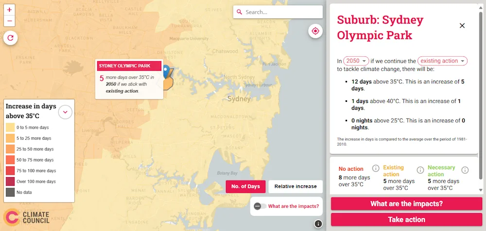
The Climate Council’s Heat Map of Australia is an interactive tool that shows how cutting climate pollution will limit extreme heat in our neighbourhoods. It projects the average number of hot and very hot days, as well as very hot nights, for each suburb by 2050 and 2090, and across three scenarios: no action, continuing ...
climatecouncil.org.au

Mapbox Unveils Digital Twin In Partnership With Snowflake And Maxar

Mapbox, the leading location data platform for mobile and web applications, announced a partnership with Snowflake, the Data Cloud company, and Maxar Intelligence, aimed at delivering a cutting-edge digital twin solution for the telecommunications industry. This collaboration leverages Snowflake’s geospatial capabilities and Maxar’s high-resolution 3D terrain and satellite imagery, combined with Mapbox’s powerful rendering capabilities ...
aithority.com
Global Atlas For Pumped Hydro At Mining Sites

Global Atlas For Pumped Hydro At Mining Sites

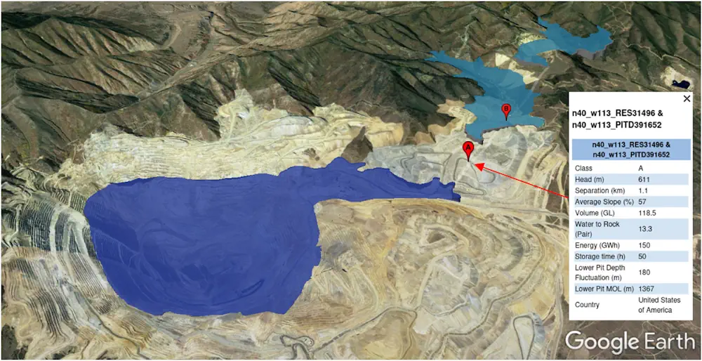
Researchers at the Australian National University (ANU) have created a global atlas for potential pumped hydro storage sites located in former mining areas. “Mining sites can be shaped during the end stages of mining to form a pumped hydro reservoir,” the scientists explained, noting that mining sites are often located close to the power network ...
pv-magazine.com
Access Over 181,000 USGS Historical Topographic Maps

Access Over 181,000 USGS Historical Topographic Maps

In collaboration with the US Geological Survey (USGS), we recently updated Esri’s online USGS historical topographic map collection with over 1,745 new maps, bringing the total number of maps in our collection to over 181,000 (181,008 to be exact). We also corrected a number of maps that our users reported as having georeferencing or other ...
esri.com

Instagram Is Working On A ‘Friend Map’ Feature That Would Let You Track Friends’ Locations

Instagram is developing a “Friend Map” feature, a Meta spokesperson confirmed to TechCrunch on Monday. The opt-in feature, which is similar to Snapchat’s Snap Map, would allow users to see their friends’ locations in real time. The company says the feature is an internal prototype and is not being tested externally. The feature was first ...
techcrunch.com
Esri India To Train 100K Students In Geospatial Technology For Free

Esri India To Train 100K Students In Geospatial Technology For Free

Multinational geographic information system company Esri India and independent public policy think tank Centre for Knowledge Sovereignty (CKS) have unveiled the pilot phase of the Master Mentors Geo-enabling Indian Scholars (MMGEIS) program to train students across the country in geospatial technology. The students will be guided by a team of experienced professionals including A. S. ...
analyticsindiamag.com
Online Mapping Tool Offers Land Use Information

Online Mapping Tool Offers Land Use Information

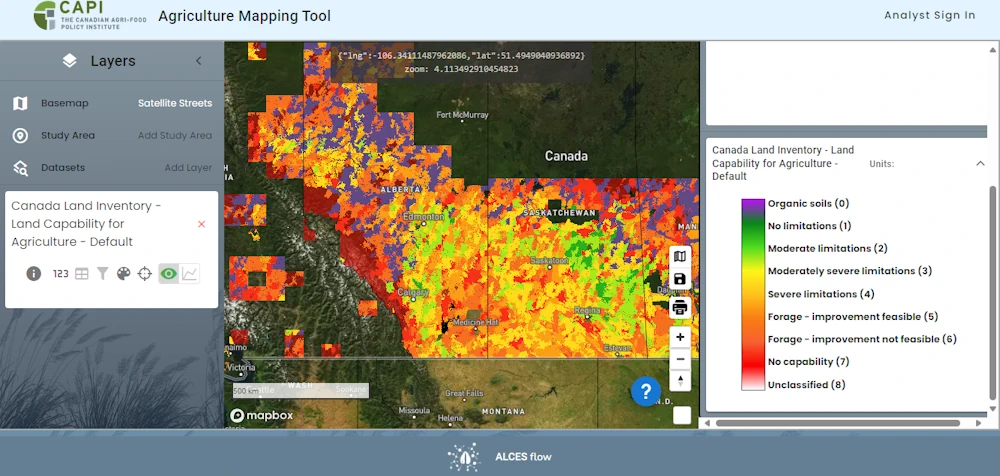
A new online tool allows users to examine agricultural land use across the country. Developed by ALCES for the Canadian Agri-Food Policy Institute, the Agriculture Web Mapping Application Tool offers maps and datasets about land use, management practices and agri-environmental indicators. Census, crop production and land use data can be viewed individually or overlaid. Tyler ...
producer.com
Binghamton Graduate Student Creates Public Safety Maps To Help Campus Community

Binghamton Graduate Student Creates Public Safety Maps To Help Campus Community

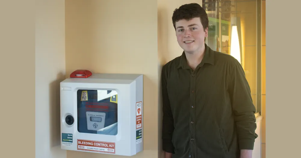
In dire situations, it is important to know where safety resources like blue lights, police stations and automated external defibrillators (AEDs) are located across Binghamton University’s multiple campuses. Thanks to the work of Ryan Kinsella, this kind of information is easier to access than ever before. A graduate student in the Geography Department, Kinsella has ...
binghamton.edu
Il «Gemello Digitale» Di Brescia Pronto A Nascere Al Via La Sperimentazione Sulla Linea 3 Del Tram

Il «Gemello Digitale» Di Brescia Pronto A Nascere: Al Via La Sperimentazione Sulla Linea 3 Del Tram

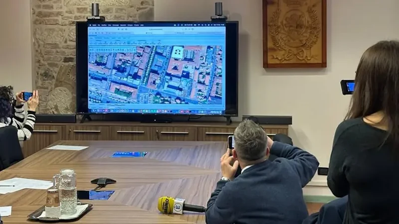
Il gemello digitale di Brescia è pronto a vedere la luce. Entro l’autunno il Comune si doterà infatti dell’infrastruttura di base (il software) che verrà popolata e modellata a seconda delle esigenze che verranno individuate e ritenute importanti. E una sperimentazione è già attiva e fa riferimento al tracciato della ipotetica linea 3 del tram ...
giornaledibrescia.it
Prosegue La Mappatura Degli Alberi, Già Censite 3500 Piante 60 Dovranno Essere Abbattute

Prosegue La Mappatura Degli Alberi, Già Censite 3500 Piante: 60 Dovranno Essere Abbattute

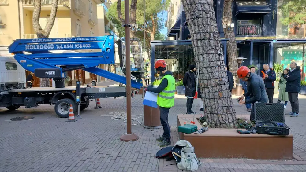
Geat, società di gestione servizi per l’ambiente e il territorio, è stata incaricata dal Comune di Riccione di condurre un censimento completo del patrimonio arboreo presente sul territorio comunale. Il progetto, avviato nel 2023, ha l’obiettivo di valutare lo stato di salute e la sicurezza di circa 10.500 alberi, pari a un terzo del totale ...
riminitoday.it

El Estudio Que Revela Posibles Vínculos Entre Incendios Forestales Y Expansión Urbana En Chile

Apartir de la catástrofe sobre los recientes incendios forestales que afectaron a distintos sectores de la Región de Valparaíso, nuevamente se ha puesto la atención sobre la eventual relación que tendrían estos siniestros con el interés inmobiliario por ocupar los espacios que fueron damnificados. En el estudio “Construyendo sobre cenizas. ¿Son utilizados los incendios forestales ...
interferencia.cl
Mom Makes Map For Vancouver Baby Changing Tables 'You're Flying Blind When You're A Parent'

Mom Makes Map For Vancouver Baby Changing Tables: ‘You’re Flying Blind When You’re A Parent’

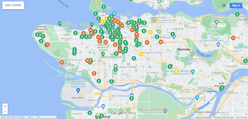
Michelle Cyca has had to change too many diapers on bathroom floors. The mother of two (her youngest is in his peak diaper phase right now), says she finally had enough after having to change her child’s diaper on the concrete floor of an Oak Street deli. So she decided to do something about it. ...
vancouverisawesome.com

The Role Of Gulls In Spreading Olive Seeds Across Balearic Islands

The spread of the olive tree throughout the Balearic Islands is more closely linked to the thriving local gull population than previously thought, a new study indicates. Researchers found that these birds significantly contribute to the dispersal of olive seeds, which are found inside the pit, across the Mediterranean archipelago, with some seeds traveling considerable ...
oliveoiltimes.com
Esri Releases New Landsat Satellite Data App To View And Analyze Land Changes

Esri Releases New Landsat Satellite Data App To View And Analyze Land Changes

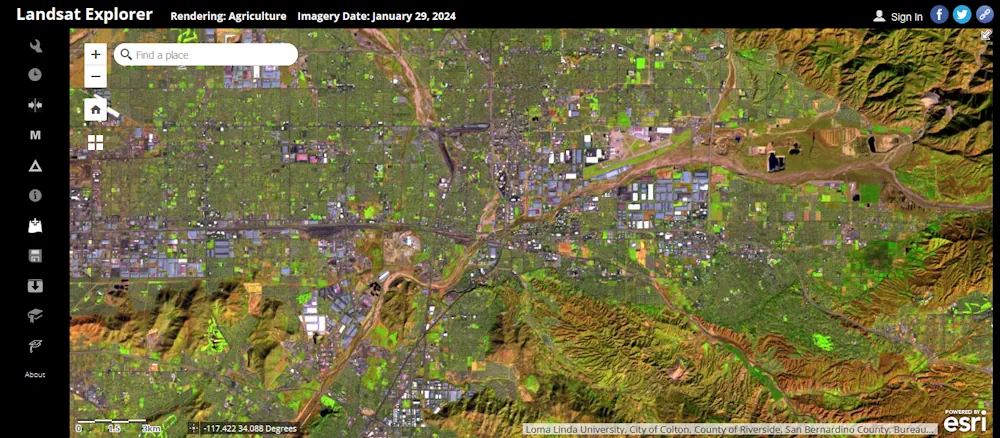
Esri, the global leader in mapping and location intelligence, announces the launch of Landsat Explorer, a groundbreaking online app that makes it easier than ever for organizations to access and analyze multispectral imagery from Landsat satellite missions. The new app from Esri’s ArcGIS Living Atlas of the World provides unprecedented ease of use and accessibility ...
businesswire.com

برای نخستین بار؛ نقشه پراکنش گونه‌های شاخص حیات‌وحش تهیه می‌شود

حسن اکبری، معاون محیط زیست طبیعی و تنوع زیستی سازمان حفاظت محیط‌زیست گفت: برای نخستین بار نقشه پراکنش ۱۹ گونه جانوری شاخص حیات‌وحش کشور تهیه می‌شود که تاکنون ۵۰ درصد کار پیشرفت داشته است. جغرافیای وسیع و گسترده ایران گونه‌های جانوری زیادی را در خود جای داده است و در هر گوشه و کنار کشور ...
irna.ir

Geographic Information System To Assess And Mitigate Natural Disasters

Southampton University has partnered with three of Egypt’s top institutions in a project aiming to assess and mitigate natural disasters through geographic information system (GIS) mapping technology. The project, ‘Seismic Resilience of Egypt’s Built Environment: A GIS-Based Framework for Assessment and Mitigation’ (Egypt-SeReAM), has received £133.5K from the Engineering and Physical Sciences Research Council (EPSRC) ...
theengineer.co.uk
Municipality Maps Commercial Buildings That Could Have Distressed, Potentially Dangerous Roofs

Municipality Maps Commercial Buildings That Could Have Distressed, Potentially Dangerous Roofs

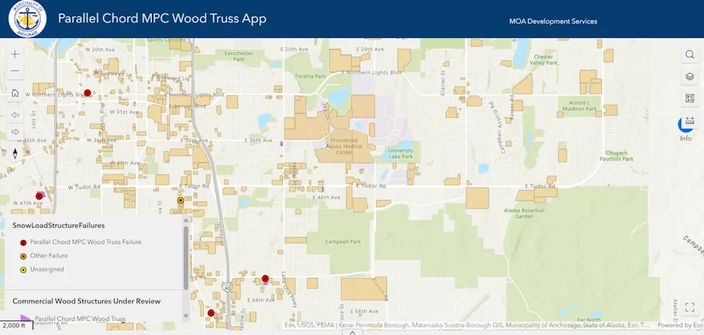
Municipal engineers released a new online resource on Thursday meant for commercial building owners to identify if their building in the Anchorage area contains a roof type that has been blamed for numerous snow-induced collapses. The resource comes as the municipality says the snow load on buildings is approaching 90% of the 40 pounds per ...
alaskasnewssource.com

Register Now For GEO Business 2024

Visitor registration is now open for GEO Business, the UK’s largest geospatial event. The free-to-attend expo designed for geospatial professionals who want to unlock the power of location intelligence, returns to ExCeL London on 5-6 June 2024. The highly anticipated 2024 instalment is set to be the best yet, as it returns for its landmark ...
suasnews.com
Mapy Małopolski - Nowy Geoportal Województwa Zastąpił MIIP

Mapy Małopolski – Nowy Geoportal Województwa Zastąpił MIIP

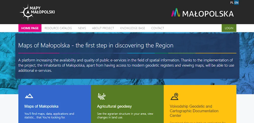
Nowy geoportal zwiększa dostępność i jakość e-usług publicznych w zakresie informacji przestrzennej. Mieszkańcy Małopolski poza dostępem do nowoczesnych rejestrów geodezyjnych i przeglądaniem map będą mogli korzystać z dodatkowych e-usług. Aplikacje mapowe znajdziemy przechodząc do zakładki Katalog Zasobów. Użytkownicy zarejestrowani, którzy założą konto w systemie będą mogli skorzystać z rozszerzonego pakietu dostępnych narzędzi umożliwiających m.in. tworzenie ...
gisplay.pl

La Universidad Nacional De La Plata Trabaja Con Nación En El Aprovechamiento Del Litio Como Recurso Natural Estratégico

El vicepresidente del Área Académica de la Universidad Nacional de La Plata (UNLP), Fernando Tauber, se reunió en la Ciudad de Buenos Aires con la titular de la secretaría de Minería de la Nación, Flavia Royón, para aportar el conocimiento y experiencia de la Casa de Estudios en el aprovechamiento del litio como recurso natural ...
infoblancosobrenegro.com
سامانه اطلس سرمایه‌گذاری كشور رونمایی شد

سامانه اطلس سرمایه‌گذاری كشور رونمایی شد

این مراسم با حضور رئیس سازمان سرمایه‌گذاری و کمک‌های اقتصادی و فنی ایران، رئیس سازمان نقشه‌برداری کشور، “مجتبی توانگر” رئیس کمیته اقتصاد دیجیتال و “عزت الله اکبری” رئیس کمیسیون صنایع و معادن مجلس شورای اسلامی و تعدادی از معاونان وزارت اقتصاد برگزار شد. اطلس سرمایه گذاری در پاسخ به ضرورت موجود اطلس سرمایه گذاری کشور ...
shada.ir

The Impact Of Wildfire Smoke On Rooftop PV

Researchers from the University of New South Wales (UNSW) in Australia have investigated the effects of wildfires on the electricity production of rooftop PV systems and have concluded that residential solar arrays could be used for wildfire detection and monitoring, due to their sensitivity to smoke. In the study “Quantifying the impact of wildfire smoke ...
pv-magazine.com

DCU, Bentley Partner For 3D Smart City Research Initiative

Dublin City University (DCU) has partnered with Bentley Systems to create an advanced digital twin of its campus as part of its Smart DCU initiative. The partnership combines artificial intelligence (AI) and immersive digital twin technology. The campus will be used as a testing ground for innovative smart city solutions, with the aim of creating ...
gpsworld.com
NASA Is Helping Hawai’i Farmers Grow More Food With AI

NASA Is Helping Hawai’i Farmers Grow More Food With AI

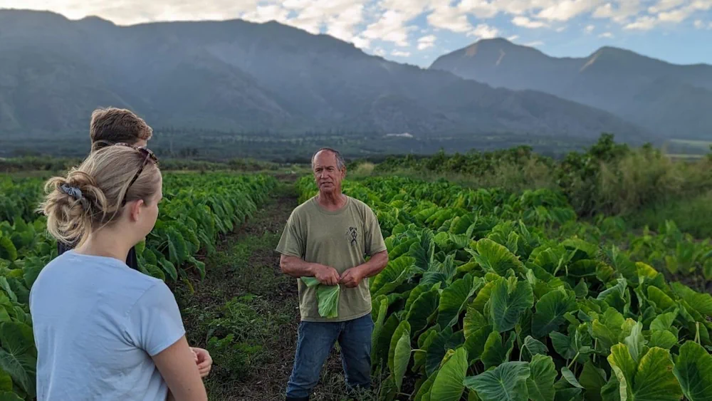
For many Hawaiian farmers, agriculture is more than a profession; it is their kuleana, or responsibility. It is a practice with deep cultural roots tied to the ancient concept of aloha ʻāina—love and responsible stewardship of the land. Despite this cultural connection to farming, agricultural production and food systems across Hawai’i have suffered from decades ...
fooddive.com

Azerbaijan Elaborates A Map Of Armenia’s Mining Industry

A map of Armenia’s mining industry is being elaborated in Azerbaijan, Chairman of the Public Association of Cartographers of Azerbaijan Mugabil Bayramov said, Trend reports. He mentioned that 40 percent of the map has already been elaborated at the moment. “The map is being prepared in two formats. It will be used to find out ...
en.trend.az