Geomaticians

Geology

Comparing Sandy Beach And Dune Changes Using Lidar And Drone Technology

Coastal landscapes, including sandy beaches and foredunes, are dynamic and susceptible to changes caused by water level fluctuations, storm events, and human activities. Monitoring these changes is crucial for effective coastal management and resilience planning. Traditional methods for measuring geomorphic changes, such as small-unoccupied aircraft systems paired with structure-from-motion photogrammetry (sUAS-SfM), are often costly and ...
naturalsciencenews.com
BAS Releases Interactive Antarctic Map Viewer

BAS Releases Interactive Antarctic Map Viewer

The British Antarctic Survey (BAS) has released a new map viewer that brings together all of the Antarctic Digital Database datasets, plus other useful information, and displays them together in an open-access interactive website. The BAS’ Mapping and Geographic Information Centre (MAGIC) is responsible for keeping the maps and data up to date, with the ...
spatialsource.com.au
Drone And Geospatial Team Becomes First To Map The Coca River In The Amazon Basin

Drone And Geospatial Team Becomes First To Map The Coca River In The Amazon Basin

The geology along Ecuador’s Coca River is moving in fast-forward. In a scientific field where natural wonders form over millennia, but natural disasters occur in minutes, speed is less than desirable. Over the last four years, the river and its surrounding area within the Amazon basin have experienced a lava dam collapse, 500 million tons ...
phys.org
New Wānaka Lake Bed Map To Help Identify Tsunami, Earthquake Risks

New Wānaka Lake Bed Map To Help Identify Tsunami, Earthquake Risks

A new map showing the bed of Lake Wānaka in “incredible detail” will help scientists work out the lake’s potential for earthquakes and tsunami, Niwa says. The work was done after an active fault was found under the lake three years ago. Lake Wānaka is thought to be at risk of a tsunami-like event due ...
stuff.co.nz
New Geological Map Reveals Secrets Of Greenland's Icy Interior

New Geological Map Reveals Secrets Of Greenland’s Icy Interior

A team of international scientists involving the Durham University Geography department has unveiled a new map of the geological provinces hidden beneath the Greenland Ice Sheet. This comprehensive synthesis, published in Geophysical Research Letters, promises to advance our understanding of this critical component of the global climate system. The new subglacial geology map provides an ...
phys.org
Brazil Looking To Improve Geological Mapping System For Mining

Brazil Looking To Improve Geological Mapping System For Mining

The Brazilian geological survey department, SGB, launched a public consultation to improve the country’s geological mapping system for the mining sector. The public consultation will be open until June 15. “This action is part of the 10-year basic geological mapping plan (PlanGeo) and is aimed at receiving proposals from the mining sector and civil society ...
bnamericas.com
Major 'Magnetic Anomaly' Discovered Deep Below New Zealand's Lake Rotorua

Major ‘Magnetic Anomaly’ Discovered Deep Below New Zealand’s Lake Rotorua

New maps have revealed a hidden hydrothermal system beneath a legendary lake in New Zealand. The Rotorua area is well known for hydrothermal activity, with the Tourism New Zealand website stating that clouds of steam drift around the lake’s shore, and that sulfur gives a “magical green-blue” color to the water. Researchers at GNS Science, ...
livescience.com

La Universidad Nacional De La Plata Trabaja Con Nación En El Aprovechamiento Del Litio Como Recurso Natural Estratégico

El vicepresidente del Área Académica de la Universidad Nacional de La Plata (UNLP), Fernando Tauber, se reunió en la Ciudad de Buenos Aires con la titular de la secretaría de Minería de la Nación, Flavia Royón, para aportar el conocimiento y experiencia de la Casa de Estudios en el aprovechamiento del litio como recurso natural ...
infoblancosobrenegro.com

Azerbaijan Elaborates A Map Of Armenia’s Mining Industry

A map of Armenia’s mining industry is being elaborated in Azerbaijan, Chairman of the Public Association of Cartographers of Azerbaijan Mugabil Bayramov said, Trend reports. He mentioned that 40 percent of the map has already been elaborated at the moment. “The map is being prepared in two formats. It will be used to find out ...
en.trend.az
We Are Not Tracking The Impact Of Half The World’s Mines

We Are Not Tracking The Impact Of Half The World’s Mines

A modern, sustainable society depends on the mining industry to supply crucial materials. Batteries and electric vehicles require metals like lithium and cadmium, wind turbines require rare earth metals and our cities need aggregate materials like gravel and sand for construction. On the other hand, the mining industry also produces materials like coal which are ...
pursuit.unimelb.edu.au

İzmir’in Tsunami Haritası Çıkarılacak

İzmir Dokuz Eylül Üniversitesi (DEÜ) Mühendislik Fakültesi Jeoloji Mühendisliği Bölümü Öğretim Üyesi ve Deprem Araştırma ve Uygulama Merkez (DAUM) Müdürü Doç. Dr. Ökmen Sümer, İzmir iç ve dış körfezindeki tüm kıyıların ve koyun geometrisini çıkartıp, depremlerin tsunami etkilerini araştırdıklarını belirtip, sonunda oluşturulacak tsunami baskın haritalarıyla, risklerin azaltılmasına imkan sağlanacağını söyledi. Doç. Dr. Sümer, “Bu proje ...
cumhuriyet.com.tr
New Map Shows Where Damaging Earthquakes Are Most Likely To Occur In US 

New Map Shows Where Damaging Earthquakes Are Most Likely To Occur In US 

Nearly 75% of the U.S. could experience damaging earthquake shaking, according to a recent U.S. Geological Survey-led team of more than 50 scientists and engineers. This was one of several key findings from the latest USGS National Seismic Hazard Model (NSHM). The model was used to create a color-coded map that pinpoints where damaging earthquakes ...
phys.org

Joshi Launches India’s National Geoscience Data Repository (NGDR) Portal

Minister for Mines Pralhad Joshi launched India’s National Geoscience Data Repository (NGDR) portal on Tuesday. NGDR is a comprehensive online platform that will host the geospatial data for the entire country. Terming the NGDR portal the culmination of the work of several years, Mines Secretary VL Kantha Rao said that out of the total 32 ...
psuwatch.com
Investigadores De La UNAM Diseñan Algoritmo Capaz De Detectar Las Cenizas Del Volcán Popocatépetl

Investigadores De La UNAM Diseñan Algoritmo Capaz De Detectar Las Cenizas Del Volcán Popocatépetl

Investigadores de la UNAM, bajo la dirección del maestro en Geografía Víctor Manuel Jiménez Escudero, han desarrollado un algoritmo innovador que puede detectar con precisión las emisiones de ceniza provenientes del volcán Popocatépetl, conocido por su constante actividad, uno de los más dinámicos y vigilados del mundo. El Laboratorio Nacional de Observación de la Tierra ...
es.wired.com
Mapping Australia’s Heavy Minerals In World-First

Mapping Australia’s Heavy Minerals In World-First

The Australian Government’s Exploring for the Future program is continuing to deliver for the resources industry with the release of a new tool to support the discovery of minerals critical to the net zero transformation. The Heavy Mineral Map of Australia, developed by Geoscience Australia in collaboration with Curtin University, has been created using heavy ...
minister.industry.gov.au
NASA Researchers Measure Sinking Land In American Samoa

NASA Researchers Measure Sinking Land In American Samoa

On Sept. 29, 2009, an 8.1-magnitude earthquake struck near American Samoa, Samoa, and Tonga, triggering a tsunami that caused human casualties and $200 million in property damage on the islands. The earthquake also exacerbated another problem in American Samoa: subsidence, or the sinking of land. When combined with relative sea level rise, land sinking can ...
phys.org
Australia, Canada And US Unify Critical Minerals Data

Australia, Canada And US Unify Critical Minerals Data

The U.S. Geological Survey (USGS) has released a compilation of national-scale geological, geophysical and mineral resource datasets from Australia, Canada and the US through a collaboration between the three countries’ federal geological surveys. “Geology doesn’t stop at the border and neither does our data,” said USGS scientist Anne McCafferty, who led the effort. “Scientists will ...
usgs.gov
В Анапе Разработают Мобильное Приложение Для Геологов

В Анапе Разработают Мобильное Приложение Для Геологов

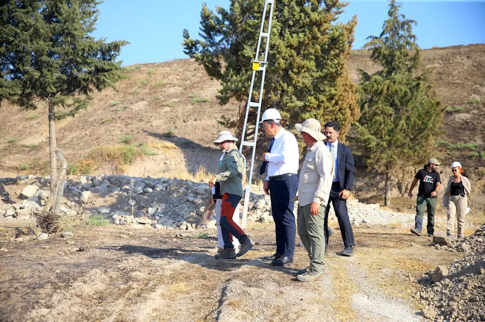
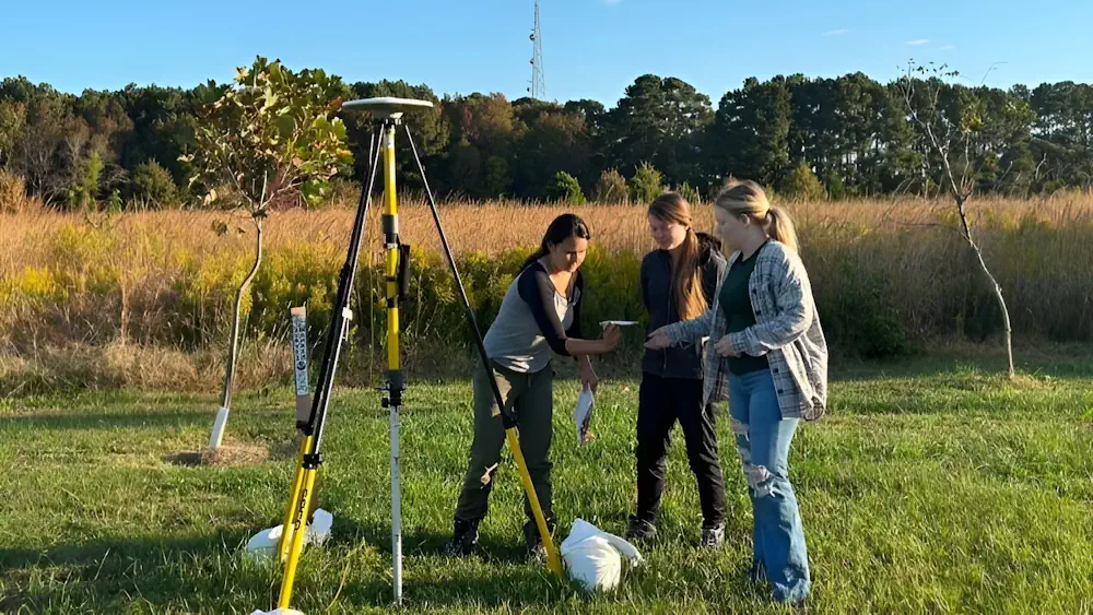
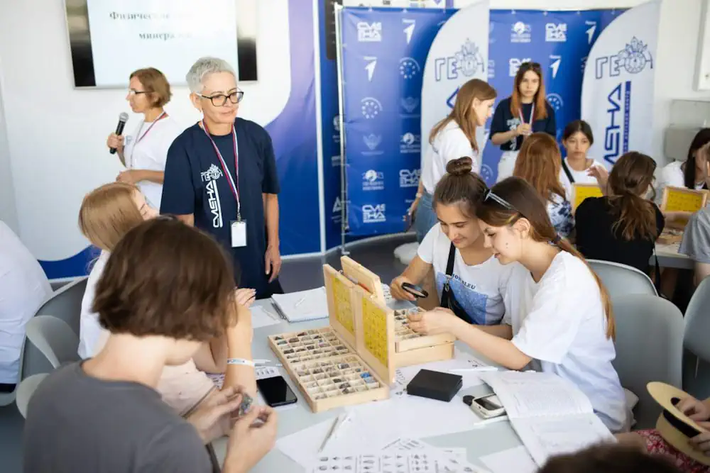
Образовательная программа «Юная смена геологов» стартовала во Всероссийском детском центре «Смена». Проект объединил 150 школьников из 29 регионов России от 11 до 17 лет. В рамках программы сменовцы освоят базовые дисциплины и получат практические навыки по направлениям топография, ориентирование на местности, минералогия, кристаллография, петрография, палеонтология, основы горного дела, экология и геодезия. Образовательные занятия для проведут ...
anapa.media
WSGS Debuts Interactive Map Of Wyoming's Mineral Resources

WSGS Debuts Interactive Map Of Wyoming’s Mineral Resources

The Wyoming State Geological Survey has developed a new interactive map that will make it easier to research the state’s extensive mineral resources. The online Mineral Resources of Wyoming map will be routinely updated as new data become available. The map is an update and expansion of the WSGS’s 2018 Mines and Minerals map. New ...
wyomingnews.com
El SEGEMAR Y El Servicio Geológico De Arabia Saudita Firman Acuerdo De Cooperación Científica Geológica

El SEGEMAR Y El Servicio Geológico De Arabia Saudita Firman Acuerdo De Cooperación Científica Geológica

El objeto del acuerdo es la cooperación en el campo de la geología, proporcionando un marco institucional para el intercambio de conocimientos y mejorar las competencias técnicas y geológicas entre ambos organismos. En este sentido, ambas instituciones coincidieron en promover la cooperación científica y técnica en temas de prospección geológica, geofísica y evaluación de recursos ...
argentina.gob.ar
Naukowcy Z WAT Proponują, By Wykorzystać GPS W Monitorowaniu Poziomu Wód Podziemnych

Naukowcy Z WAT Proponują, By Wykorzystać GPS W Monitorowaniu Poziomu Wód Podziemnych

Naukowcy z Wojskowej Akademii Technicznej zaproponowali innowacyjną metodę pomiaru ubożenia wód podziemnych opartą na pomiarach GPS. To, jak zmienia się poziom wód podziemnych, będzie można monitorować zdalnie – nawet w najbardziej odległych częściach świata. Mimo że techniki teledetekcyjne się rozwijają, a obserwacje naziemne stają się coraz dokładniejsze, modele opisujące poziom wód gruntowych nadal nie są ...
portalsamorzadowy.pl

Buenos Aires Albergará Las Jornadas De Geociencias Para Ingeniería

Durante los días 1 y 2 de noviembre de este año, tendrá lugar la cuarta edición de las Jornadas de Geociencias para la Ingeniería. El evento es organizado por el Instituto de Geodesia y Geofísica Aplicadas y el Departamento de Agrimensura de la Facultad de Ingeniería de la Universidad de Buenos Aires y tendrá lugar ...
comercioyjusticia.info
Mystery Of How Diamonds Reach The Earth’s Surface Finally Solved

Mystery Of How Diamonds Reach The Earth’s Surface Finally Solved

Diamonds form under great pressures in the depths of the Earth and are hundreds, or even billions of years old. They are usually found in types of volcanic rocks called kimberlites, which are located in the oldest, strongest, and thickest parts of the continents, such as in South Africa, where the well-known diamond rush of ...
earth.com
UNESCO Launches Map Of UK Sites Including The Living Coast

UNESCO Launches Map Of UK Sites Including The Living Coast

A new map has been unveiled featuring all 58 United Nations Education, Scientific and Cultural Organization (UNESCO) sites in the UK. It includes biospheres, creative cties, global geoparks and World Heritage sites. The map, illustrated by artist Tom Woolley, was launched by UNESCO to raise awareness of the breadth of natural, cultural and built heritage ...
brighton-hove.gov.uk
Global GPS Measurements Indicate Observable Phase Of Fault Slip Two Hours Before Large Earthquakes

Global GPS Measurements Indicate Observable Phase Of Fault Slip Two Hours Before Large Earthquakes

Analysis of Global Positioning System (GPS) time-series data from nearly 100 large earthquakes worldwide has provided evidence for the existence of a precursory phase of fault slip occurring two hours before seismic rupture. “If it can be confirmed that earthquake nucleation often involves an hours-long precursory phase, and the means can be developed to reliably ...
eurekalert.org
Giant ‘Gravity Hole’ In The Ocean May Be The Ghost Of An Ancient Sea

Giant ‘Gravity Hole’ In The Ocean May Be The Ghost Of An Ancient Sea

There’s a massive “hole” in the Indian Ocean, researchers say—but it’s not the kind that could drain away all that water. Instead it’s a term geologists use to describe a spot where Earth’s gravity is lower than average. And a new study may have finally revealed its origins: it appears to be caused by plumes ...
scientificamerican.com

The Institute Of Geosciences And Georesources Of The National Resource Council Has Published An Update Of Geothopica

The Institute Of Geosciences And Georesources Of The National Resource Council Has Published An Update Of Geothopica – Italy’s National Geothermal Data Platform. The updated version of GeoThopica, which was originally created in 2007 by CNR-IGG, benefits from the BNDG currently containing about twice the data compared to when it was originally created. The most ...
thinkgeoenergy

GSI To Carry Remote Sensing In Bihar To Identify Magnetite-bearing Rocks

The Bihar government has decided to sign an MoU with Geological Survey of India for conducting remote sensing and aerial survey of the southern part of the state to identify magnetic anomaly on the surface representing the presence of rocks having a higher content of ferrous and ferromagnesian minerals, an official said. For the first ...
business-standard.com
UAF Scientists To Hunt For Clues About Arctic Ocean Glaciation

UAF Scientists To Hunt For Clues About Arctic Ocean Glaciation

Evidence indicates a thick ice sheet, not annual sea ice and icebergs, covered the Arctic Ocean at some point during the last 140,000 years. Now, University of Alaska Fairbanks scientists will be looking for more geologic proof of the ice sheet’s existence, sources, behavior and extent. UAF Geophysical Institute scientists will focus on the Beaufort ...
kinyradio.com
New 3D Maps Reveal Hundreds Of Ancient Landslides South Of Auckland

New 3D Maps Reveal Hundreds Of Ancient Landslides South Of Auckland

Just-released maps have revealed hundreds of ancient landslides around Pukekohe, while offering a multi-dimensional view of the region’s active faults and volcanic features. Capturing more than 830 square kilometres, from Manukau Harbour’s southern shoreline to the lower Waikato River, the new GNS Science-produced maps show Auckland’s rolling southern landscapes as they’ve never been seen. It ...
nzherald.co.nz