Human Activities Degraded A California-Sized Area Of Tropical Forests In The Last Six Years
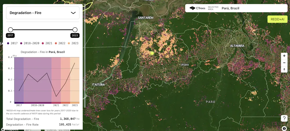
A new data platform from CTrees, REDD+AI, is the first to measure forest degradation from logging, fire, and road construction across all tropical forests. Enabled by artificial intelligence and advanced satellite data, the system detects change in every 5-meter area of tropical forests worldwide. Forest degradation refers to activities that cause loss of trees, carbon, ...
ctrees.org