Geomaticians

ESRI

Hospital Using New Software To Manage Raac Repairs

Hospital Using New Software To Manage Raac Repairs

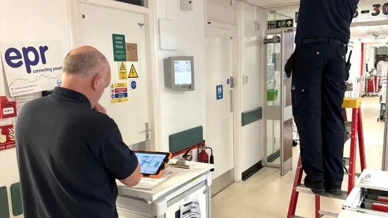
A West Yorkshire hospital has become the first in the UK to use new geospatial software to help pinpoint high-risk crumbling concrete panels. More than 80% of floors, walls and ceilings at the Airedale Hospital, in Keighley, are made of Raac, or reinforced autoclaved aerated concrete, which has a lifespan of about 30 years. Though ...
bbc.com

Esri Releases Latest Land Cover Map With Updated Sentinel-2 Satellite Data

Esri, the global leader in location intelligence, in its partnership with Impact Observatory, has released an updated global land-use/land-cover map of the world based on the most up-to-date 10-meter Sentinel-2 satellite data. In the update, the Sentinel-2 10m Land Use/Land Cover Time Series includes new data from 2023, expanding the series to include global coverage ...
businesswire.com

Overture Maps Foundation Releases The First Beta Of Its Open Map Dataset

The Overture Maps Foundation today launched the first beta of its global open map dataset. With this, the foundation, which is backed by the likes of Amazon, Esri, Meta, Microsoft and TomTom, is getting one step closer to launching a production-ready open dataset for developers who need geospatial data to power their applications. “This Beta ...
techcrunch.com
London Gatwick Airport Builds Geospatial Platform With Esri GIS

London Gatwick Airport Builds Geospatial Platform With Esri GIS

London Gatwick has created a new geospatial platform using Esri’s ArcGIS to support multiple operational areas at the airport, including engineering and environmental services. The system is already making engineering and construction works safer by reducing accidental strikes on buried utilities and enabling better management of the airports biodiversity. London Gatwick is one of the ...
gim-international.com

Dublin Urban Rivers Life Project Selects ESRI To Reduce Levels Of Wastewater

Geographic information systems (GIS) provider Esri Ireland has been chosed by Dublin Urban Rivers Life (DURL) project to help prevent preventing circa 13 million litres of polluted wastewater from entering Dublin rivers annually. DURL is a joint venture between South Dublin and Dún Laoghaire-Rathdown County Councils, with funding received from the EU Life Programme. It ...
techcentral.ie
Access Over 181,000 USGS Historical Topographic Maps

Access Over 181,000 USGS Historical Topographic Maps

In collaboration with the US Geological Survey (USGS), we recently updated Esri’s online USGS historical topographic map collection with over 1,745 new maps, bringing the total number of maps in our collection to over 181,000 (181,008 to be exact). We also corrected a number of maps that our users reported as having georeferencing or other ...
esri.com
Esri India To Train 100K Students In Geospatial Technology For Free

Esri India To Train 100K Students In Geospatial Technology For Free

Multinational geographic information system company Esri India and independent public policy think tank Centre for Knowledge Sovereignty (CKS) have unveiled the pilot phase of the Master Mentors Geo-enabling Indian Scholars (MMGEIS) program to train students across the country in geospatial technology. The students will be guided by a team of experienced professionals including A. S. ...
analyticsindiamag.com
Esri Launches Maps.Com, A Content Platform For Creators Demonstrating The Power Of Maps

Esri Launches Maps.Com, A Content Platform For Creators Demonstrating The Power Of Maps

Created by Esri, the global leader in mapping and location intelligence software, the new website is a platform for sharing and discussing visually engaging maps that inspire, challenge, educate, reward, and provoke across a range of topics and formats. The site will serve as a celebration of science and art, presenting maps that captivate not ...
businesswire.com

Esri Integrates 3D Tiles Into The ArcGIS System Of Record, Enhancing 3D GIS Workflows

Advances in imagery collection and photogrammetry techniques have increased demand for digital representations of the physical world, or geospatial digital twins. To meet this demand, Esri will integrate 3D Tiles into its ArcGIS software. With the ability to work with a variety of data types, including open 3D data standards, customers can develop innovative solutions ...
datanami.com

Esri Launches Online GIS Course For Climate Action

As the impacts of climate change increase and intensify around the world, one aspect that has become clear is the geographic nature of the issue. The ability to tackle such a wide-reaching geographic challenge requires technology that gives context, which location intelligence provides. To support the individuals working toward this goal, Esri, the global leader ...
businesswire.com

Esri NA Signs Deal To Provide Egypt With GIS Programs

Egyptian Ministry of Communications and Information Technology has signed an agreement with the geographic information system (GIS) software firm Esri North Africa (Esri NA) to provide the latter’s latest GIS programs to the Egyptian universities, a statement showed. The deal also aims to build the capacities of the Egyptian staff in the field of GIS ...
zawya.com

Esri Canada Acquires Ratio.City To Help Address Canada’s Housing Crisis

Esri Canada, today announced its acquisition of Ratio.City, a Toronto-based urban planning software and data company. This acquisition expands Esri Canada’s community planning solutions portfolio, enabling customers to better collaborate within the land development and planning community, and accelerating the design and approval of more affordable housing. “Ratio.City’s extensive expertise in planning, design and development ...
directionsmag.com
Microsoft And Esri To Speed Up Access To Earth-Observation Data

Microsoft And Esri To Speed Up Access To Earth-Observation Data

To speed up access to Earth observation data for millions of customers, Esri is closely integrating its ArcGIS geographic mapping platform with Microsoft Azure Space. “We’re putting the entire technology stack in Azure Space data centers,” Richard Cooke, Esri, imagery and remote sensing director, told SpaceNews at the World Satellite Business Week conference here. “We ...
spacenews.com
Esri Canada Launches Assessment Analyst Valueit For Accurate Property Assessment Values

Esri Canada Launches Assessment Analyst Valueit For Accurate Property Assessment Values

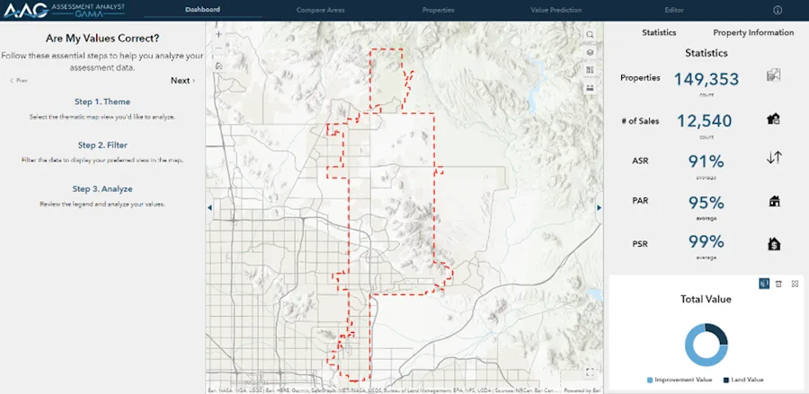
Esri Canada today announced the launch of Assessment Analyst ValueIT, a powerful visualization and analytic application that revolutionizes property assessment by providing clarity and control over the accuracy of assessment values. With AA ValueIT, assessors can confidently determine if assessments meet local or state standards by leveraging the full potential of computer-assisted mass appraisal (CAMA) ...
directionsmag.com

RSA And Esri Sign MoU To Boost Geospatial Services For Rwanda’s Social-Economic Development

The CEO of the Rwanda Space Agency (RSA), Colonel Francis Ngabo, and the President of Esri, Jack Dangermond, signed a Memorandum of Understanding (MoU) to establish a collaborative partnership, setting the foundation for promoting geospatial services to drive social-economic development in Rwanda. The momentous event occurred on the sidelines of the 2023 Esri User Conference ...
africanews.space
Using Geospatial Tools To Assess Sewer Risk

Using Geospatial Tools To Assess Sewer Risk

Anglian Water is the largest water and water recycling company by geographic area in England and Wales, serving much of the Eastern portion of the United Kingdom. Recently, the utility company created a geospatial tool in order to get a real-time picture of sewer risk and identify specific hotspots to prioritize where work is most ...
geoweeknews.com

Esri Maps Ireland’s Summer 2023 Festival Circuit

Esri Ireland, the market leader in Geographic Information Systems (GIS), has created a digital map highlighting some of the best-loved and lesser-known festivals happening across the island of Ireland this summer. Using Esri’s ArcGIS digital mapping system, the interactive map has something for all tastes and interests, allowing you to plan your ultimate festival adventure ...
irelandbeforeyoudie.com

Geospatial Startup Partners With World’s Largest Mapping Company To Improve Urban Planning To Create Happier And Healthier Cities

A “pioneering” British tech startup aims to improve urban planning for towns and cities by helping planners to better respond to local needs for community facilities, spaces and events. Yeme Tech, has created a highly sophisticated Community Data Platform (CDP) to help planners and developers instantly identify social infrastructure, facilities, and community spaces which are ...
directionsmag.com
La UNA Proyecta Implementación De SmartCampus

La UNA Proyecta Implementación De SmartCampus

La Prof. Dra. Zully Vera de Molinas, rectora de la Universidad Nacional de Asunción (UNA), recibió la visita de representantes de tres organizaciones nacionales y extranjeras con el objetivo de establecer las bases para introducir un sistema de información geográfica (SIG) para desarrollar un Smart Campus. La visita tuvo lugar en el campus de San ...
una.py

Esri España Y Seresco Aúnan Fuerzas Para Ofrecer Soluciones Al Sector Agrícola Mediante La Tecnología Arcgis

Esri, empresa líder mundial en tecnología geoespacial, y Seresco, especialistas y referentes en España en consultoría y sistemas de información orientados al registro, análisis predictivo y gestión de riesgos asociados al sector agroalimentario, colaborarán para ofrecer soluciones conjuntas que permitirán poner a disposición del sector los datos y las herramientas para la gestión sostenible de ...
dirigentesdigital.com

Esri India And ideaForge Join Hands

Esri India, the country’s leading Geographic Information System (GIS) Software & Solutions provider announced the signing of a Memorandum of Understanding (MOU) with ideaForge, a market leader in the Indian Unmanned Aircraft Systems. The objective of this partnership is to boost the adoption of drones in India. The partnership between Esri India and ideaForge will ...
timestech.in
Esri Maps Out Routes As Migratory Birds Return To Ireland

Esri Maps Out Routes As Migratory Birds Return To Ireland

Esri Ireland, the Geographic Information Systems (GIS) operator, has created a digital map highlighting the flight paths of a number of migratory birds which have returned to Ireland’s shores after having flown south for the winter. The maps are to mark World Migratory Bird Day (WMBD), which falls on May 13th, an annual awareness-raising campaign ...
afloat.ie

Fulcrum Integrates Esri’s ArcGIS Maps SDK In Its Platform

Fulcrum, a field inspection management platform, has integrated Esri’s ArcGIS Maps software development kit (SDK) into its platform to provide customers with seamless access to Esri’s geographic information system (GIS) capabilities. The integration will allow Fulcrum’s customers in industries such as power, water, telecom, agriculture, environmental engineering, and others to access and leverage Esri data ...
geospatialworld.net

Locana Showcases Leading Mobile Geospatial Capabilities To Energy, Utilities And Infrastructure Markets At European Shows

Locana, an international leader in spatial technology, announced that its Lemur mobile GIS solution will be showcased at the International SAP Conference for Utilities in Basel, Switzerland and the ESRI International Infrastructure Management & GIS Conference in Frankfurt, Germany. Both events will address how mobile field work requirements across Europe are rapidly shifting — and ...
directionsmag.com
Esri Releases Reality Mapping Extension For ArcGIS Pro

Esri Releases Reality Mapping Extension For ArcGIS Pro

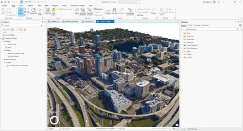
A large, new release of Esri’s desktop GIS software ArcGIS Pro has been released. Version 3.1 includes many new features and tools. Perhaps the biggest new feature is a reality mapping toolbox named ArcGIS Reality for ArcGIS Pro. The extension complements ArcGIS Pro’s ortho mapping capability with high-fidelity 2D and 3D product generation. This new ...
geoweeknews.com

Esri To Provide Malta Agencies With GIS Solutions

The Malta Information Technology Agency (MITA) has signed an enterprise agreement with Esri to enhance its GIS capabilities. The three-year agreement will provide Esri software, professional services and technical support to MITA and 22 other agencies across the Maltese government. Agencies such as health, communications and infrastructure organisations that do not currently benefit from enterprise ...
National Geographic Society And Utrecht University Launch World Water Map

National Geographic Society And Utrecht University Launch World Water Map

The National Geographic Society launched the World Water Map as part of its five-year World Freshwater Initiative to better understand developing freshwater shortages around the world and inspire sustainable action. The Map was created by the National Geographic Society in cooperation with Utrecht University and Esri to identify water availability hotspots, visualize global freshwater supply ...
blog.nationalgeographic.org

Esri GIS Helps Identify Gaps In Mental Health Service Provision

The Association of Mental Health Providers (AMHP) has created the first ever complete picture of mental health service provision across England, via a freely available interactive map, working in partnership with Esri UK. By combining data from the AMHP’s members and other mental health service providers, alongside demographic data, the map helps users understand where ...
directionsmag.com
GIS Portal Enhances Collaboration For UK Nuclear Power Station

GIS Portal Enhances Collaboration For UK Nuclear Power Station

EDF, a French electric utility company, has partnered with Esri UK to implement an enterprise GIS for Hinkley Point C (HPC) nuclear power station, one of the largest and most complex construction projects in Europe. The GIS portal has enabled better collaboration and streamlined digital workflows by providing a central source of all spatial data, ...
gim-international.com

Esri Unterzeichnet Vereinbarung Mit Malta Über Zugang Zu Gis-technologie Und Schulungen

MITA hat eine Vereinbarung mit Esri unterzeichnet, dem weltweiten Marktführer im Bereich Location Intelligence, um die Fähigkeiten der MITA bei geografischen Informationssystemen (GIS) zu erweitern. Der Dreijahresvertrag beinhaltet die Bereitstellung von Esri-Software, professionellen Dienstleistungen und technischem Support für MITA und 22 weitere Behörden der maltesischen Regierung. Im Rahmen der Vereinbarung werden die bestehenden GIS-Anwender in ...
boerse.de