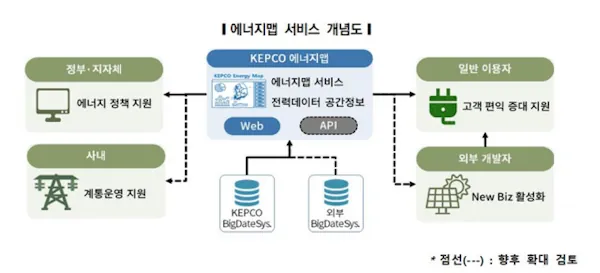
Google Expands Environmental Mapping Tools
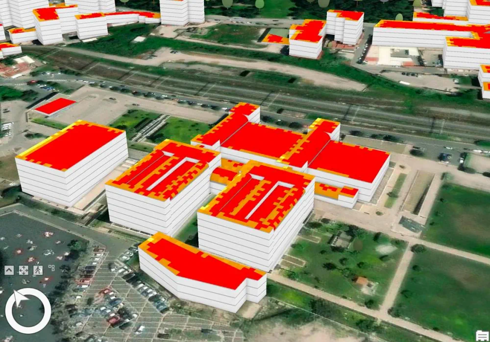
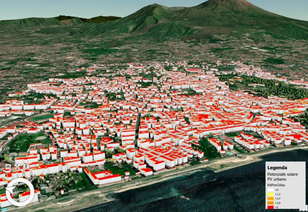
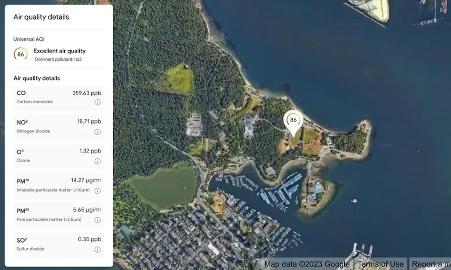
Google is expanding its sustainability offerings with new products from its Google Maps platform, including mapping technologies for solar energy, air quality, and pollen distribution. The mapping tools use AI and machine learning paired with aerial imagery and environmental data to provide valuable information for developers, businesses, and organizations to track and mitigate their environmental ...
environmentalleader.com