Geomaticians

Ecology

Terras Indígenas Na Amazônia Brasileira Ajudam A Prevenir Doenças Causadas Por Queimadas, Diz Estudo

Terras Indígenas Na Amazônia Brasileira Ajudam A Prevenir Doenças Causadas Por Queimadas, Diz Estudo

Novo estudo de dez anos, revisado por pares, sugere que as florestas administradas por Indígenas na Amazônia Brasileira absorvem milhares de poluentes de gases venenosos provenientes de incêndios florestais, evitando 15 milhões de dispendiosos casos de doenças todos os anos. Com base em uma análise de dados de dez anos, os autores do novo estudo ...
blogdopedlowski.com
Desarrollan Mapas Temáticos Que Reflejan Cambios Ambientales Producidos Por La Actividad Agropecuaria

Desarrollan Mapas Temáticos Que Reflejan Cambios Ambientales Producidos Por La Actividad Agropecuaria

Investigadores que trabajan en el Laboratorio de Investigación y Reflexión en Agroecología (LIRA), de la Facultad de Ciencias Agrarias y Forestales de la UNLP diseñan, a partir de diferentes índices calculados, mapas temáticos que permiten visualizar el riesgo ambiental de las actividades agropecuarias en la provincia de Buenos Aires. Cuando se habla de riesgo, entran ...
unlp.edu.ar

Guatemala Y Ecuador Planifican Más Cooperación

Con el objetivo de formalizar y aprobar iniciativas de interés común para el período 2023-2024, se llevó a cabo la II Reunión de la Comisión Mixta de Cooperación Técnica y Científica, Educativa y Cultural entre Guatemala y Ecuador, informó el Ministerio de Relaciones Exteriores (Minex). La cita tuvo como propósito promover desarrollo ambiental, comercial y ...
dca.gob.gt
Observing Group-living Animals With Drones And Computer Vision

Observing Group-living Animals With Drones And Computer Vision

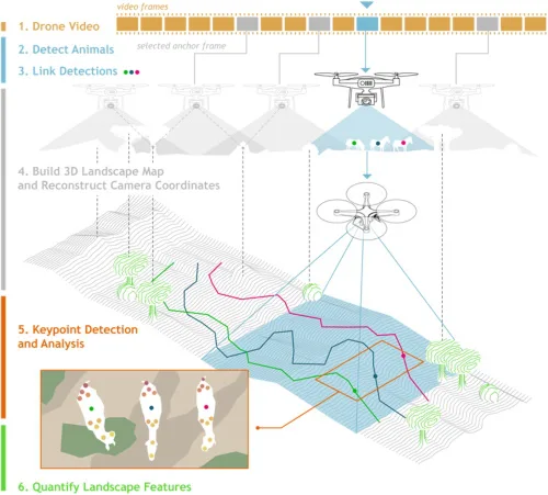
To explore animal groups such as zebras or gelada monkeys, Ben Koger, Blair Costelloe, Iain Couzin, and other researchers from the Max Planck Institute of Animal Behavior, the CASCB at the University of Konstanz, and Aarhus University developed a new method for collecting data about animal behaviour and the animals’ surrounding natural physical landscape using ...
Researchers To Explore Issues And Challenges To Suburban Densification

Researchers To Explore Issues And Challenges To Suburban Densification

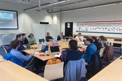
Researchers from the University of Liverpool are part of a new European project to explore the challenges, drivers and barriers of making suburban areas more populated. The SUBDENSE project, which involves TU Dortmund University, the Institut national de l’information géographique et forestière (IGN) and the IOER Leibniz Institute of Ecological Urban and Regional Development, was ...
news.liverpool.ac.uk
Geoportal Nova Ferramenta Orienta Interessados Em Obter Licenciamento Ambiental No Amazonas

Geoportal: Nova Ferramenta Orienta Interessados Em Obter Licenciamento Ambiental No Amazonas

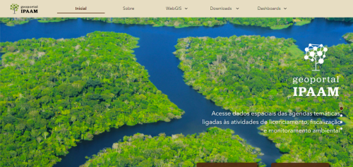
O Instituto de Proteção Ambiental do Amazonas (Ipaam) lançou uma ferramenta de consulta que fortalecerá o licenciamento ambiental no Estado do Amazonas, o Geoportal. A ferramenta é um repositório de dados espaciais e não espaciais de agendas temáticas ligadas às atividades de licenciamento, fiscalização e monitoramento ambiental, que visa oferecer à sociedade maior facilidade no ...
portalamazonia.com

Government Of Canada Launches Interactive Mapping Tool

The Honourable Joyce Murray, Minister of Fisheries, Oceans and the Canadian Coast Guard launched the new Canada Marine Planning Atlas (the Atlas). The Atlas is an interactive mapping tool that allows users to view and interact with data relevant to marine spatial planning. It includes data on economic, ecological and sociocultural activities that sometimes overlap ...
geospatialworld.net
Indonesia Opens Its ‘Ocean Account’ For Sustainable Marine Management

Indonesia Opens Its ‘Ocean Account’ For Sustainable Marine Management

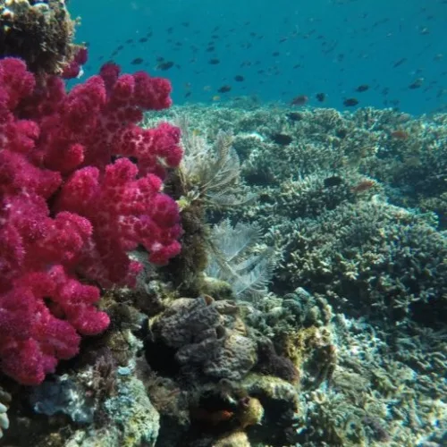
The Indonesian government is designing a new scheme to measure the long-term benefits provided by the country’s marine and coastal ecosystems. The ocean accounting system will serve as the standard indicator for the government in policymaking and zoning regarding Indonesia’s fisheries, conservation areas, and marine essential ecosystems. “We’ve been working on the ocean account with ...
news.mongabay.com
Sharks, Spatial Data, And A Conservation Success Story

Sharks, Spatial Data, And A Conservation Success Story

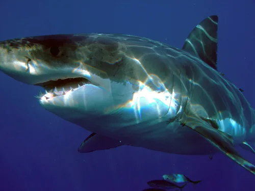
It’s hard out there for a shark. A critical barometer to the health of ocean ecosystems, shark and ray populations have faced significant global declines from overfishing, habitat loss, and environment degradation. Add to the mix a slow reproductive cycle and the broader logistical challenges of trying to monitor animals with ranges that can exceed ...
phys.org
New Story Map Uncovers The Natural Beauty Of Cleethorpes Saltmars

New Story Map Uncovers The Natural Beauty Of Cleethorpes Saltmarsh

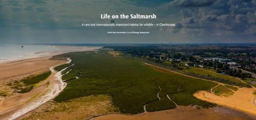
Like the Amazon, Cleethorpes Saltmarsh is a spectacular landscape that supports a rich variety of plants, birds and other creatures. It also captures and stores polluting carbon dioxide – more so than an area of rainforest the same size. North East Lincolnshire Council has created a new immersive story map to tell the remarkable story ...
nelincs.gov.uk

Crean Un Mapa Para Que Los Ganaderos Registren Los Ataques De Lobos Al Ganado Sin Censuras Ni Filtros Ecologistas

Los ataques al ganado por parte de depredadores como en lobo son un problema que va en aumento en toda Europa. Hartos de sufrir el hostigamiento de estos animales y la censura de los medios que se niegan a hacerse eco de la problemática, un grupo de ganaderos franceses de la zona de los Vosgos, ...
revistajaraysedal.es
Scientists Use AI To Learn Extent Of Seagrass Scarring

Scientists Use AI To Learn Extent Of Seagrass Scarring

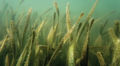
Scientists from the University of Florida, Auburn University and the Tampa Bay Estuary Program are using artificial intelligence technology to identify damaged seagrass beds in Tampa Bay — and so far, they’ve found almost 24,000 scars. “Seagrass is a critical habitat in Tampa Bay and is considered an indicator of a healthy estuary. It stabilizes ...
naples.floridaweekly.com
서울대-국민대 연구진, 외래생물 위치정보 추적 시스템 개발

서울대-국민대 연구진, 외래생물 위치정보 추적 시스템 개발

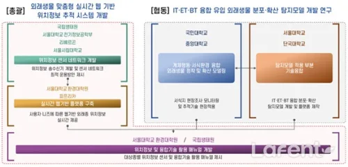
이에 따라 외래생물의 위치를 추적할 수 있는 위치정보 시스템, 실시간 지도화가 가능한 공간정보 플랫폼, 수집된 정보의 과학적 분석을 통한 대상 종의 생태성 이해와 우선 대응지역 도출, 이 모든 과정을 보다 쉽게 활용할 수 있는 매뉴얼이 요구된다. 특히 기존 위치추적 장치들은 주로 해외 제조사 제품들로, 자료의 보안성과 신뢰성, 송수신 음영지역, 안정성과 내구성, 기술지원 및 비용 등의 ...
lafent.com
Habitat Mapping Data Can Fill Gaps In Knowledge On Biodiversit

Habitat Mapping Data Can Fill Gaps In Knowledge On Biodiversity

Data gathered by habitat mapping programs can make important contributions to biodiversity research. They provide insight into changes of the local flora since the 1980s—a period that is not well covered by other sources of information. A team from the Martin Luther University Halle-Wittenberg and the Hamburg Authorities for the Environment, Climate, Energy and Agriculture ...
phys.org

Land Analysis In Turkey And Bulgaria To Contribute To Ecological Efforts

A research project conducted at Koç University aims to shed light on future social and environmental threats. The study of 30,000 km2 of land in Turkey and Bulgaria will analyze radical changes in land use and land cover. Correlating the data with population dynamics, the research will contribute to predictions of possible agricultural population loss ...
sciencex.com

Using Sentinel-2 Data For Seawater Quality Monitoring

In an article published in the journal Remote Sensing, the researchers used Sentinel-2/Multispectral Instrument (MSI) imagery data to a calibrated ocean chlorophyll 2-band (OC-2) model to retrieve chlorophyll-a (chl-a) concentration in the Ha Long bay from 2019 to 2021. Using Sentinel-2 MSI photos on the Google Earth Engine (GEE) platform, this study examines the anthropogenic ...
azooptics.com
Climate Change Is Making Lakes Less Blue

Climate Change Is Making Lakes Less Blue

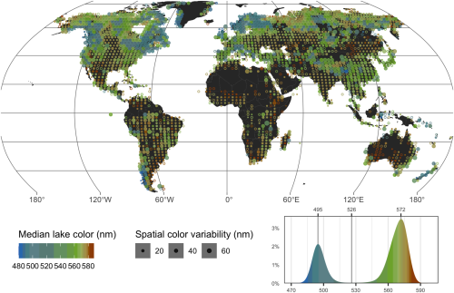
If global warming persists, blue lakes worldwide are at risk of turning green-brown, according to a new study which presents the first global inventory of lake color. Shifts in lake water color can indicate a loss of ecosystem health. While substances such as algae and sediments can affect the color of lakes, the new study ...
eurekalert.org
Researchers Map Streamflow Alterations To Gauge Human Impact On Ecosystems

Researchers Map Streamflow Alterations To Gauge Human Impact On Ecosystems

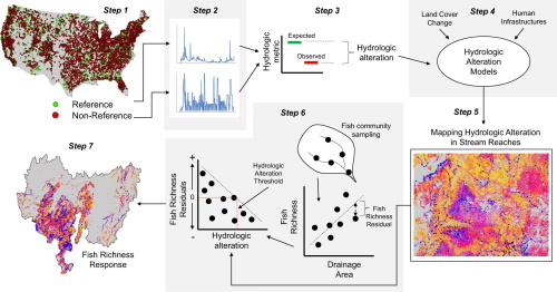
Altering streamflow can endanger the ecosystems that rely on it, but researchers have lacked data on how human infrastructure has impacted streamflow in the U.S. Now, a study involving a Colorado State University researcher has mapped streamflow alterations across the continental U.S., providing a wealth of data for determining societal impacts on ecosystems. Up to ...
phys.org