Geomaticians

Drone

Presentan Servicio De “Teledetección Con Drones” Para Digitalizar Y Registrar Información Geoespacial Forestal

Presentan Servicio De “Teledetección Con Drones” Para Digitalizar Y Registrar Información Geoespacial Forestal

En la Expoamazónica 2023, el Instituto Tecnológico de la Producción (ITP), a través del CITEforestal Maynas, presentó el servicio de “teledetección con drones”, el cual beneficiará al sector forestal de la región de Loreto. Durante la exhibición que albergó a un gran número de participantes, los especialistas del CITE mostraron como dicha tecnología de vanguardia, ...
agroperu.pe
Balko Tech Unveils Advanced Modular Drone Lidar Solution

Balko Tech Unveils Advanced Modular Drone Lidar Solution

Balko Tech, a Canadian innovator in the geospatial industry, has announced the launch of Connectiv, the next evolution of its modular drone Lidar system. This release also includes the introduction of the e-Connect application. Following the success of the e-ONE system in 2021, Connectiv represents a significant leap forward in technology, designed to offer geospatial ...
gim-international.com

Leica Geosystems Upgrades Lidar UAV

Leica Geosystems, part of Hexagon, has added new capabilities to the Leica BLK2FLY. It now has the ability to scan indoors, providing expanded coverage for complex scanning projects, and the ability to create digital twins for entire structures, both indoors and outdoors. Hexagon upgraded the autonomous UAV scanning system to allow for safe, effective indoor ...
gpsworld.com
Satellites Detect Where Locust Infestations Begin

Satellites Detect Where Locust Infestations Begin

Locusts can destroy grain crops and pastures, threatening people’s livelihoods. In an international project, researchers from the German Aerospace Center (Deutsches Zentrum für Luft- und Raumfahrt; DLR) have now developed methods to help detect locust outbreaks as early as possible and take action against them. Earth observation images acquired by satellites play a central role ...
dlr.de
Australia Deploys S-100 Lidar Drones For Amphibious Support

Australia Deploys S-100 Lidar Drones For Amphibious Support

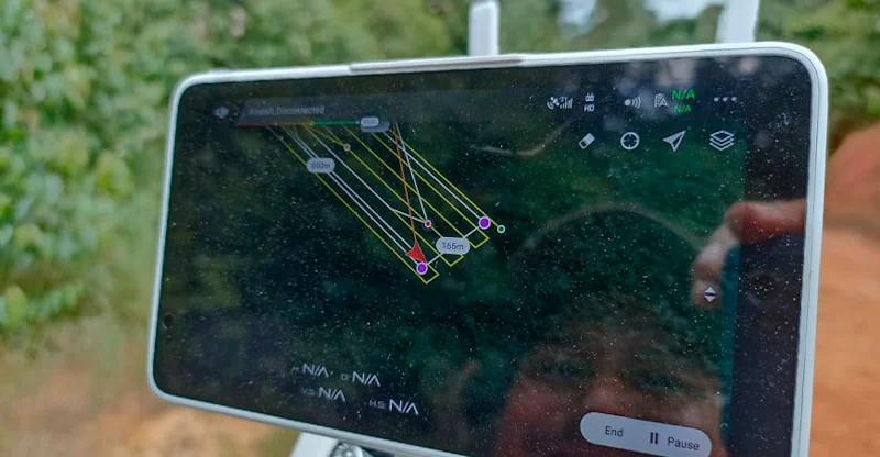
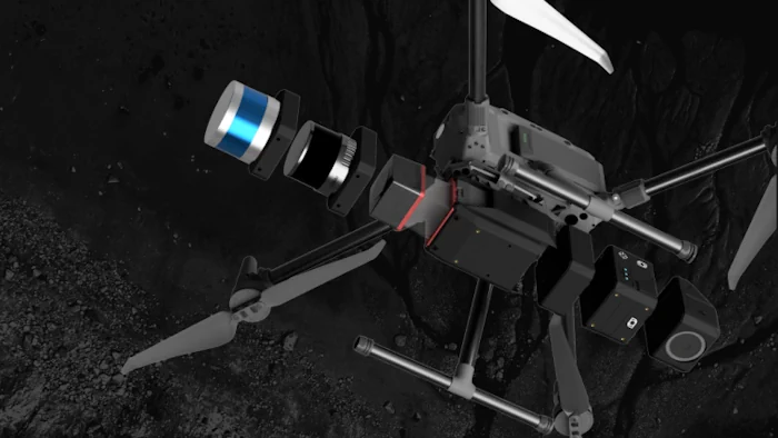
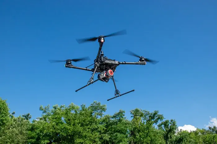
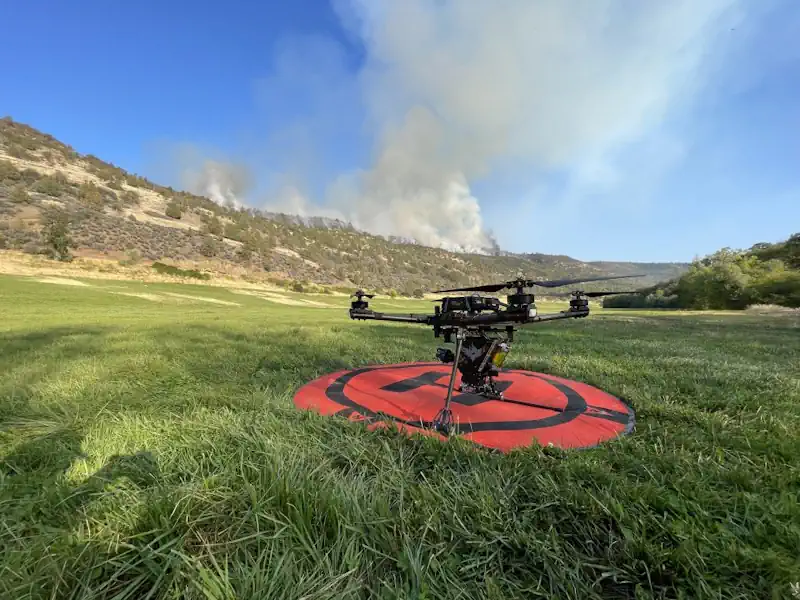
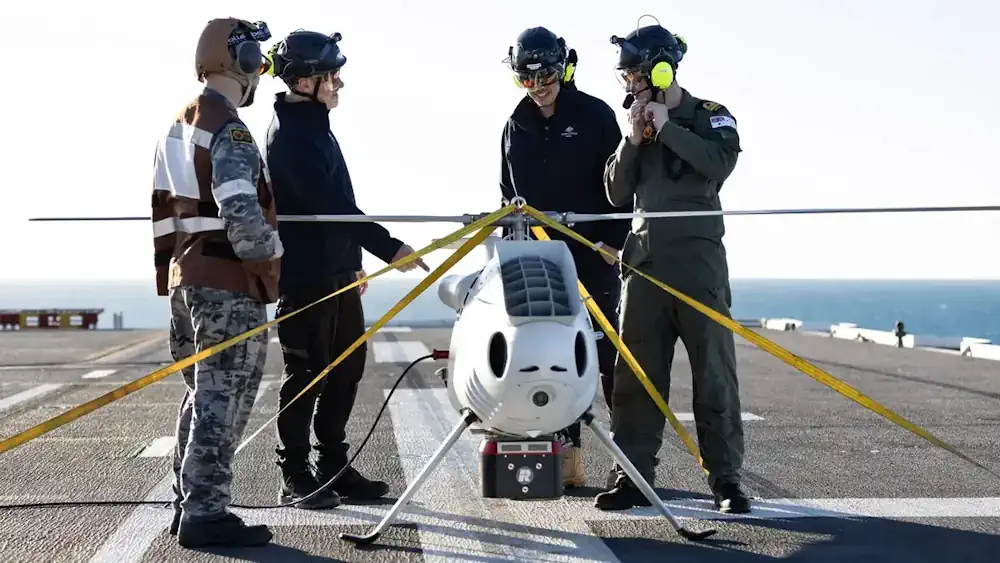
The Australian Navy has tested a new Light Detection and Ranging (LiDAR) equipped drone designed to support amphibious operations. Using the sensors, the drone, an S100 unmanned aerial vehicle, performed bathymetric and littoral light detection during this year’s ‘Exercise Sea Raider’. Deployed from the HMAS Adelaide, the drone projected green wavelength laser beams through the ...
interestingengineering.com
GeoCue’s New Imaging Systems Powerful Tools For Drone-based Aerial Mapping And Surveying

GeoCue’s New Imaging Systems: Powerful Tools For Drone-based Aerial Mapping And Surveying

With the release of GeoCue’s three new, high-end TrueView 3D Imaging Systems, surveying and mapping professionals can take their drone-based operations to new levels. The Alabama-based company’s TV625, TV680, and TV680LR offer customers access to a full range of advanced-level systems for collecting LiDAR and photogrammetry. Each system combines a lightweight and compact laser scanner ...
commercialuavnews.com
Wildfire Watch Forest Fuel Mapping And Drones Represent The Next Wave Of Firefighting

Wildfire Watch: Forest Fuel Mapping And Drones Represent The Next Wave Of Firefighting

Technology is furthering innovation in wildland firefighting across the west, including the Tahoe Basin — and not just in the process of extinguishing flames but in prevention of these catastrophic burns. Last fall, researchers at the University of Nevada, Reno, kicked off a series of projects that seek to map out the vegetation in the ...
tahoedailytribune.com
Drone Lidar In Poland TPI Joins Global Distribution Network Of GeoCue

Drone Lidar In Poland: TPI Joins Global Distribution Network Of GeoCue

GeoCue is delighted to announce the inclusion of TPI, the largest supplier of geospatial equipment in Poland, into its global distribution network. This strategic partnership will create new opportunities for GeoCue and TPI to expand their reach and provide cutting-edge geospatial solutions to customers in Poland and beyond. As part of this collaboration, TPI now ...
uasweekly.com

Berlin Gears Up For Geospatial Excellence

As the host city of Intergeo 2023 this October, Berlin promises to deliver the perfect kick-start for the geospatial industry in these rapidly changing times. The vibrant German capital is renowned for its innovating and entrepreneurial spirit, and the event itself is being held in Berlin’s biggest and most modern venue, Hub27. Earth observation, unmanned ...
gim-international.com

Ex-ISRO Official Promoted Sisir Radar Test Flew Drone Fitted With ‘Rabbit SAR’

Space sector startup, Sisir Radar Private Ltd has successfully tested its Synthetic Aperture Radar (SAR) fitted on a drone, said a senior company official. “The drone fitted with SAR was flown (on Friday) at a place called Sonarpur, about 50 km from Kolkata,” Tapan Misra, Founding Director and Chief Scientist, Sisir Radar Private Ltd, told. ...
dtnext.in
L'agricoltura Del Futuro L'uso Di Droni Per Un'irrigazione Più Sostenibile Negli Uliveti

L’agricoltura Del Futuro: L’uso Di Droni Per Un’irrigazione Più Sostenibile Negli Uliveti

Un recente studio pubblicato sulla rivista Agronomy ha dimostrato come l’uso di immagini visibili e termiche acquisite da un drone possa essere un metodo efficace per monitorare lo stato idrico delle piante, la crescita della chioma e la resa degli ulivi. Questa scoperta potrebbe avere implicazioni significative per la gestione sostenibile dell’acqua in agricoltura. Gli ...
quadricottero.com

Esri India And ideaForge Join Hands

Esri India, the country’s leading Geographic Information System (GIS) Software & Solutions provider announced the signing of a Memorandum of Understanding (MOU) with ideaForge, a market leader in the Indian Unmanned Aircraft Systems. The objective of this partnership is to boost the adoption of drones in India. The partnership between Esri India and ideaForge will ...
timestech.in

O Dronach W Geodezji Na Bezpłatnym Webinarze

Akademia UAV i SkySnap zapraszają na bezpłatny webinar dotyczący procesu wdrażania dronów w geodezji. Spotkanie odbędzie się 6 czerwca o godz. 17.00. Program wydarzenia obejmuje następujące zagadnienia: (1) Jak wdrażać drony w firmie geodezyjnej – tworzenie własnych zasobów czy zlecenia podwykonawcom? (2) Prawo dronowe – o czym warto wiedzieć i na co zwrócić uwagę przy ...
geoforum.pl

2ème Édition De “Tunisia Drone Day” Se Tiendra Le 10 Juin 2023 À La Cité Des Sciences

L’Association Africaine pour la Promotion du Géospatial (AGEOS) organise en collaboration avec le cercle Aéronautique, comprenant la Fédération Tunisienne des Pilotes de Ligne (FTPL), l’Association Tunisienne de l’Aéronautique (ATA) et l’Association Tunisienne des Contrôleurs de la Circulation Aérienne (ATCCA), la deuxième édition de la conférence internationale “Tunisia Drone Day “. Cette conférence se tiendra le ...
tekiano.com
Le Mappe Dei Satelliti Per Pianificare Soccorsi E Ricostruzione Post-alluvione

Le Mappe Dei Satelliti Per Pianificare Soccorsi E Ricostruzione Post-alluvione

Studiomapp, azienda con base a Ravenna specializzata in geo-intelligence e già premiata dal Dipartimento di Difesa degli Stati Uniti per aver vinto una sfida internazionale per velocizzare le operazioni di soccorso dopo disastri naturali analizzando immagini satellitari con l’intelligenza artificiale, ha reso disponibile mercoledì l’ultima mappa aggiornata delle aree colpite dall’alluvione in Romagna. per far ...
ravennatoday.it

Dubai Signs Deal To Enhance Drone Flight Routes

The Dubai Civil Aviation Authority (DCAA) and Dubai Municipality announced the signing of a Memorandum of Understanding (MoU) to collaborate on the Dubai Horizons project. The new initiative focuses on the planning of drone flight routes and landing sites. Over a three-year period, both parties will combine their expertise in generating geospatial data for the ...
itp.net
Mapeamento Identifica Conservação De Manguezais Da Grande Reserva Mata Atlântica

Mapeamento Identifica Conservação De Manguezais Da Grande Reserva Mata Atlântica

Pela primeira vez, pesquisadores de diferentes áreas de conhecimento se reúnem para entender como está a saúde dos manguezais na linha de costa, na área conhecida como Grande Reserva Mata Atlântica. A pesquisa envolve trabalho de campo, nos bosques de mangue, e um mapeamento aéreo feito por drones equipados com câmeras altamente tecnológicas e imagens ...
Cansel Partners With GeoCue To Offer Drone Lidar And Processing Software

Cansel Partners With GeoCue To Offer Drone Lidar And Processing Software

Cansel, a technology solutions provider for industries including engineering, surveying, construction, and utilities, announced a partnership with GeoCue, a global provider of 3D LiDAR imaging sensors and geospatial software. Now as a distributor of GeoCue, Cansel will offer the full product line of TrueView LiDAR 3D imaging sensors and LP360 processing software throughout Canada. TrueView ...
geospatialworld.net
Drone De Asa Fixa Com Sensor Multiespectral Por Valor Promocional Na Feira Droneshow 2023

Drone De Asa Fixa Com Sensor Multiespectral Por Valor Promocional Na Feira Droneshow 2023

A empresa G drones estará presente na feira MundoGEO Connect, DroneShow e SpaceBR Show, que acontece de 9 a 11 de maio no Centro de Convenções Frei Caneca, em São Paulo (SP). A G drones está com uma promoção do Disco Mapir para a DroneShow. O asa fixa está com valor de R$ 16.800,00. O ...
mundogeo.com
El Proyecto Europeo Perivallon, Liderado Por ETRA, Crea Soluciones Frente A Delitos Ambientales

El Proyecto Europeo Perivallon, Liderado Por ETRA, Crea Soluciones Frente A Delitos Ambientales

El proyecto Perivallon (Protecting the EuRopean terrItory from organised enVironmentAl crime through inteLLigent threat detectiON tools), coordinado por Grupo ETRA y cofinanciado por el programa Horizonte Europa, trabaja en el desarrollo de herramientas de inteligencia avanzada para proteger el territorio europeo de los delitos ambientales. En este sentido, trabaja en el desarrollo de herramientas y ...
esmartcity.es
Esri Releases Reality Mapping Extension For ArcGIS Pro

Esri Releases Reality Mapping Extension For ArcGIS Pro

A large, new release of Esri’s desktop GIS software ArcGIS Pro has been released. Version 3.1 includes many new features and tools. Perhaps the biggest new feature is a reality mapping toolbox named ArcGIS Reality for ArcGIS Pro. The extension complements ArcGIS Pro’s ortho mapping capability with high-fidelity 2D and 3D product generation. This new ...
geoweeknews.com
Survei Garis Pantai Untuk BIG

Survei Garis Pantai Untuk BIG

Pemanfaatan teknologi drone telah menyelesaikan proyek survei garis pantai sepanjang 1.080 kilometer. Hal ini dilakukan untuk kebutuhan data dari badan informasi geospasial (big) yang bertugas melaksanakan tugas pemerintahan di bidang informasi geospasial. “Hal ini menjadi tantangan bagi perusahaan-perusahaan teknologi drone untuk terus mengembangkan teknologi drone dan memberikan solusi terbaik bagi berbagai sektor industri, termasuk pemerintah,” ...
merahputih.com
AI Project Aims To Use Tech To Predict Landslides, Illegal Mining, Erosion And Emissions In Irish Bogs

AI Project Aims To Use Tech To Predict Landslides, Illegal Mining, Erosion And Emissions In Irish Bogs

Irish boffins are exploring how artificial intelligence can be used to predict threats to Irish peat bogs and their impact on the climate. Ireland’s national centre for applied AI, CeADAR, has teamed up with the National Parks and Wildlife Service and Science Foundation Ireland Research Centre in Applied Geosciences iCRAG for a €200k project, AI2Peat. ...
irishmirror.ie
Kea Aerospace Debuts Solar-powered Stratospheric UAS With Audi EV Technology

Kea Aerospace Debuts Solar-powered Stratospheric UAS With Audi EV Technology

The New Zealand-based company Kea Aerospace has developed an innovative solar-powered stratospheric aircraft, called the Kea Atmos Mk 1, which is designed for high-altitude flight testing. The aircraft has a wingspan of 12.5 meters and weighs under 40 kilograms, making it lightweight enough to fly at altitudes higher than commercial airliners, up to 50,000 feet. ...
uasweekly.com

Mapeamento Com Drones Vai Ajudar Na Prevenção A Desastres Meteorológicos

O Governo do Estado do Espírito Santo, por meio do Instituto Jones dos Santos Neves (IJSN) e da Defesa Civil Estadual, está desenvolvendo um projeto que vai contribuir para a prevenção e o enfrentamento de desastres meteorológicos. É o aerolevantamento de território com uso de drones. A iniciativa prevê o mapeamento tridimensional do território, permitindo ...
es.gov.br

Drones To Tally Canines

The Bruhat Bengaluru Mahanagara Palike (BBMP) is contemplating using drones to aid the upcoming dog census in the city. According to the officials, the technology is being actively considered as it will help cover a larger area in a short period and will give a better understanding of the stray population. “Property surveys in the ...
bangaloremirror.indiatimes.com
Mapping Pedestrian Street Behavior Using Unmanned Aerial Vehicles

Mapping Pedestrian Street Behavior Using Unmanned Aerial Vehicles

A new study published in PLOS ONE tests the performance of UAV-based observation techniques in measuring pedestrian activity in two comparative settings in Santiago de Chile. Scientists developed an alternative approach of systematic behavioral observation of daily activities in the street based on the use of a UAV. They adapted the data acquisition techniques of ...
techexplorist.com
광주시, 지적·공간정보 고정밀 구축에 드론 활용한다

광주시, 지적·공간정보 고정밀 구축에 드론 활용한다

광주시는 지난 2022년 6월 지적 확정 측량검사 및 3차원 공간정보 변화지역 갱신을 위해 정밀 측량용 드론을 도입, 지금까지 30개소 15㎢를 촬영했다. 촬영자료는 정사영상 제작 및 3차원 모델링 데이터로 구축, 경계 확인 및 3차원 공간정보 갱신자료로 활용되고 있다. 특히, 드론을 활용함으로써 약 1억원의 예산 절감 효과도 거뒀다. 광주시는 그동안의 운영 경험을 토대로 올해부터 부서 협업을 통해 ...
boannews.com
Observing Group-living Animals With Drones And Computer Vision

Observing Group-living Animals With Drones And Computer Vision

To explore animal groups such as zebras or gelada monkeys, Ben Koger, Blair Costelloe, Iain Couzin, and other researchers from the Max Planck Institute of Animal Behavior, the CASCB at the University of Konstanz, and Aarhus University developed a new method for collecting data about animal behaviour and the animals’ surrounding natural physical landscape using ...

Drones E Modelagem 3D Auxiliarão A Recuperação De Florestas

A popularização dos drones comerciais, das inteligências artificiais e dos softwares de modelagem 3D permitiram o desenvolvimento de um novo método para controlar áreas de reflorestamento. Durante seu doutorado no Instituto de Energia e Ambiente (IEE) da USP, o engenheiro florestal e pesquisador Rafael Walter de Albuquerque criou um procedimento mais rápido e capaz de ...