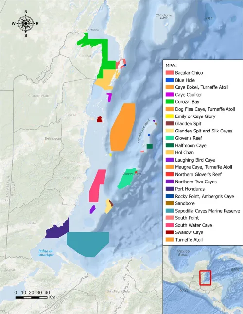
Scientists Use NASA Satellite Data To Determine Belize Coral Reef Risk
Using two decades of NASA satellite measurements stored in the cloud, scientists recently assessed the vulnerability of Belize’s renowned coral reefs to bleaching and collapse. The findings could help management authorities protect the reefs from human impacts such as development, overfishing, pollution, and climate change. In a study published in Frontiers in Remote Sensing, the ...
climate.nasa.gov