A large number of historical spy-satellite photographs from the Cold War Era were declassified decades ago. This valuable remote sensing data has been utilized by scientists across a wide range of disciplines from archaeology to civil engineering. However, its use in ecology and conservation remains limited.
A new study led by Dr. Catalina Munteanu from the Faculty of Environment and Natural Resources at the University of Freiburg, Germany, aims to advance the application of declassified satellite data in the fields of ecology and conservation.
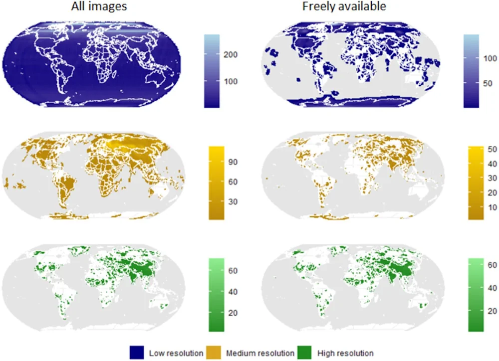
In their study, the researchers initially evaluated the spatial, temporal, and seasonal coverage of more than 1 million declassified images from four historical U.S. spy-satellite programs, showing that this data spans nearly the entire globe and is available across all seasons. Upon reviewing how spy-satellite imagery is currently employed in ecology-related fields, the team then identified potential future applications. Crucially, the broad spatial-temporal scale of the satellite images could enhance the understanding of ecological concepts such as shifting baselines, lag effects, and legacy effects.
This improved understanding could lead to better mapping of the historical extent and structure of ecosystems, aid in the reconstruction of past habitats and species distributions as well as offer new insights into historical human impacts on present ecosystem conditions. Going forward, this knowledge can also be helpful for conservation planning and ecosystem restoration efforts by helping identify, for example, meaningful ecological baselines, the researchers explain.
However, the use of spy-satellite data in ecological research faces several challenges. The study highlights issues such as limited access to and sharing of data, high costs, the necessity of pre-processing and rectifying images, and the absence of consistent workflows within the scientific community. To address these challenges, the researchers call for collaborative efforts between data holders, remote sensing experts, and the ecological research community.