Researchers at the University of Southampton have conducted the most detailed spatial analysis to date of storm surges along the coast of the UK and Ireland. The oceanographers found that coastlines in the north of the Irish Sea experience the longest and largest surges, while those occurring around the southwest coast of England have the smallest geographical footprint and last the shortest amount of time. Across all coastlines investigated, and over a period stretching four decades, the winter seasons of 1989/90 and 2013/14 stood out as having the highest number and most severe storm surge events. The study findings are published in the June edition of the journal Weather and Climate Extremes and online.
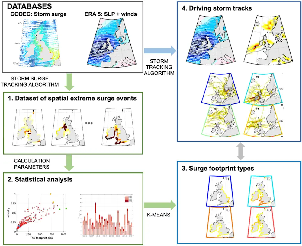
A storm surge is an abnormal rise in seawater level during a storm, measured as above that of the normal tide height for the area. The surge is caused by wind pushing water onshore and is influenced by a storm’s size, speed, and where it tracks in relation to the coast. The storm surge footprint is the extent of simultaneous flooding along a stretch of coastline and influences the damage associated with coastal flooding.
The research, which also involved scientists in Spain, the USA, and The Netherlands, examines data on storm surges recorded between 1980 and 2017. The team identified 270 extreme storm surge events over the study period, based on their duration, footprint size, severity, and how frequently a similar event may reoccur. From this, they classified eight distinct surge footprint types and linked them to the characteristics of the storms that caused them.