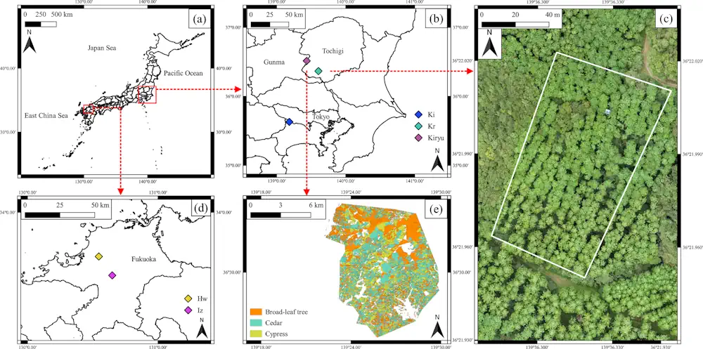
Forests, known as nature’s “green dams,” play a crucial role in replenishing Earth’s groundwater reserves. However, overcrowding in planted forests due to lack of maintenance activities, such as thinning practices, is a pressing concern in Japan. This overcrowding causes substantial water loss from these forests into the atmosphere through a combination of soil evaporation and tree transpiration (Et) known as evapotranspiration. In the rich forests of Japan, Et is a major factor in the depletion of water resources. Therefore, accurately measuring Et across wide areas is a critical need because it allows better management of the available groundwater resources, especially during droughts. To address this challenge, a dedicated research team from the University of Tsukuba has developed a model that can predict Et more accurately than previous methods. This cutting-edge project focused on cypress plantations, combining satellite remote sensing technology with detailed forest inventory (FI) data. The work is published in the ISPRS Journal of Photogrammetry and Remote Sensing.
Predicting Et is extremely difficult because it is heavily affected by the changes in weather conditions and the physiological reactions of trees. However, the team’s innovative model seamlessly integrates these variables, using satellite-based surface temperature data, multispectral imaging, and comprehensive FI data. A major component of the model involves calculating the sapwood area, which is the part of the tree that transports water, based on FI information. This integrated model has yielded impressive results, showing a high correlation (r = 0.76–0.89) between its prediction and actual Et measurements.
This pioneering model is not limited to cypress trees and could be adapted to predict Et in other forest species. It can also be used in combination with other remote-sensing tools such as drones. This model is an important step toward enhancing the precision and efficiency of forest management practices. It is a vital tool for promoting sustainable forestry and understanding the vital role of forests in recharging Earth’s water resources.