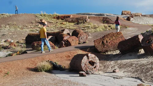
Satellite imagery could help paleontologists spot promising fossil sites before trekking into remote places. New research from the lab of UO paleontologist Edward Davis in the Department of Earth Sciences shows that satellite data can reveal large individual fossils from the air, allowing field researchers to embark on more targeted searches on the ground. Their findings were published Nov. 28 in the journal Geological Magazine. The team analyzed multispectrum satellite imagery, which includes not just visible light, but also other wavelengths like ultraviolet and infrared. By looking at how all these different types of light are absorbed or reflected by the landscape, researchers can pick out specific features, like fossils, from the background. This kind of satellite data is often used to do aerial surveys of cities and track patterns of land use. But it hasn’t been used before to search for single fossils.