Recent research highlights a significant rise in Southwest China’s aboveground carbon levels between 2013 and 2021, showcasing the area’s capacity to counterbalance the negative impacts of severe droughts. This development emphasizes the vital role of Southwest China as a carbon sink, attributed to substantial ecological efforts and the deployment of cutting-edge remote sensing methodologies.
For over four decades, Southwest China has acted as a major carbon sink, playing a crucial role in offsetting human-made CO2 emissions. Yet, the region faced reduced carbon absorption capabilities due to severe drought conditions, notably between 2009-2013 and in 2022, highlighting its vulnerability to climate-induced stressors. This situation underscores the urgent need for measures to protect against environmental variability.
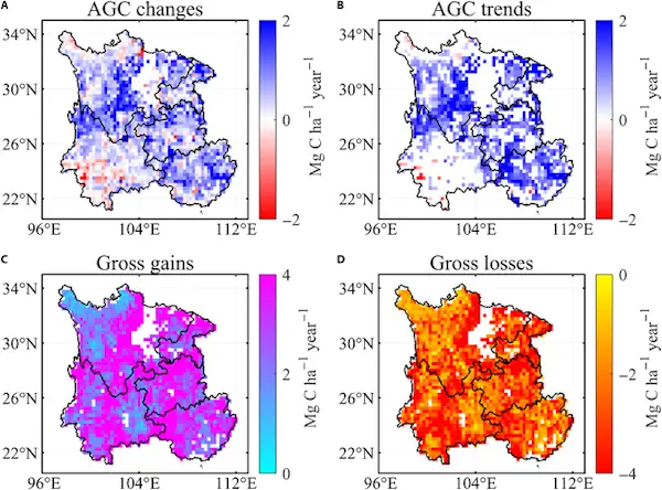
The study, published in the Journal of Remote Sensing on March 4, 2024, leverages satellite and ground-based data to explore drought’s profound impact on the region’s carbon dynamics. This research is a key advancement in understanding the interplay between climate events and the carbon cycle, crucial for maintaining global climate balance.
Employing a novel blend of satellite imagery and ground data, the investigation meticulously evaluated drought effects on carbon dynamics within Southwest China. This integrated data approach shed light on the significant carbon losses due to drought, illustrating the region’s carbon stock vulnerability to climatic changes. The study sets a new standard for employing technology to track and comprehend ecological shifts.