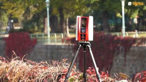
Premiered at Intergeo Trade Fair and Exhibition in Germany in October, the Riegl VZ-600i is the company’s latest addition to its terrestrial laser scanning portfolio. The “i” in the product name stands for “integrated” and refers to an integrated second high performance processor that allows for automatic onboard registration of scan data in the field. The instrument offers high productivity and versatility: with 3D position accuracy of 3 mm and less than 30 sec scan time for high-resolution scans with 6 mm point spacing at 10 m, this enables more than 60 scan positions/hour with real-time registration. The system weights less than 6 kg (13 lbs), has a 2.2 MHZ Pulse Repetition Rate (PRR), three internal cameras & GNSS integrated, and is prepared for mobile mapping applications.