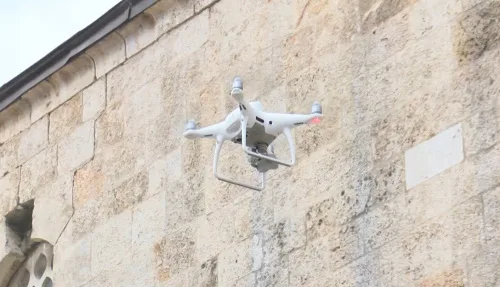
Teams from Istanbul University started their investigations of historical buildings that were severely damaged. Working in separate groups in the field, the teams make measurements using the photogrammetry technique with the help of drones and performing lidar mapping. “… The first step is the three-dimensional (3D) visualization of the surrounding buildings and the most important structure locally with a laser scanner. Carrying out damage assessment studies with the structure to be created based on these. The main point here is to carry the heritage to the future, within the scope of a project called the digital twin, so that we will have a digital record in our hands.” There are eight historical structures with high priority that we have identified in Hatay. We make deformation measurements of them with 3D models, assessing to what extent it needs an intervention. After that, the projects will be initiated. The Ulu Mosque tumbled to the ground. We will assess all the damage before the debris is removed so that it does not suffer further damage.”