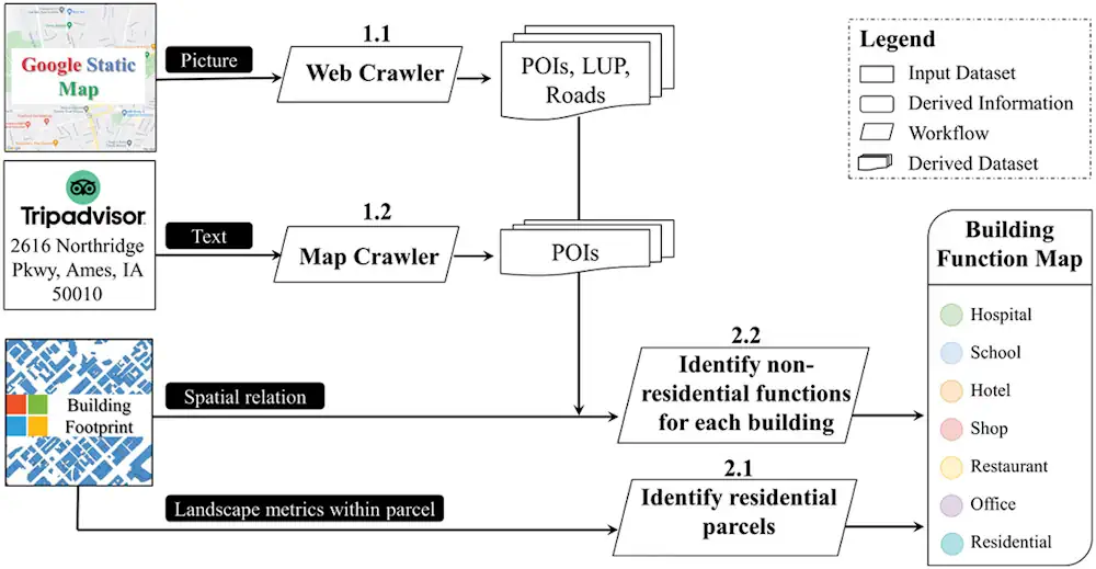
In a pioneering study published in Geo-spatial Information Science, a research group led by Yuyu Zhou from The University of Hong Kong developed an integrated framework that achieves 94% accuracy in mapping building functions across 50 U.S. cities using multi-source web-based geospatial data, offering potential for worldwide application.
The team utilized TripAdvisor.com and Google Maps as primary data sources due to their extensive coverage and dynamic updating features. The research findings are promising. The proposed framework demonstrated an impressive average overall accuracy of 94% with a kappa coefficient of 0.63. While the study centered on U.S. cities, its potential for global application, especially in regions with data accessibility challenges, is immense. Furthermore, as the digital footprint of cities grows, the researchers see opportunities to refine this approach. They recommend future endeavors to enhance mapping accuracy, especially in multi-functional buildings and in regions less covered by TripAdvisor.com and Google Maps.