For a study published in the Journal of Remote Sensing, a team of scientists led by Xihan Mu from Beijing Normal University has made a leap forward in environmental monitoring and ecological research. They have created seamless maps of Fractional Vegetation Cover (FVC) over China at 30-meter resolution and semimonthly intervals, covering the years 2010-2020.
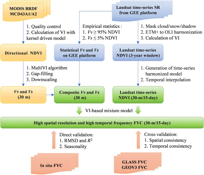
The researchers adopted an adaptive time-series model for creating clear, seamless, and radiometrically consistent Normalized Difference Vegetation Index (NDVI) image composites using all available Landsat images in Google Earth Engine. Using an improved VI-based mixture model, they have developed a method that transforms Landsat NDVI datasets into a detailed Fractional Vegetation Cover (FVC) map.
This innovation’s heart is the MultiVI algorithm, which precisely calculates pixel-wise coefficients to transform NDVI into FVC. This method marks a major advancement over traditional VI-based mixture models, which typically depend on less accurate, statistically derived endmember VI values. MultiVI, on the other hand, employs multiangle data to generate pixel-wise endmember VI values, resulting in a more refined and accurate FVC calculation. The researchers validated this approach by comparing the generated FVC with ground measurements and existing global FVC products, demonstrating its good spatial and temporal consistency.