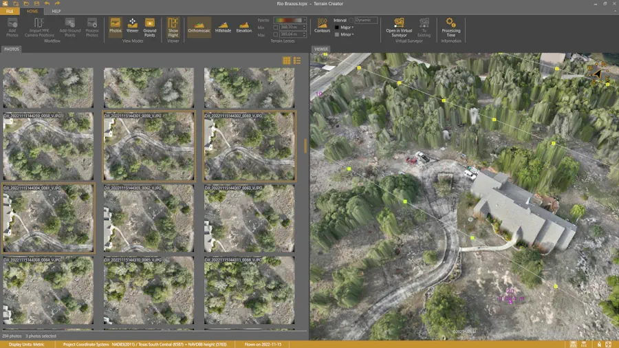
Virtual Surveyor has added drone photogrammetry capabilities to the latest release of its popular Virtual Surveyor smart drone surveying software. The new Terrain Creator app photogrammetrically processes drone photos to generate survey-grade terrains which then transfer seamlessly into the traditional Virtual Surveyor workspace where the real survey work can be performed.
“Virtual Surveyor software is now two desktop apps in one subscription package that create a seamless end-to-end drone survey workflow to save time and money,” said Tom Op ‘t Eyndt, Virtual Surveyor CEO. “Terrain Creator removes complexity from the drone photogrammetry process, offering a visual and intuitive application to produce an orthomosaic and digital surface model (DSM) from drone photos.”