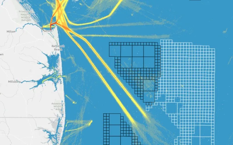
The Automatic Identification System that tracks vessel movements with transponders on ships has helped create an “AIS database of 30 billion-plus vessel locations has become the go-to resource for maritime planners and ocean geospatial tech experts,” according to a recent summary from NOAA. That data is a base for a NOAA website, MarineCadastre.gov . For the ocean, NOAA developed the tool AccessAIS to help users access AIS data and more from MarineCadastre.gov on birds, economics, boundaries, federal regulations and other factors in planning. New AIS data are added regularly, and tool uses are growing each month.