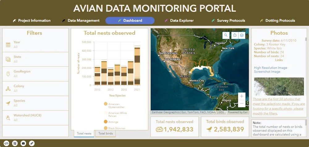
A newly released Avian Data Monitoring Portal brings together more than a decade of aerial survey photos along the northern Gulf of Mexico to provide an easily searchable database for researchers, natural resource managers, and the public. Found at avianmonitoring.com, the portal will help coastal managers, coastal restoration engineers, researchers, and others not only see coastal nesting bird distributions, but also inform future restoration efforts.
The portal is based on aerial survey data collected by Colibri Ecological Consulting, a partner with the Deepwater Horizon Regionwide TIG. Aerial surveys began in 2010, resulting in seven years of survey data capturing the Louisiana coast and colonial waterbird nesting sites across the northern Gulf of Mexico. This effort resulted in more than 49,000 photographs that were “dotted” by Colibri to quantify species and nests across the survey area.
“We started with multiple hard drives full of high-resolution photographs taken over many years. It took a lot of modern computing capacity to database and geo-reference those images as well as hours and hours of manual effort for some steps in the data processing,” said Tim Carruthers, director of coastal ecology at The Water Institute. “Each challenge required new thinking and often new skill sets as we worked towards maximum utility and availability of this data.”
The Water Institute, supported by the Regionwide TIG, compiled these photographs and the associated dotting data into a web-based, geospatially enabled portal. The Avian Data Monitoring Portal links Environmental Systems Research Institute (Esri) Enterprise Geographic Information Systems (GIS) software with a Web Mapping Service (WMS), and the aerial survey photo database to create a dashboard that enables navigation of the data to explore total nests and birds observed over various geographical areas and time scales.