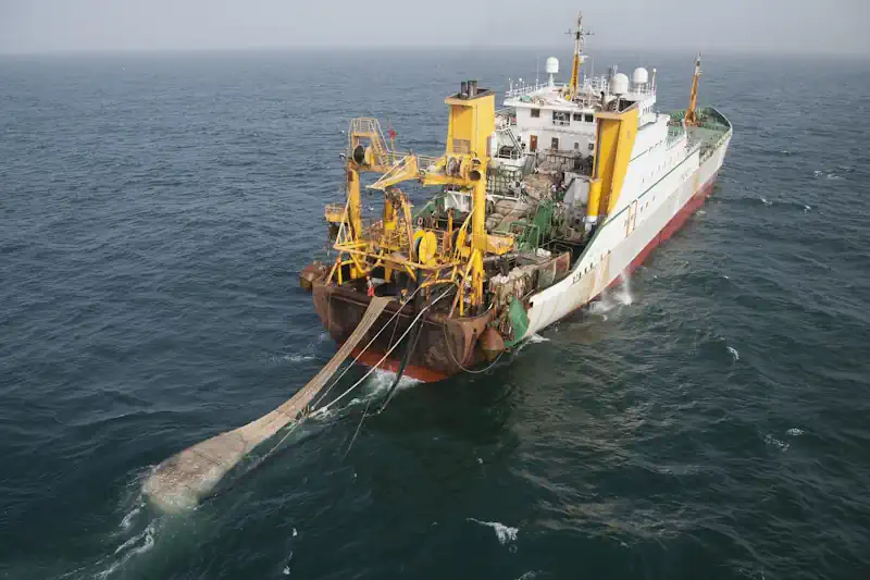
Around one-third of fish stocks worldwide are overfished, while 20 percent of all seafood is obtained through illegal, unreported, and unregulated fishing. Most such fishing, known as IUU, occurs on the high seas, where the governance of marine areas is tricky and their protection is virtually non-existent. IUU fishing vessels pursuing the largest profits often overexploit these waters, which comprise the most biodiverse ocean ecosystems on the planet. These vessels also undermine legal and sustainable fishing, harming developing coastal nations and costing $23 billion each year to the global economy.
That’s why the UN’s so-called High Seas Treaty was such a big deal. The treaty, drafted in March by UN member nations, is a pivotal step toward the protection of marine ecosystems that have until now been beyond the reach of international law. Currently, only 1 percent of international waters on the high seas is under environmental protection. The treaty, which falls in line with the UN Global Biodiversity Framework’s 30×30 target (a plan to protect 30 percent of Earth’s ocean, land, and inland waters by 2030) by establishing environmentally protected areas and monitoring human threats to ecosystems.
To protect marine life under the treaty, the UN must drastically limit IUU fishing on the high seas. The biggest hurdles to achieving this are so-called dark fleets — vessels that are not monitored by public tracking systems. Officials don’t know where these ships are or what they take from the oceans, creating what researchers call the “ocean data gap,” which makes it hard to enact and enforce stricter regulations. And the key to filling it lies, perhaps unsurprisingly, in a new wave of satellite technologies that survey the oceans. “You think about how incredibly well-monitored everything is on land,” says David Kroodsma, director of research at the Global Fishing Watch, a collaboration between Google, conservation organization Oceana, and environmental watchdog SkyTruth. “You have sensors and smartphones everywhere, satellite imagery of every road and every building. And as soon as you pan over the ocean, it just turns into nothingness, and we don’t know what’s happening.”
One reason for this is that vessel monitoring is regulated by governments, which before the High Seas Treaty had ignored what vessels had been doing on the open ocean, and by regional fisheries management organizations (RFMOs), which are alliances of those countries and set fishing rules for the regions just outside national jurisdiction. Lax policies make it difficult to trace vessel activity out in the ocean and don’t support sharing the data publicly, which means that intergovernmental agencies and environmental organizations have limited information to act on. “There’s two sources of GPS information,” Kroodsma says. “AIS [automatic identification system] is public, anyone can use it, but it’s not mandated, and it’s easy to turn off. It’s a very difficult data set to work with.” The other is VMS, or vessel-monitoring system, which is mandated by governments, though few countries are willing to disclose it publicly, he says. This endemic lack of transparency and accountability in fishing practices is a chief culprit in the overexploitation of marine resources.
To address the lack of ocean data, Kroodsma’s team at Global Fishing Watch has developed algorithms and methods of artificial intelligence that merge the limited existing vessel data with imagery from Earth-monitoring satellites, filling in information gaps. Synthetic aperture radar (SAR), developed in the 70s, for example, can identify all large vessels made of metal, regardless of weather conditions, but it lacks regular coverage over the oceans. VIIRS, meanwhile, is a NASA-operated infrared satellite that can monitor vessels that use powerful lights for fishing, while high-resolution optical imagery can provide visual data on all vessels. Because both of these technologies are limited by cloud cover, their data needs to be complemented by SAR or GPS. In 2020, Kroodsma’s team combined these three satellite sources with AIS position data to identify and track illegal fishing vessels in the North Pacific high seas, near China and North Korea.
The new tech is not a cure-all, however. Since the High Seas Treaty is not binding, but rather a guide for best practices, it leaves regulations and enforcement to individual nations and RFMOs. Yet when combined with other monitoring best practices, such as port inspections, human observers, and onboard vessel cameras, officials can better identify what is being caught and how much, including accidental bycatch of sensitive species. It has come at a critical time, with seafood consumption growing at twice the rate of the global population.