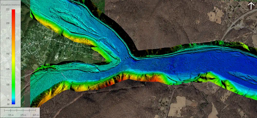
The U.S. Geological Survey recently published a new topobathymetric lidar dataset for the Potomac River as part of its 3D Elevation Program (3DEP). Topobathymetric lidar provides 3D maps of the submerged riverine topography. The maps were produced in two phases for more than 120 river miles of the Potomac River through a data-acquisition contract with Dewberry. The study area began near Hancock, Md., and extended downstream to the Little Falls dam near Washington, D.C. The project was co-funded by the USGS and the Interstate Commission on the Potomac River Basin (ICPRB). The publication of topobathymetric lidar for inland rivers was made possible in part by Inflation Reduction Act investments, which are advancing the 3D National Topography Model 3DEP initiative to better map and integrate the Nation’s elevation and hydrography.