Farmland is often a battleground in the fight against climate change. Solar panels and energy crops are pitted against food production, while well-intended policy choices can create incentives for farmers to till up new lands, releasing even more heat-trapping gas into the atmosphere. That’s why strategies for sustainable plant-based fuels focus on marginal lands — fields that are too hard to cultivate or don’t produce good enough yields to be considered profitable.
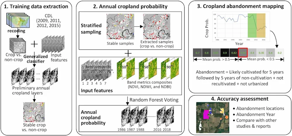
A new tool developed by scientists at the University of Wisconsin–Madison could help relieve that tension. Led by Yanhua Xie and Tyler Lark, researchers with the Great Lakes Bioenergy Research Center, the team used machine learning to map nearly 30 million acres of United States cropland abandoned since the 1980s, creating a tool that could guide decisions about how to balance production of energy and food.
Their findings, published in the journal Environmental Research Letters, include the most detailed mapping of previously cultivated land in the U.S. to date. They provide field-level resolution of abandoned farmland that could be used to grow crops like switchgrass or sorghum, which can trap carbon in the soil and serve as feedstocks for biofuels and replacements for petrochemicals.
The study was a collaboration between researchers at UW–Madison and Michigan State University and was funded by the U.S. Department of Energy. The resulting data are publicly available in the GLBRC’s interactive atlas of U.S. cropland, which also maps trends in farmland expansion and irrigation.
Researchers have traditionally relied on datasets like the USDA’s Census of Agriculture, which provides county-level estimates of farmland at five-year intervals and can be used to estimate how much land has been taken out of production. But until now there was no way of knowing exactly where that land was or when it was abandoned. “Most of these estimates have all been at the county level,” Lark says. “This is really the highest resolution analysis available, looking right on the landscape — field by field, acre by acre — of where these crop lands are.” While satellite imagery has been around for decades, without recent advances in cloud computing, Lark says it was impossible to classify the nearly 2 billion acres of land in the coterminous U.S.