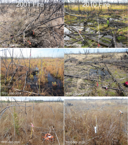
Researchers from Florida Atlantic University, in collaboration with the United States Army Corps of Engineers Cold Regions Research & Engineering Laboratory, and Alaska Ecoscience, systematically analyzed the effects of six large fires that have occurred since 2000 on the Tanana Flats lowland in interior Alaska on land cover change, vegetation dynamics, and terrain subsidence, or sinking. For the first time, they have developed a machine learning-based ensemble approach to quantify fire-induced thaw settlement across the entire Tanana Flats, which encompasses more than 3 million acres (approximately 1,250 km2). Researchers linked airborne repeat lidar data to time-series Landsat products (satellite images) to delineate thaw settlement patterns across the six fire scars. This novel approach helped to explain about 65 percent of the variance in lidar-detected elevation change.