Researchers at The University of Western Australia have led the development of a new technique for accurately mapping shallow and coastal marine habitats.
Dr Sharyn Hickey and Dr Stan Mastrantonis, from UWA’s School of Agriculture and Environment, School of Biological Sciences and Oceans Institute, were co-authors of the research published in the ISPRS Journal of Photogrammetry and Remote Sensing.
“In an era where critically important coastal ecosystems are threatened by climate change, there is a fundamental need for efficient, reliable mapping and monitoring of marine vegetation,” Dr Mastrantonis said.
The study, which included researchers from UWA, the Australian Institute of Marine Science and the Department of Primary Industries and Regional Development, spanned a 400km stretch of the Mid West coastline of Western Australia.
Co-author Dr Ben Radford from AIMS said the project explored the limits of satellite remote sensing in the marine and coastal environment.
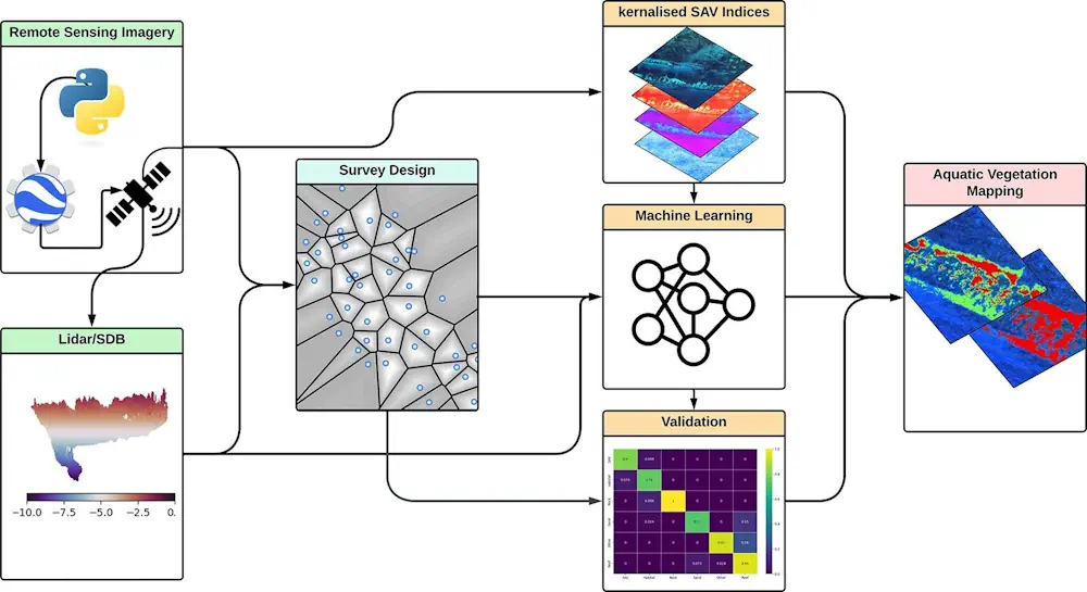
“By integrating onsite data with information gathered through underwater imagery, and satellite remote sensing, we formulated a novel remote sensing vegetation index,” Dr Radford said.
“It reliably maximises the spectral differences between aquatic vegetation and other types of habitats, making it easier to discriminate compared to other methods,” he said.
The mapping method was found to be especially effective in regions dominated by coastal macroalgae, essential for marine life and supporting recreational and commercial fishing activities.